- Perry Municipal Airport (Oklahoma)
-
Perry Municipal Airport 
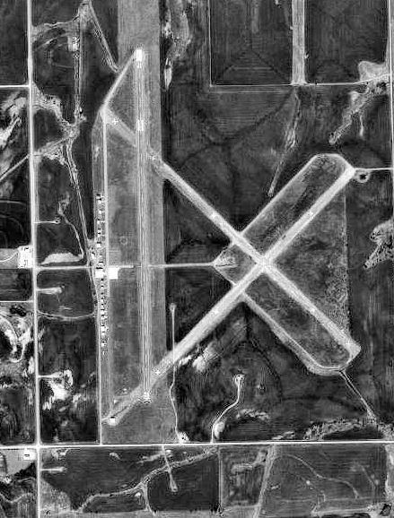
USGS aerial image, 1995 IATA: none – ICAO: none – FAA LID: F22 Summary Airport type Public Owner City of Perry Serves Perry, Oklahoma Elevation AMSL 1,002 ft / 305 m Coordinates 36°23′08″N 097°16′38″W / 36.38556°N 97.27722°W Runways Direction Length Surface ft m 17/35 5,110 1,558 Asphalt Statistics (2009) Aircraft operations 30,000 Based aircraft 21 Source: Federal Aviation Administration[1] Perry Municipal Airport (FAA LID: F22) is a city-owned public-use airport located five nautical miles (9 km) north of the central business district of Perry, a city in Noble County, Oklahoma, United States.[1] This airport is included in the FAA's National Plan of Integrated Airport Systems for 2009–2013, which categorized it as a general aviation facility.[2]
Contents
History
Established as Noble Army Airfield and activated on 11 February 1942. Assigned to the USAAF Gulf Coast Training Center (later Central Flying Training Command) as a basic (level 1) pilot training airfield. Operated by the Enid Flying School as an auxiliary to Enid Army Airfield.
Flying training was performed with Fairchild PT-19s as the primary trainer. Also had several PT-17 Stearmans and a few P-40 Warhawks assigned. Inactivated 28 October with the drawdown of AAFTC's pilot training program and was declared surplus and turned over to the Army Corps of Engineers. Eventually discharged to the War Assets Administration (WAA) and deeded to the City of Perry as a commercial airport. [3] [4] [5]
Facilities and aircraft
Perry Municipal Airport covers an area of 800 acres (320 ha) at an elevation of 1,002 feet (305 m) above mean sea level. It has one runway designated 17/35 with an asphalt surface measuring 5,110 by 75 feet (1,558 x 23 m).[1]
For the 12-month period ending November 4, 2009, the airport had 30,000 aircraft operations, an average of 82 per day: 60% military and 40% general aviation. At that time there were 21 aircraft based at this airport: 76% single-engine, 10% multi-engine, 5% helicopter and 10% ultralight.[1]
See also
References
- ^ a b c d FAA Airport Master Record for F22 (Form 5010 PDF). Federal Aviation Administration. Effective 29 July 2010.
- ^ National Plan of Integrated Airport Systems for 2009–2013: Appendix A: Part 4 (PDF, 1.61 MB). Federal Aviation Administration. Updated 15 October 2008.
- ^
 This article incorporates public domain material from websites or documents of the Air Force Historical Research Agency.
 - ^ Shaw, Frederick J. (2004), Locating Air Force Base Sites History’s Legacy, Air Force History and Museums Program, United States Air Force, Washington DC, 2004.
- ^ Manning, Thomas A. (2005), History of Air Education and Training Command, 1942–2002. Office of History and Research, Headquarters, AETC, Randolph AFB, Texas ASIN: B000NYX3PC
External links
- FAA Terminal Procedures for F22, effective 20 October 2011
- Resources for this airport:
- AirNav airport information for F22
- FlightAware airport information and live flight tracker
- SkyVector aeronautical chart for F22
 Army Air Forces Training Command
Flying Training Flying Schools Eastern Flying Training Command · Central Flying Training Command · Western Flying Training CommandSpecialized Schools Bombardier · Contract Flying · Glider Training · Gunnery · Navigator
Technical Training Eastern Technical Training Command · Central Technical Training Command · Western Technical Training CommandCategories:- 1943 establishments
- Airports in Oklahoma
- Buildings and structures in Noble County, Oklahoma
- Airfields of the United States Army Air Forces in Oklahoma
- USAAF Contract Flying School Airfields

Wikimedia Foundation. 2010.