- Ngaka Modiri Molema District Municipality
-
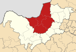 A map of the North West showing Ngaka Modiri Molema
Ngaka Modiri Molema District Municipality (formerly Central District Municipality[1]) is one of the four districts of North West province in South Africa. Its capital is Mafikeng, which is also the capital of the province.
Contents
Geography
Neighbours
Ngaka Modiri Molema District has the following neighbours:
- The Republic of Botswana to the north
- Dr Ruth Segomotsi Mompati District Municipality to the west
- Dr Kenneth Kaunda District Municipality to the south
- Bojanala Platinum District Municipality district to the east
- Waterberg District Municipality (Limpopo province) to the north-east
Local municipalities
The district contains the following local municipalities:
Local municipality Population % Mafikeng 259 478 34.01% Ditsobotla 147 596 19.34% Ramotshere Moiloa 137 439 18.01% Tswaing 114 150 14.96% Ratlou 104 322 13.67% Demographics
The following statistics are from the 2001 census and the 2007 Community Survey (only for race).
Language Population % Setswana 643 845 84.38% Afrikaans 36 700 4.81% IsiXhosa 31 842 4.17% Sesotho 24 308 3.19% English 8 448 1.11% IsiZulu 7 320 0.96% Other 3 434 0.45% Sepedi 3 016 0.40% IsiNdebele 1 548 0.20% SiSwati 1 508 0.20% Xitsonga 723 0.09% Tshivenda 293 0.04% Gender
Gender Population % Female 395 930 51.89% Male 367 061 48.11% Ethnic group
Ethnic group Population (2001) % (2001) Population (2007) % (2007) Black African 719 023 94.24% 760 544 95.21% White 29 715 3.89% 22 984 2.88% Coloured 11 265 1.48% 10 499 1.31% Indian/Asian 2 988 0.39% 4 757 0.60% Age
Age Population % 000 - 004 82 826 10.86% 005 - 009 88 869 11.65% 010 - 014 92 003 12.06% 015 - 019 88 529 11.60% 020 - 024 70 530 9.24% 025 - 029 59 967 7.86% 030 - 034 53 025 6.95% 035 - 039 48 171 6.31% 040 - 044 42 075 5.51% 045 - 049 32 569 4.27% 050 - 054 25 227 3.31% 055 - 059 21 085 2.76% 060 - 064 17 893 2.35% 065 - 069 13 514 1.77% 070 - 074 10 638 1.39% 075 - 079 8 010 1.05% 080 - 084 4 675 0.61% 085 - 089 2 016 0.26% 090 - 094 845 0.11% 095 - 099 386 0.05% 100 plus 138 0.02% Politics
Election results
Election results for Ngaka Modiri Molema District in the South African general election, 2004.
- Population 18 and over: 446 018 [58.46% of total population]
- Total votes: 254 874 [33.40% of total population]
- Voting % estimate: 57.14% votes as a % of population 18 and over
Party Votes % African National Congress 196 318 77.03% United Christian Democratic Party 37 610 14.76% Democratic Alliance 8 166 3.20% Freedom Front Plus 2 636 1.03% African Christian Democratic Party 2 130 0.84% Pan African Congress 2 059 0.81% United Democratic Movement 1 634 0.64% New National Party 915 0.36% Independent Democrats 848 0.33% Azanian People's Organisation 593 0.23% Inkhata Freedom Party 423 0.17% SOPA 317 0.12% EMSA 259 0.10% PJC 175 0.07% NA 170 0.07% CDP 158 0.06% TOP 140 0.05% UF 133 0.05% KISS 66 0.03% Minority Front 63 0.02% NLP 61 0.02% Total 254 874 100.00% References
- ^ "New Municipal Names". Municipal Demarcation Board. http://www.demarcation.org.za/Contacts/new_munic_names.aspx. Retrieved 2009-03-08.
Coordinates: 25°55′S 25°50′E / 25.917°S 25.833°E
Province of North West, South Africa Provincial Capital: Mafikeng District
and Local
MunicipalitiesNgaka Modiri MolemaVentersdorp · Tlokwe · Matlosana · Maquassi HillsCategories:- District Municipalities of North West (South African province)
- North West (South Africa) geography stubs

Wikimedia Foundation. 2010.