Neustadt Dam

Neustadt Dam
Neustadt Dam
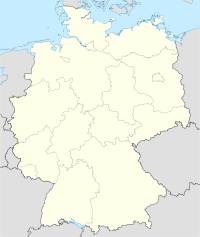
Neustadt Dam is located in Germany
{{{alt}}}
Location of Neustadt Dam
Official name Talsperre Neustadt
Coordinates 51°34′50″N 10°52′2″E / 51.58056°N 10.86722°E / 51.58056; 10.86722Coordinates: 51°34′50″N 10°52′2″E / 51.58056°N 10.86722°E / 51.58056; 10.86722
Construction began 1904
Opening date 1905
Dam and spillways
Height 32 m (105 ft)
Length 134.6 m (442 ft)
Crest width 4.25 m (13.9 ft)
Volume 32,000 m3 (1,100,000 cu ft)
Reservoir
Capacity 1,270,000 m3 (45,000,000 cu ft)
Catchment area 5.4 km2 (2.1 sq mi)
Surface area 136,800 m2 (1,473,000 sq ft)

The Neustadt Dam, also known as the Nordhausen Dam (German: Talsperre Neustadt or Nordhäuser Talsperre) is the oldest dam in the Free State of Thuringia in Germany. It supplies drinking water to the town of Nordhausen. The barrier of is a curved gravity dam made of rubble stone based on the Intze Principle. The dam was built in 1904–1905 in the southern Harz mountains and raised by a further 5  in 1922–1923. The impounded stream is the Krebsbach. The operator of the dam is the Thüringer Fernwasserversorgung; the water is supplied to the Wasserverband Nordhausen (Nordhausen Water Association).

Swimming and water sports are not permitted on the lake, but there is a public path around the lakeshore.

The dam was refurbished between 1997 and 2001. It was reinforced, waterproofed on the upstream side with asphaltic concrete, given an inspection walkway and an impervious blanket.

On the western side of the valley is a checkpoint (no. 218) in the Harzer Wandernadel hiking system.

See also

External links


Wikimedia Foundation. 2010.

Игры ⚽ Нужен реферат?

Look at other dictionaries:

  • List of dams and reservoirs in Germany — These are dams and reservoirs in Germany. The German word Talsperre (literally: valley barrier) may mean dam, but it is often used to include the associated reservoir as well.[1] The reservoirs are often separately given names ending in see,… …   Wikipedia

  • List of dams and reservoirs in the Harz — The Wendefurth Reservoir In the Harz mountains there is a higher than average number of dams with their associated reservoirs. The reason is that the Harz is one of the regions with the heaviest rainfall in Germany and so its water power was… …   Wikipedia

  • Köln — Wappen Deutschlandkarte …   Deutsch Wikipedia

  • Liste der Mitgliedsverbindungen des CV — Wappen des CV Die Liste der Mitgliedsverbindungen des CV ist eine Gesamtaufstellung aller derzeit existierenden Mitgliedsverbindungen in den Cartellverbänden der katholischen Studentenverbindungen. Inhaltsverzeichnis 1 …   Deutsch Wikipedia

  • literature — /lit euhr euh cheuhr, choor , li treuh /, n. 1. writings in which expression and form, in connection with ideas of permanent and universal interest, are characteristic or essential features, as poetry, novels, history, biography, and essays. 2.… …   Universalium

  • Harz — Mountains redirects here. For the district of the same name, see Harz (district). Harz Range Country Germany …   Wikipedia

  • Frankenberg/Eder — Wappen Deutschlandkarte …   Deutsch Wikipedia

  • Frankenberg (Eder) — Wappen Deutschlandkarte …   Deutsch Wikipedia

  • Cor de la Bryere — Cor de la Bryère is one of the most influential sires in modern warmblood breeding. He is known as the Reserve Stallion of the Century , second only to Landgraf I. Lived: 1968 2000 Nickname: Corde Color: dark bay/brown Markings: star, half cannon …   Wikipedia

  • Frankfurt/Main — Wappen Karte …   Deutsch Wikipedia

Share the article and excerpts

Direct link
Do a right-click on the link above
and select “Copy Link”