Alaska — • The first knowledge of Alaska was acquired in 1741 through the expedition under Vitus Bering, a Dane in the Russian service, who sailed from Okhoysk Catholic Encyclopedia. Kevin Knight. 2006. Alaska Alaska … Catholic encyclopedia
Alaska — This article is about the U.S. state of Alaska. For other uses, see Alaska (disambiguation). Alaskan redirects here. For other uses, see Alaskan (disambiguation). State of Alaska … Wikipedia
History of Alaska — Alaska history redirects here. For the academic journal, see Alaska History (journal). For a topical guide to this subject, see Historical outline of Alaska. Alaska in 1895 (Rand McNally). The boundary of southeastern Alaska shown is that claimed … Wikipedia
Adak, Alaska — Infobox Settlement official name = Adak, Alaska settlement type = CDP nickname = motto = imagesize = 300px image caption = Adak image map caption = Location of Adak, Alaska mapsize = 250px mapsize1 = map caption1 = subdivision type = Country… … Wikipedia
Sitka, Alaska — Sitka redirects here. For other uses, see Sitka (disambiguation). City and Borough of Sitka City and Borough View toward Sitka from the Pacific Ocean. Sitka … Wikipedia
Pelican, Alaska — Infobox Settlement official name = Pelican, Alaska settlement type = City nickname = motto = imagesize = image caption = image mapsize = 250px map caption = Location of Pelican, Alaska mapsize1 = map caption1 = subdivision type = Country… … Wikipedia
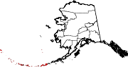
National Register of Historic Places listings in Aleutians West Census Area, Alaska — Location of the Aleutians West Census Area in Alaska This is a list of the National Register of Historic Places listings in Aleutians West Census Area, Alaska. This is intended to be a complete list of the properties and districts on the National … Wikipedia
District of Alaska — This article refers to Alaska in the period from 1884 to 1912. For the federal court sometimes called District of Alaska , see United States District Court for the District of Alaska. District of Alaska District of the United States … Wikipedia
Deadhorse, Alaska — Deadhorse unincorporated community Aerial view of Deadhorse, March 2007 … Wikipedia
Barrow, Alaska — Infobox Settlement official name = Barrow settlement type = City nickname = motto = imagesize = image caption = image map caption = mapsize = mapsize1 = map caption1 = pushpin pushpin label position = bottom pushpin map caption =Location within… … Wikipedia