- Naselle River
-
Naselle River Country United States State Washington County Pacific, Wahkiakum Source - location Willapa Hills - coordinates 46°28′8″N 123°33′14″W / 46.46889°N 123.55389°W [1] Mouth Chelto Harbor - location Willapa Bay - coordinates 46°27′54″N 123°56′24″W / 46.465°N 123.94°W [1] Discharge for river mile 17.4 near Naselle, WA - average 425 cu ft/s (12 m3/s) [2] - max 10,400 cu ft/s (294.5 m3/s) - min 18 cu ft/s (0.5 m3/s) 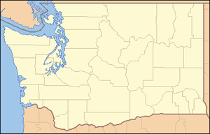
 Location of the mouth of the Naselle River in Washington
The Naselle River is a river in the U.S. state of Washington.
Contents
Course
The Naselle River originates in the Willapa Hills and flows generally west, passing the community of Naselle before emptying into the southern part of Willapa Bay.
Tributaries of the Naselle include, from source to mouth, Alder Creek, North Fork Naselle River, Cedar Creek, Brock Creek, Salmon Creek, Lane Creek, O'Conner Creek, South Naselle River, Johnson Creek, Dell Creek, Petes Creek, Holm Creek, Smith Creek, and Ellsworth Creek. The community of Naselle is located near the confluence of the Naselle and South Naselle Rivers. The broad tidal mouth of the Naselle River is known as Chelto Harbor.[3] The Naselle River was used in a book called our Only May Amelia by Jennifer L. Holm.
History
The river's name has been spelled Nasel and Nasal. An early settler along the river called it the Kenebec. According to Edmond S. Meany the name comes from the Nisal Indians, a Chinookan tribe formerly residing on the river.[4]
See also
References
- ^ a b U.S. Geological Survey Geographic Names Information System: Naselle River
- ^ "Water Resources Data-Washington Water Year 2005; Naselle and Willapa River Basins; 12010000 Naselle River near Naselle, WA". United States Geological Survey. http://pubs.usgs.gov/wdr/2005/wdr-wa-05-1/pdf/wa00103ADR2005_Figure8.pdf. Retrieved 2009-05-19.
- ^ Course info mainly from USGS topographic maps accessed via the "GNIS in Google Map" feature of the USGS Geographic Names Information System website.
- ^ Meany, Edmond S. (1921). "Origin of Washington Geographic Names". The Pacific Northwest Quarterly (Washington University State Historical Society) X-XI: 278. http://books.google.com/?id=m3BbU-rG1dwC. Retrieved 2009-06-11.
Categories:- Rivers of Washington (state)
- Landforms of Pacific County, Washington

Wikimedia Foundation. 2010.