- Narbethong, Victoria
-
Narbethong
Victoria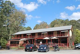
Black Spur Inn at Narbethong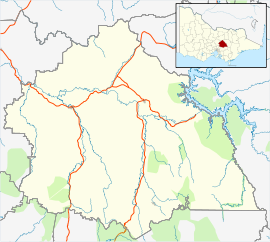
 Narbethong
Population: 280[1] Postcode: 3778 Elevation: 360 m (1,181 ft) Location: 87 km (54 mi) NE of Melbourne LGA: Shire of Murrindindi State District: Seymour Federal Division: McEwen Mean max temp Mean min temp Annual rainfall 15.8 °C
60 °F7.5 °C
46 °F1,365 mm
53.7 inLocalities around Narbethong: Glenburn Buxton Marysville Toolangi Narbethong Cambarville Healesville Warburton McMahons Creek Narbethong is a town in central Victoria, Australia. The town is located on the Maroondah Highway, 87 kilometres (54 mi) north east of the state capital, Melbourne. At the 2006 census, Narbethong and the surrounding area had a population of 280.[1]
Narbethong Post Office opened on 16 October 1883 and closed in 1993.[2]
The town was substantially damaged in the Black Friday bushfires in 1939. It was again severely impacted in the Black Saturday bushfires in 2009.[3]
References
- ^ a b Australian Bureau of Statistics (25 October 2007). "Narbethong (State Suburb)". 2006 Census QuickStats. http://www.censusdata.abs.gov.au/ABSNavigation/prenav/LocationSearch?collection=Census&period=2006&areacode=SSC26293&producttype=QuickStats&breadcrumb=PL&action=401. Retrieved 2009-02-08.
- ^ Premier Postal History. "Post Office List". https://www.premierpostal.com/cgi-bin/wsProd.sh/Viewpocdwrapper.p?SortBy=VIC&country=. Retrieved 2008-04-11.
- ^ "Wiped out: Towns destroyed by killer fires". ABC News. Australian Broadcasting Corporation. http://www.abc.net.au/news/stories/2009/02/08/2485378.htm. Retrieved 2009-02-07.
External links
- "Narbethong climate - site name: TOOLANGI (MOUNT ST LEONARD DPI)". Bureau of Meteorolgy. Australian Government. http://www.bom.gov.au/climate/averages/tables/cw_086142.shtml. Retrieved 28 Feb 2009.
Towns in the Shire of Murrindindi Acheron • Alexandra • Buxton • Castella • Cheviot • Eildon • Flowerdale • Glenburn • Hazeldene • Highlands • Kinglake • Kinglake West • Limestone • Marysville • Molesworth • Murrindindi • Narbethong • Pheasant Creek • Strath Creek • Taggerty • Thornton • Toolangi • Yarck • Yea •
Categories:- Towns in Victoria (Australia)
- Victoria (Australia) geography stubs


Wikimedia Foundation. 2010.