- Nanos (plateau)
-
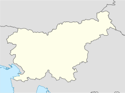
Nanos Mountain plateau Pleša Peak on the Nanos Plateau with the Nanos transmitterCountry Slovenia Region Inner Carniola Part of Dinaric Alps Coordinates 45°47′54.76″N 14°3′54.57″E / 45.7985444°N 14.0651583°E Nanos (Italian: Monte Re) is a karst limestone plateau in Slovenia that divides the continental part of Slovenia from the Littoral Region. It is about 6 km wide and 12 km long in the northern extension of the Dinaric Alps. The highest point of the plateau is Suhi vrh (1,313 metres (4,308 ft)). The most popular destination is Pleša (1,262 m (4,140 ft)) with the Vojko Lodge (Slovene: Vojkova koča) below its summit.[1]
In 1987, the southern and western slopes of Nanos were declared a regional park with an area of 2,632 hectares (6,500 acres).[2]
Contents
Historical role
Nanos has an important symbolic place in the history and identity of Littoral Slovenes. In September 1927, the anti-Fascist insurgent organization TIGR was founded on the Nanos Plateau. In February 1942, one of the first battles between the partisan insurgence and the Italian Army took place there; in the battle, the partisan leader Janko Premrl (a.k.a. Vojko) was killed.
The Nanos transmitter
The Nanos transmitter is a FM-/TV-broadcasting facility consisting of a 50 m guyed tower, a guyed mast, which may be a bit less tall, and a small guyed mast. The transmitter building has many dishes for radio relay links. The Nanos transmitter went into service in 1962 and played an important role in introducing PAL-standard color TV in the former Yugoslavia. The facility was attacked during the Slovenian independence war.
References
External links
Categories:- Dinaric Alps
- Plateaus of Slovenia
- Slovenia geography stubs
Wikimedia Foundation. 2010.


