Nakapiripirit

Nakapiripirit
Nakapiripirit
Nakapiripirit is located in Uganda
Nakapiripirit
Map of Uganda showing the location of Nakapiripirit.
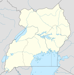
Coordinates: 01°48′52″N 34°42′49″E / 1.81444°N 34.71361°E / 1.81444; 34.71361
Country  Uganda
Region Northern Uganda
Sub-region Karamoja sub-region
District Nakapiripirit District
Population (2011 Estimate)
 – Total 2,800
Time zone EAT (UTC+3)

Nakapiripirit is a town in Northern Uganda. It is the seat of the district headquarters of Nakapiripirit District, and the district is named after this town.

Contents

Location

Nakapiripirit is located approximately 125 kilometres (78 mi), by road, northeast of Mbale, the nearest large town.[1] This location lies approximately 360 kilometres (220 mi), northeast of Kampala, the capital of Uganda and the largest city in that country.[2] The coordinates of Nakapiripirit are: 01 48 52N, 34 42 49E (Latitude: 1.8144444 Longitude: 34.7136111).

Population

In 2011, the Uganda Bureau of Statistics (UBOS), estimated the mid-year population of Nakapiripirit at 2,800.[3]

Landmarks

The landmarks in Nakapiripirit or near its borders include:

External links

See also

References

Coordinates: 01°48′52″N 34°42′49″E / 1.81444°N 34.71361°E / 1.81444; 34.71361


Wikimedia Foundation. 2010.

Игры ⚽ Поможем решить контрольную работу

Look at other dictionaries:

  • Nakapiripirit — Original name in latin Nakapiripirit Name in other language State code UG Continent/City Africa/Kampala longitude 1.91667 latitude 34.78333 altitude 1352 Population 0 Date 2012 05 07 …   Cities with a population over 1000 database

  • Nakapiripirit District —   District   District location in Uganda …   Wikipedia

  • Nakapiripirit District — Admin ASC 2 Code Orig. name Nakapiripirit District Country and Admin Code UG.N.91 UG …   World countries Adminstrative division ASC I-II

  • Distrito de Nakapiripirit — Saltar a navegación, búsqueda El Distrito de Nakapiripirit se ubica al noreste de Uganda, en la sección verde. El Distrito de Nakapiripirit es un distrito ugandés, ubicado al noreste de Uganda. Su nombre, Nakapiripirit, proviene de su ciudad… …   Wikipedia Español

  • Karamoja — sub region is a region in northeastern Uganda comprising of the five districts of Abim, Kaabong, Kotido, Moroto and Nakapiripirit. Kaabong is on the northeastern borders to Sudan and Kenya, and is home to the Kidepo Valley National Park,… …   Wikipedia

  • Moroto District —   District   District location in Uganda …   Wikipedia

  • Liste der Berge oder Erhebungen in Uganda — Dies ist eine (bisher unvollständige) Liste der Berge oder Erhebungen in Uganda. Sie umfasst die höchsten Erhebungen des ostafrikanischen Landes. Name des Berges Höhe Gebirge Distrikt Anmerkungen Mount Stanley 5 110 m Ruwenzori Gebirge Kasese auf …   Deutsch Wikipedia

  • Karamoja — Le Karamoja est une province frontalière située au nord est de l Ouganda. Elle se compose de cinq districts: Nakapiripirit, Moroto, Abim, Kotido et Kaabong. À l extrême nord de la province se trouve la frontière du Soudan et le parc national de… …   Wikipédia en Français

  • Napak District —   District   District location in Uganda District location in Uganda Coordinates …   Wikipedia

  • Districts of Uganda — Uganda is divided into 111 districts and one city (the capital city of Kampala)[1] across four administrative regions. Most districts are named after their main commercial and administrative towns. Each district is further divided into counties… …   Wikipedia

Share the article and excerpts

Direct link
Do a right-click on the link above
and select “Copy Link”