- Naitaba
-
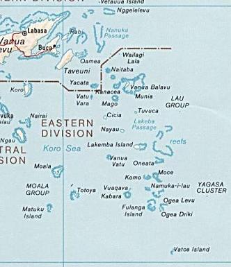
 Naitauba Island shown in the Lau Islands
Naitamba Island,[1][2] (Naitauba,[3] Naitaba[4]) is an island of the northern Lau Islands of Fiji. It is a triangular shaped island approximately 2.4 km (1.5 mi) in diameter.[5] The island is volcanic with coral and rises to 186 metres (610 ft) on a flat-topped hill toward the southern end of the island.[6] The island is forested and coconuts were grown commercially for copra. There is a barrier reef completely surrounding the island.[6]
History
In 1965 the actor Raymond Burr and his partner purchased 1,625 hectares (4,015 acres) on the island,[7] where they raised copra and cattle.[8] This land was sold in 1983 to Johannine Daist Communion for the use of Adi Da,[9] with a purchase price of $2.1 million.[10]
Notes
- ^ "Naitamba Island (Approved)" Naitaba at GEOnet Names Server, United States National Geospatial-Intelligence Agency
- ^ Henderson, George Cockburn (1933) The Discoverers of the Fiji Islands: Tasman, Cook, Bligh, Wilson, Bellinghausen J. Murray, London, page 203, OCLC 56000674
- ^ "Naitauba (Variant)" Naitaba at GEOnet Names Server, United States National Geospatial-Intelligence Agency
- ^ "Naitaba (Variant) " Naitaba at GEOnet Names Server, United States National Geospatial-Intelligence Agency
- ^ Bartholomew, John George (1890) The Royal Atlas & Gazetteer of Australasia T. Nelson, London, gazetteer page 35, OCLC 25600847
- ^ Mersmann, Andrew (April 2008) "Robert Benevides: Raymond Burr Vineyards, Sonoma County, California" Passport Online, last accessed 23 November 2010
- ^ "Raymond Burr Vineyards History". Raymondburrvineyards.com. http://www.raymondburrvineyards.com/his.html. Retrieved 30 March 2010.
- ^ Duke, Lynne (12 June 2005). "Deep Throat's Daughter, The Kindred Free Spirit". Washington Post. http://www.washingtonpost.com/wp-dyn/content/article/2005/06/11/AR2005061100724.html. Retrieved 23 November 2010.
- ^ Stanley, David (1992) Fiji Islands Handbook (3rd edition) Moon Publications, Chico, California, page 192, ISBN 0-918373-92-1
Coordinates: 17°01′S 179°17′W / 17.017°S 179.283°WNorthern Lau Islands Cicia · Kaibu · Kanacea · Mago · Malima · Munia Island · Namalata · Naitaba · Nayau · Tuvuca · Vanua Balavu · Vatu Vara · Wailagi Lala · YacataSouthern Lau Islands Moala Islands Outliers Islands of Fiji Principal islands Significant outliers Archipelagos Kadavu Group · Lau Islands · Lomaiviti Islands · Mamanuca Islands · Moala Islands · Ringgold Isles · Rotuma Group · Vanua Levu Group · Viti Levu Group · Yasawa IslandsCategories:- Islands of Fiji
- Lau Islands
- Fiji geography stubs
Wikimedia Foundation. 2010.