- Nagy-Milic
-
Nagy-Milic / Veľký Milič Location on Hungary–Slovakia border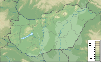
 Nagy-Milic / Veľký Milič
Elevation 894 m (2,933 ft) Location Location  Hungary –
  Slovakia border
Coordinates 48°34′36″N 21°27′28″E / 48.57667°N 21.45778°ECoordinates: 48°34′36″N 21°27′28″E / 48.57667°N 21.45778°E Geology Type Vulcanic Nagy-Milic in Hungarian, or Veľký Milič in Slovak, is the highest peak of the Hungarian part of the Zemplén Mountains, which is part of the Carpathian Mountains. The mountain is situated on the border of Hungary and Slovakia. It is 894 metres tall and is near the northernmost point of Hungary.
Categories:- Mountains of Hungary
- Mountains of Slovakia
- International mountains of Europe
- Hungary–Slovakia border
- Borsod-Abaúj-Zemplén County
- Mountains of the Western Carpathians
- Borsod-Abaúj-Zemplén geography stubs
- Slovakia geography stubs

Wikimedia Foundation. 2010.