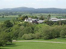
- Myndtown
-
Myndtown (sometimes formerly spelt Mindtown) is a small village and civil parish in rural Shropshire, around 5 miles to the north-east of Bishop's Castle.
The village of Myndtown itself lies immediately beneath the slope of the Long Mynd; it consists of only two farms and the small parish church of St. John, which has 12th century origins and is Grade II listed.[1] The parish is sparsely populated and includes some other small settlements such as Asterton.
References
- ^ Church of St John, Myndtown, British Listed Buildings
Ceremonial county of Shropshire Boroughs or districts Major settlements Rivers Topics - Geology
- Settlements
- History
- Museums
- Parliamentary constituencies
- Railways
Coordinates: 52°30′00″N 2°53′56″W / 52.500°N 2.899°W
Categories:- Civil parishes in Shropshire
- Villages in Shropshire
- Shropshire geography stubs
Wikimedia Foundation. 2010.

