- Mynagappally
-
Mynagappally
മൈനാഗപ്പള്ളി
— village — Coordinates 9°2′30″N 76°35′0″E / 9.04167°N 76.583333°ECoordinates: 9°2′30″N 76°35′0″E / 9.04167°N 76.583333°E Country India State Kerala District(s) Kollam Nearest city Karunagappally Parliamentary constituency Mavelikkara Assembly constituency Kunnathur Population 39,336 (2001[update]) Time zone IST (UTC+05:30) Mynagappally is a village in Kollam district in the state of Kerala, India.[1]
About Mynagappally
As of 2001[update] India census, Mynagappally had a population of 39336 with 19207 males and 20129 females.[1] Mynagappally is located at kunnathoor taluk of Kollam District. Its location is 7 km east of Karunagappally town and 6 km west of Sasthamcotta town. Sasthamcotta railway station is in this village. Its western border is separated by Pallikkal River from Thodiyoor panchayath. Mynagappally panchayat sharing its south border with Thevalakkara Panchayat, North side with Sooranad panchayat and east with Sasthamcotta panchayat.[2]
This is one of the beautiful village in Kerala, filled with paddy fields and cocunut farms. This panchayat have several industries - cashew factories (7 factories), brick industry, tiles industry, coir industry, mach box industry, etc.There are four main market places in this village.Several educational institutions and hospital facilities are here. We have our own panchayath stadium and community center. We have several sports and cultural centers all over the village area. People have good political believes and views - mainly Indian national congress and Communist party, BJP and all other kerala parties and religious parties have place in its political map. PDP's, (One of the registered political party in Kerala) Leader Abdul Nasar Madani belongs to this Village, His Orphanage Anvarssery also located at Mynagappally. Now this village is under the leadership of Indian National Congress Party.
Very famous temple "Mannoorkkavu devi temple" where Kathakali plays most often is located at mynagappally. "Vettikkadu Siva Temple" and "Cherupilakkal Juma Masjid" and Many Churches are situated here.
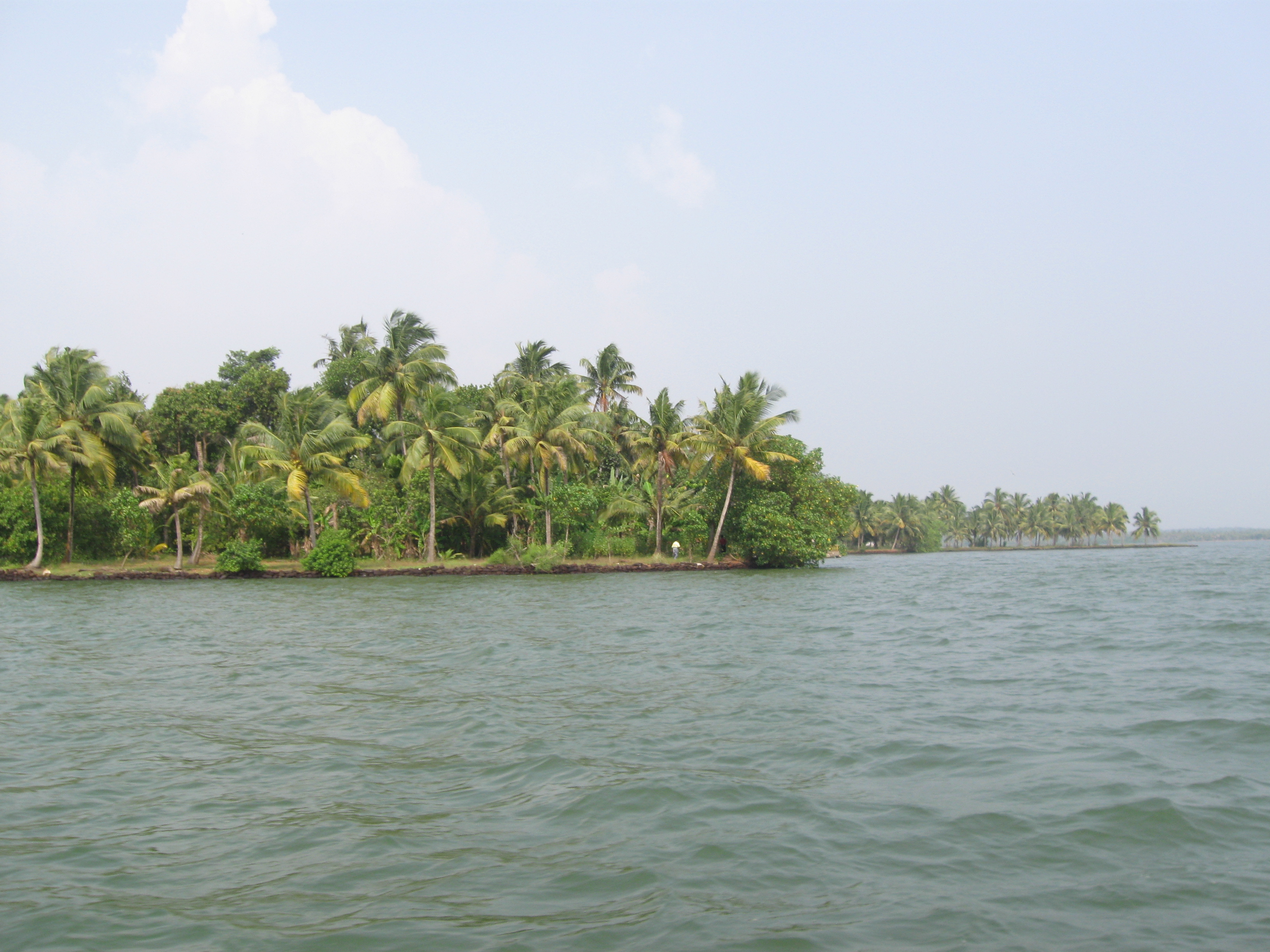
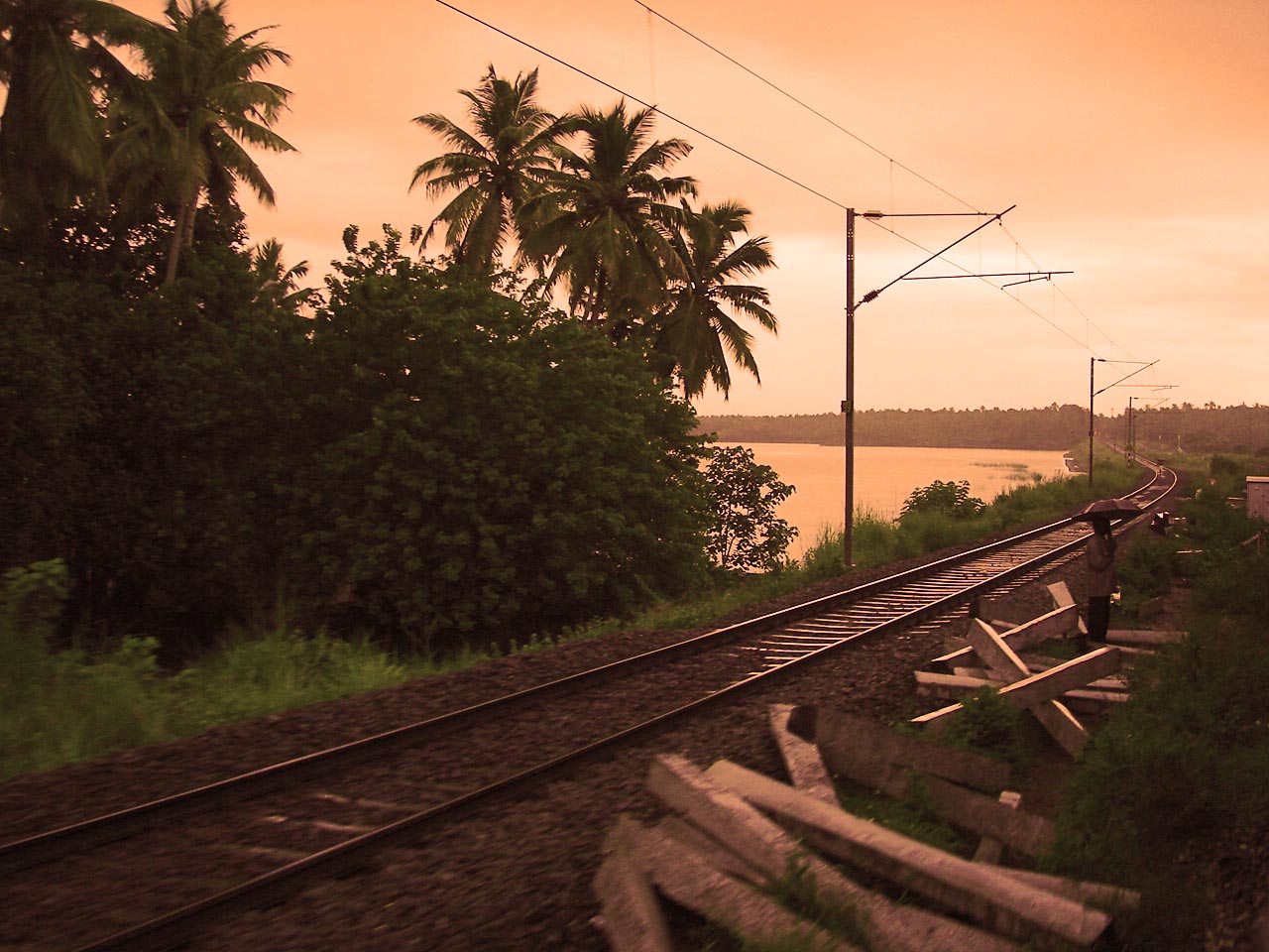
 Mynagappally-Kallukadavu Kaayal
Mynagappally is in kunnattur taluk. It is a very beautiful village which contains paddy fields and small ponds. Thevalakkara is in the south of this village. Karunagappally is the border in the west, Mooranadu is the north limit and sasthamcotta is the village which is located at the east. Railway station named 'Sasthamcotta' is located here in this village.
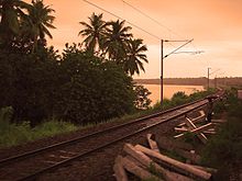 View of Kallukadavu Kayal from the railway line
Mynagappally Panchayath President: Smt. Fathima Beevi Teacher, Vice President:Adv. Thomas Vaidyan
MYNAGAPPALLY WEBSITE.....http://www.mynagappally.com
The following Villages Belongs to Kunnathur Taluk
- Sooranad North
- Sooranad South
- Mynagappally
- Poruvazhi
- Kunnathur
- West Kallada
- Sasthamkotta
High Schools in Mynagappally
- LVHS Mynagappally
- MSHSS Mynagappally
- Boys HS Thevalakkara
- http://www.orkut.co.in/Main#Community?rl=cpp&cmm=25515457
References
MYNAGAPPALLY.......WEBSITE......http://www.mynagappally.com
Categories:- Villages in Kollam district
- Kollam district geography stubs


Wikimedia Foundation. 2010.