- Murray Island (Antarctica)
-
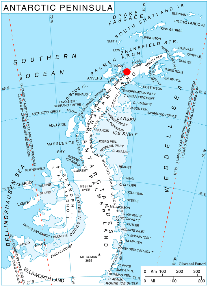
 Location of Pefaur (Ventimiglia) Peninsula on Danco Coast, Antarctic Peninsula.
Murray Island is an island 6 nautical miles (11 km) long lying at the southwest side of Hughes Bay, off the west coast of Graham Land. The feature has been known to sealers operating in the area since the 1820s, although it was shown on charts as part of the mainland. In 1922 the whale catcher Graham passed through the channel separating it from the mainland, proving its insularity. Named in association with Cape Murray, the seaward extremity of the island.
See also
Map
- British Antarctic Territory. Scale 1:200000 topographic map. DOS 610 Series, Sheet W 64 60. Directorate of Overseas Surveys, Tolworth, UK, 1978.
References
 This article incorporates public domain material from the United States Geological Survey document "Murray Island (Antarctica)" (content from the Geographic Names Information System).
Coordinates: 64°22′S 61°34′W / 64.367°S 61.567°W

This Danco Coast location article is a stub. You can help Wikipedia by expanding it.