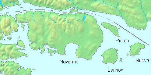
- Navarino Island
-
Navarino Island Native name: Isla Navarino 
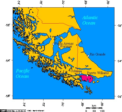
Navarino Island shown in pinkGeography Location Southern extreme of Chile Coordinates 55°05′S 67°40′W / 55.083°S 67.667°W Archipelago Tierra del Fuego Area 2,473 km2 (954.8 sq mi) Country Region Magallanes Province Antártica Comuna Cabo de Hornos Largest city Puerto Williams (pop. ~2,000) Demographics Population ~2,000 Ethnic groups Yaghan, Chileans 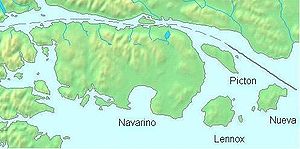 Detail map with Navarino Island
Isla Navarino is a Chilean island located strategically between Isla Grande de Tierra del Fuego, to the north, and Cape Horn, to the south. The island forms part of the Commune of Cabo de Hornos, the southernmost commune in Chile and in the world, belonging to Antártica Chilena Province in the XII Region of Magallanes and Chilean Antarctica. It constitutes the nearest land to the Antarctic continent. Its population is concentrated primarily in the communal capital, Puerto Williams, and in small settlements like Puerto Navarino and Puerto Toro. The highest point of the island is Pico Navarino at 1195 meters.
Contents
Historical background
History and archaeology may be the most valuable resource of Navarino Island and its adjacent sectors. There is a significant Yaghan archaeological site at Wulaia Bay, which C. Michael Hogan terms the Bahia Wulaia Dome Middens.[1] Interest in the Yamana or Yahgan culture attracts tourists, and there is a regional museum, the Martin Gusinde Anthropological Museum, where illustration of the Yaghan culture and the remains of the English missions can be seen. Aquatic birds, and the geology and botany of the island, also attract tourists.
Features
The scenic coast of Navarino Island offers opportunities for sea kayaking among small barren islands and channels surrounded by native vegetation and populated by a rich variety of birds.
There is fishing in the Murray Channel. Boat trips can also be taken to visit the glaciers of the northwest arm of the Beagle Channel (located in the Alberto de Agostini National Park), and towards Cape Horn and Chilean Antarctica.
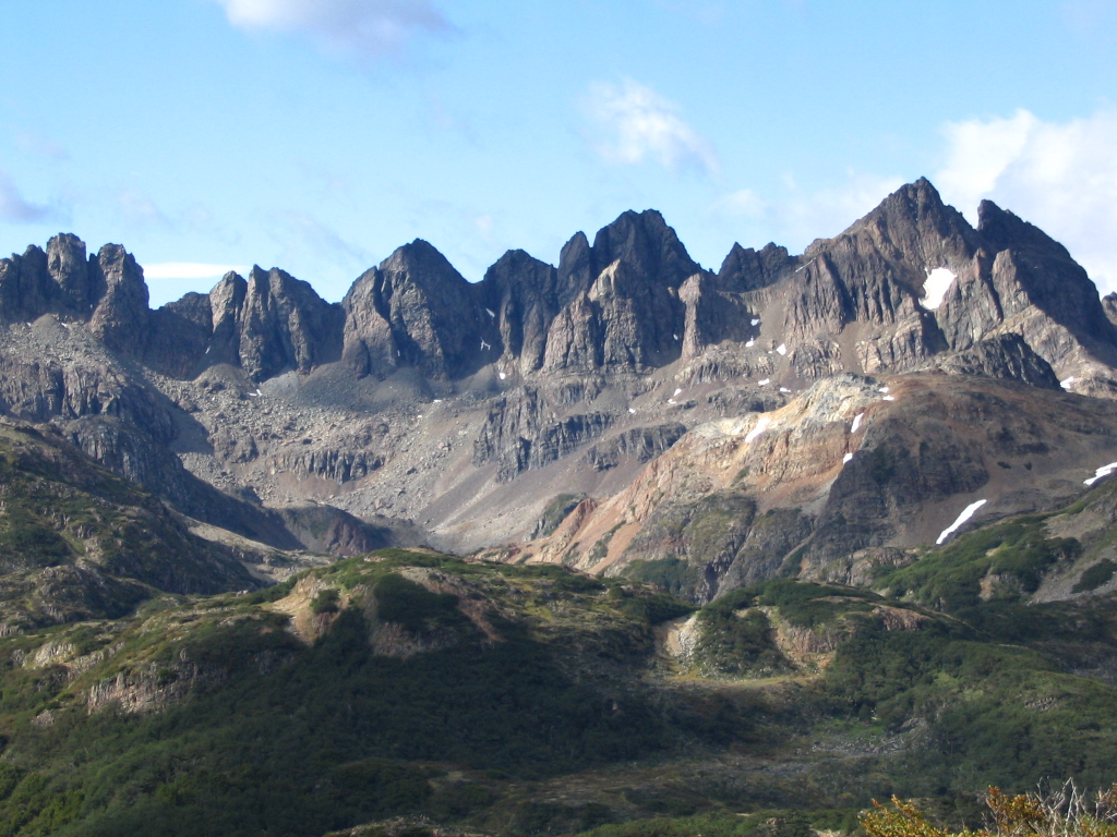
There is a five day hiking circuit around the jagged pinnacles known as the Dientes de Navarino. The trail passes peaks known as Cerro Clem and Montes Lindenmayer, named in 2001 by the Chilean Ministry of Natural Resources for the author of the Lonely Planet guide. [2] There are also areas for rock climbing.
There are several ranches, and the northern section of the island is suitable for horseback riding.
Salmon trout are found in abundance in Navarino Lake, and in the North coast of the island, the sea enters deep coves suitable for fishing snook.
Climate
In the northern coastal strip, where Puerto Williams is, the annual average precipitation is 467 mm., with a temperature of 6°C. The average temperature in the warmest month is 9.6°C, and in the coldest month 1.9°C., which is similar to the climate of Ushuaia. In the more southern areas annual precipitation increases to about 800 mm, with a slight diminution in temperatures. Precipitation is distributed more or less uniformly across the year, and some falls as snow. In the extensive southernmost part of the island, including Lakes Navarino and Windhond, there is an increase in precipitation, a diminution of summer temperatures and an increase in the winter temperatures by wind drift.
Flora
In the North end of the island the vegetation is characterized by the deciduous Magellanic forest, whose characteristic species are Lenga Beech (Nothofagus pumilio), with Ñirre Beech (Nothofagus antarctica) in the driest areas, Coihue of Magallanes (Nothofagus betuloides) in the wettest areas and some shrublands and Magellanic moorland in areas of poor drainage.
Immediately to the south is the evergreen Magellanic rainforest, probably associated with the increased precipitation, the greater altitude and an improvement in the drainage. The characteristic species is Nothofagus betuloides (Coihue of Magallanes), forming pure communities in sectors of greater altitude or coasts exposed to the wind.
The south portion of the island, surrounding Lakes Navarino and Windhond, and the territories of the southern coast, have a vegetation of Magellanic moorland. This includes a series of vegetal communities, the Esfagnosa Tundra (Sphagnum magellanicum) and the Pulvinada Tundra (Donatia fascicularis - Astelia pumilia).
At higher altitudes, the terrain is Andean Desert, which lacks trees or tall shrubs and is less than 30% covered by vegetation.
See Omora Ethnobotanical Park.
Natural and Cultural Features
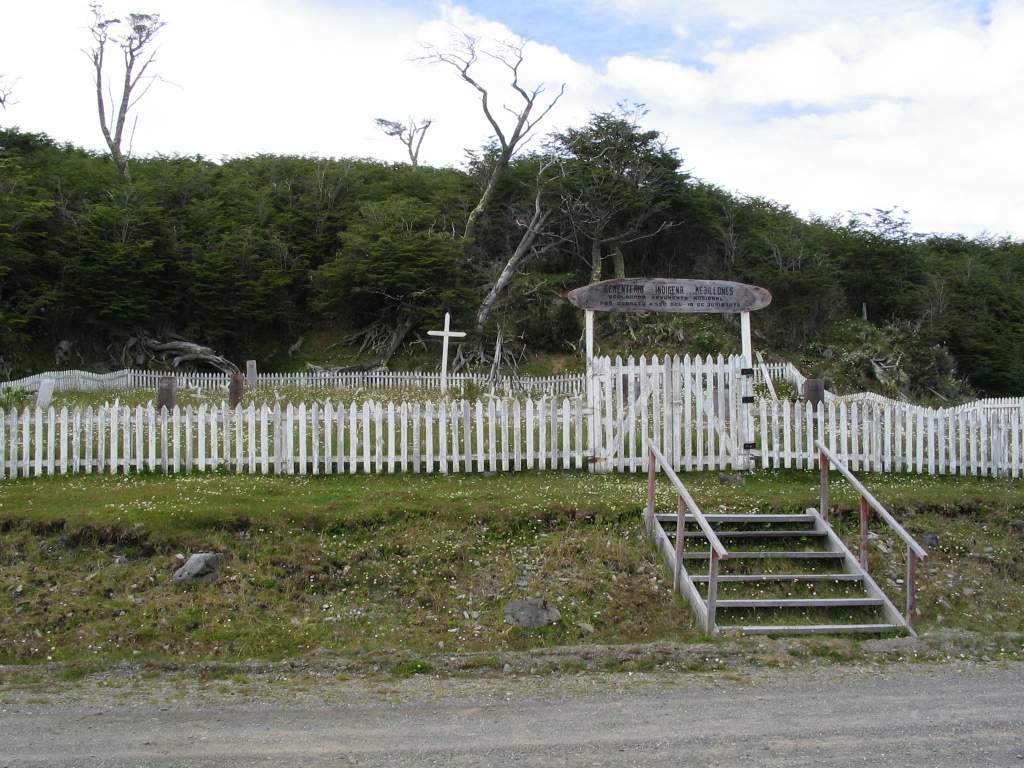
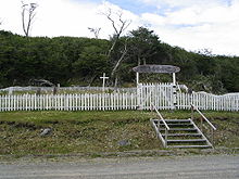 Yahgan Cemetery at Mejillones
Cultural historical sites are Bahia Wulaia and the English Mission of Douglas Creek. The large Stirling House, an iron Mecano construction brought in 1869 from England by the English missionaries, previously was in Ushuaia and then in Tekenika Bay, being finally installed in Douglas Creek. In the Yahgan cemetery at Mejillones Bay, there are tombs, dating from the first half of the 20th century, which show elements of religious syncretism.
Villa Ukika is a district of Puerto Williams where the few last Yamana or Yahgan live. In Puerto Navarino, a fishing port for king crabs, there are beautiful wooden buildings, mainly of the 1930s. Puerto Toro is the world's southernmost settlement.
There is skiing in Cerro La Bandera, near Puerto Williams.
Whales and orcas can be seen in Windhond Bay. The area of Isla Navarino and the surrounding islands have been declared a UNESCO Biosphere Reserve in June 2005, called Cabo de Hornos Biosphere Reserve.
Access
Puerto Williams can be reached by air from Punta Arenas, by DAP, daily except Sundays. In addition there is a weekly a ferry, crossing the Strait of Magellan and the Brecknock, Cockburn and Beagle Channels. The boat trip takes between 30 and 36 hours. As of January 2011, there was also a commercial connection by motorboat between Ushuaia and Isla Navarino.
Towns and Villages
- Puerto Bevan
- Puerto Williams
- Puerto Navarino
- Caleta Eugenia
- Puerto Toro
- Villa Ukika
References
- ^ C. Michael Hogan (2008) Bahia Wulaia Dome Middens, Megalithic Portal, ed. Andy Burnham
- ^ Lindenmayer, C.(2003) Trekking in the Patagonian Andes Lonely Planet ISBN 978-1-86450-059-2 p.257
See also
- Cabo de Hornos (communa)(in Spanish)
External links
Categories:- Tierra del Fuego
- Islands of Magellan and Chilean Antarctica Region
Wikimedia Foundation. 2010.