- Mount Yoshino
-
Mount Yoshino 吉野山 
Cherry blossoms at Mount YoshinoLocation Location Yoshino-cho, Yoshino-gun, Nara, Japan 
Mount Yoshino (吉野山 Yoshino-yama) is a mountain located in the town of Yoshino in Yoshino District, Nara Prefecture, Japan. In 2004, It was designated as part of a UNESCO World Heritage Site under the name Sacred Sites and Pilgrimage Routes in the Kii Mountain Range.
Mount Yoshino was the subject of a waka poem in the 10th century poetry compilation Kokin Wakashū. It is also the subject of several poems in the Hyakunin Isshu.[1]
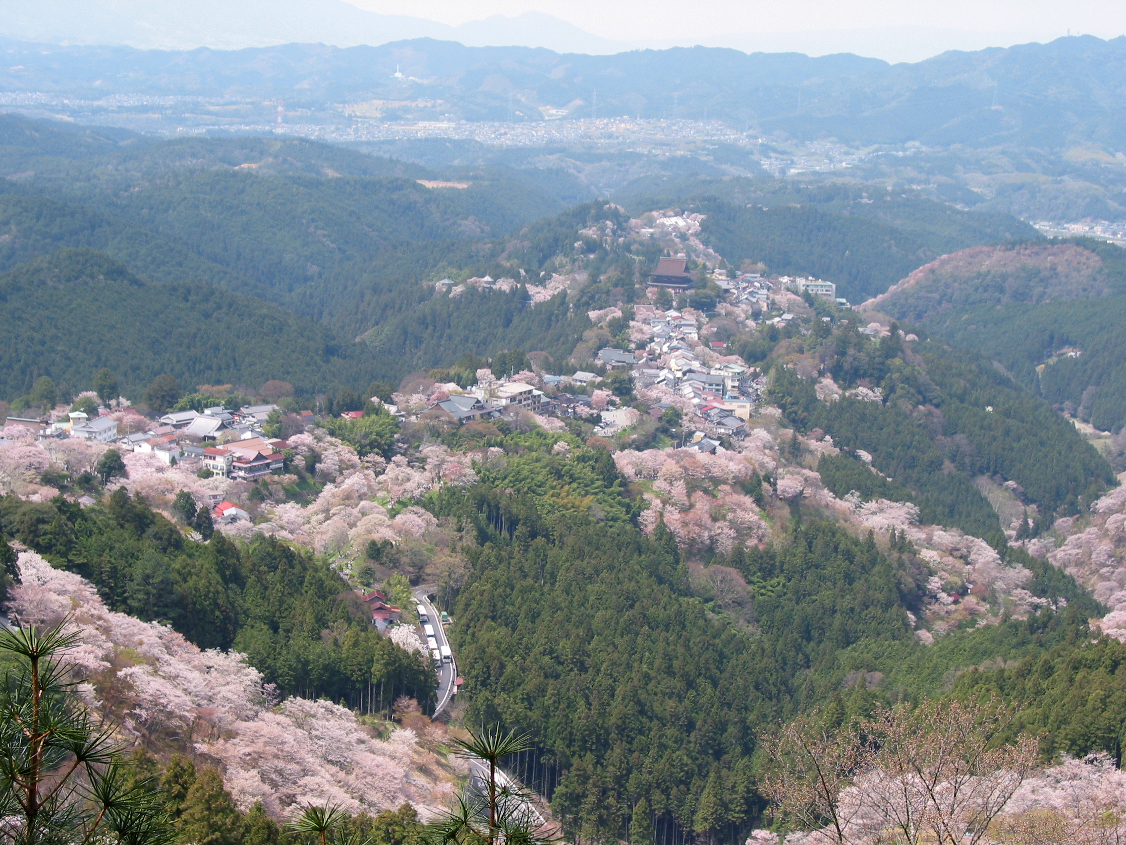
Several important religious and pilgrimage destinations are located around Mount Yoshino, including Yoshino Mikumari Shrine, Kimpu Shrine, and Kimpusen-ji. It is well known for its cherry blossoms, and attracts many visitors every autumn.
Mt. Yoshino is famous for its many thousands of sakura trees. These flowering specimen trees were planted in four groves at different altitudes, in part so that the famed trees would come into bloom at different times of the spring. A 1714 account explained that, on their climb to the top, travelers would be able to enjoy the lower 1,000 cherry trees at the base, the middle 1,000 on the way, the upper 1,000 toward the top, and the 1,000 in the precincts of the inner shrine at the top.[2][3]
Contents
See also
Notes
- ^ Mostow, Joshua S., ed. (1996). Pictures of the Heart: The Hyakunin Isshu in Word and Image, p. 56.
- ^ Kaibara Ekiken. (1714). Yoshinoyama syokeizu
- ^ Stokes, Henry Scott. "Cherry Blossom Time Puts Japan at Ease", The New York Times. March 6, 1983.
References
- Mostow, Joshua S., ed. (1996). Pictures of the Heart: The Hyakunin Isshu in Word and Image. Honolulu: University of Hawaii Press. ISBN 978-0-824-81705-3.
External links
- National Archives of Japan: Yoshinoyama syokeizu, guide to Mt. Yoshino in Yamato Province written by Kaibara Ekiken (1630–1714), published in 1714.
- Kabuki play: Yoshitune Sembon Zakura (Yoshitsune and the Thousand Cherry Trees), Yoshinoyama (The Journey to Mt. Yoshino), Act 4, Scene 1
Categories:- Mountains of Nara Prefecture
- Visitor attractions in Nara Prefecture
- Nara geography stubs
Wikimedia Foundation. 2010.