- Mount Santo Tomas
-
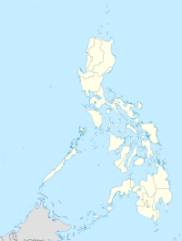
Mount Santo Tomas Location of Mount Santo Tomas in the Philippines. Elevation 1,388 m (4,554 ft) [1] Location Coordinates 16°33′N 120°55′E / 16.55°N 120.917°ECoordinates: 16°33′N 120°55′E / 16.55°N 120.917°E Geology Type stratovolcano
Mount Santo Tomas is a stratovolcano in the Philippines.Contents
Location
Mount Santo Tomas is in the municipality of Tuba, Benguet near Baguio City.
Physical Features
Mount Santo Tomas is reported to be a stratovolcano with numerous volcanic vents and fissures.
Elevation is 2,260 metres (7,410 ft).
Listings
Philippine Institute of Volcanology and Seismology (PHIVOLCS) lists Mount Santo Tomas as Inactive.[2]
The Global Volcanism Program is uncertain about the last activity of Mount Santo Tomas.[1]
Eruptions
There was a report of an eruption or "displacement" in the region on January 4, 1641, described as an outburst of water accompanied by an earthquake. January 4, 1641 is the date of the major eruption of Parker volcano in southern Mindanao that impacted much of the Philippines.[1]
There have been no reports since.
Geology
Rock type is not reported.
Mount Santo Tomas Benguet is close to the auriferous volcanic placements near Baguio, and beside the fault line which occasioned the July 16, 1990 earthquake devastating much of Luzon, and especially Baguio.
See also
- Active volcanos in the Philippines
- Potentially active volcanos in the Philippines
- Inactive volcanos in the Philippines
- Philippine Institute of Volcanology and Seismology
- Volcano
References
- ^ a b c "Santo Tomas". Global Volcanism Program, Smithsonian Institution. http://www.volcano.si.edu/world/volcano.cfm?vnum=0703-086.
- ^ "List of Inactive Volcanoes". Philippine Institute of Volcanology and Seismology (PHIVOLCS). http://www.phivolcs.dost.gov.ph/index.php?option=com_content&task=view&id=59&Itemid=116.
Categories:- Subduction volcanoes
- Volcanoes of Luzon
- Mountains of the Philippines
- Landmarks in the Philippines
- Potentially active volcanoes of the Philippines
- Volcanology stubs
Wikimedia Foundation. 2010.

