Mount Rolleston

Mount Rolleston
Mount Rolleston
Mount Rolleston is located in West Coast
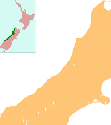
Mount Rolleston
South Island,
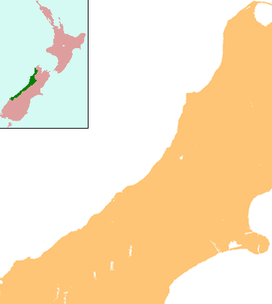
  New Zealand
Elevation 2,271 m (7,451 ft)
Location
Range Southern Alps
Coordinates 42°54′51.55″S 171°31′2.78″E / 42.9143194°S 171.5174389°E / -42.9143194; 171.5174389
Climbing
First ascent 1912 by H. Thompson, J. Gilligan

Mount Rolleston (2,271 m) is a prominent peak in Arthur's Pass National Park[1] in the South Island of New Zealand. It was named by the surveyor Arthur Dudley Dobson in 1864, who observed the peak while searching for a route through the Southern Alps to the West Coast gold fields. The name honours the then Superintendent of the Canterbury Province, William Rolleston.

While not the highest mountain in the National Park (Mount Murchison holds that honour), it is well known because it can be viewed from State Highway 73 that runs through Arthur's Pass to the West Coast of the South Island. It is also popular with climbers, as it can be climbed in a day starting from Arthur's Pass township. Mount Rolleston was first climbed in 1912 by climbers H. Thomson and J. Gilligan. Mount Rolleston can be climbed via several routes, including the Rome or Goldney Ridges[2], the latter of which allows access to Otira Slide, which in winter can be descended by skis.

Reference


Wikimedia Foundation. 2010.

Игры ⚽ Нужно решить контрольную?

Look at other dictionaries:

  • List of mountains of New Zealand by height — The following is a list of the highest mountains in New Zealand, and also of some other notable mountains and hills, ordered by height.The 30 highest mountainsThe 30 highest mountains [This list excludes mountains in the Ross Dependency, an area… …   Wikipedia

  • Otira River — Origin Mount Rolleston Mouth Taramakau River Basin countries New Zealand Length 20 km The Otira River is located in the central South Island of …   Wikipedia

  • Crow River (Canterbury) — For the tributary of the Karamea River, see Crow River, West Coast. Crow River Origin Mount Rolleston Mouth Waimakariri River Basin countries New Zealand Length 8 km (5.0 mi) …   Wikipedia

  • Main South Line — This article is about the railway in New Zealand. For the railway in NSW, Australia, see Main Southern railway line, New South Wales. Main South Line Main South Line and shunting yards at Dunedin. Ov …   Wikipedia

  • Henry A. Wise — Infobox Governor name = Henry Alexander Wise order = 33rd office = Governor of Virginia term start = 1856 term end = 1860 lieutenant = Elisha W. McComas William Lowther Jackson predecessor = Joseph Johnson successor = John Letcher birth date =… …   Wikipedia

  • List of correctional facilities in New Zealand — For more details on prisons in other countries, see list of prisons. Correctional facilities (prisons) in New Zealand (as at October 2010) are as follows: Note: the Corrections Department also operates Community Probation Services centres in most …   Wikipedia

  • New Zealand State Highway 73 — State Highway 73 Great Alpine Highway, Christchurch Ring Road Route information Maintained by …   Wikipedia

  • Henry A. Wise — Henry Alexander Wise (3 décembre 1806 12 septembre 1876) fut un avocat, un homme politique de Virginie et un général de l’armée confédérée pendant la guerre de Sécession. Sommaire 1 Débuts 2 Mariage et famille 3 Carrière politique …   Wikipédia en Français

  • Midland Line, New Zealand — Midland Line Two DX class locomotives hauling a 1,600 tonne coal train on the Midland line Overview Type Heavy Rail System …   Wikipedia

  • History of Norfolk, Virginia — Pre colonial*9500 B.C. First evidence of humans inhabiting Virginia.In 1584, Sir Walter Raleigh lead an expedition in search of a suitable place to establish a permanent English settlement in North America. By mid July of that year, two of his… …   Wikipedia

Share the article and excerpts

Direct link
Do a right-click on the link above
and select “Copy Link”