- Mount Pulong Bato
-
Mount Pulong Bato Mount Pulumbato
Location of Mt. Pulong BatoElevation 360 m (1,181 ft) [1] Location Zamboanga City,
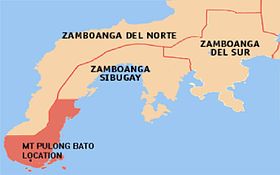
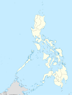
PhilippinesRange Zamboana Cordillera Coordinates 6°58′22″N 122°4′22″E / 6.97278°N 122.07278°ECoordinates: 6°58′22″N 122°4′22″E / 6.97278°N 122.07278°E Geology Type Monolith Age of rock Early to Middle Miocene[2] Volcanic arc/belt Zamboanga-Sulu Arc Last eruption Unknown Mount Pulong Bato is a monolith located in Zamboanga City at the Zamboanga Peninsula, the western tip of the island of Mindanao in the Philippines. The mountain is situated in the Upper Abong-Abong Park, in Barangay Pasonanca, only a few kilometers away from the city's downtown section.
Geology
Pulong Bato became infamous because when the Philippine Institute of Volcanology and Seismology (PHIVOLCS) confirmed the mountain is a volcano which is unknown to most people. What is unusual about the mountain is, unlike the other mountains surrounding the city, only Mt. Pulong Bato is made from solid rock. [3]
According to PHIVOLCS, the volcano is an Intrusion type of volcano meaning it was formed within earth's crust. Magma was pushed from the beneath the earth surface but did not come out through an eruption like a typical volcano (Extrusion). The magma eventually solidified while it is still enclosed by softer rocks, which was later exposed by erosion or weathering, a process that could take thousands of years.
Holy Week observance
The mountain is near the premises of the famous Abong-Abong Park, where both domestic and foreign catholic devotees pilgrimage annually during Holy Week to observe the holiday and meditate.[3]
References
- ^ "Zamboanga City Map". Mapcarta. Retrieved on 2011-08-23.
- ^ Malpas, J. and Fletcher, C.J.N. "Aspects of the tectonic evolution of China", p.308. Geological Society of London, 2004.
- ^ a b Feliciano, Jun (2005-01-07). "City has extinct volcano". Zamboanga Sunstar.
Categories:- Mountains of the Philippines
- Zamboanga City
Wikimedia Foundation. 2010.


