Mount Akiha — 秋葉山 Akiha san … Wikipedia
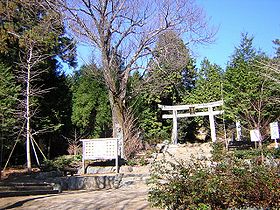
Mount Akiba — is a mountain in Hamamatsu, Shizuoka Prefecture, Japan, which comprises the southern tip of the Akaishi Mountains. It has an elevation of 866 metres. Near the top is the Akihasan Hongū Akihajinja shrine, dedicated to a god of fire … Wikipedia
Fujisan Hongu Sengen Taisha — is a Shinto shrine located on the southwestern base of Mount Fuji in Fujinomiya, Shizuoka Prefecture, Japan. It is also called Fujisan Hongu Asama Taisha, because sengen and asama are both alternative readings of the same characters (浅間). It is… … Wikipedia
Oguni Jinja — 小國神社 Honden and Maidono of Oguni Jinja Information Dedicated to … Wikipedia
Koshi River — Coordinates: 25°24′43″N 87°15′32″E / 25.41194°N 87.25889°E / 25.41194; 87.25889 … Wikipedia
Asama Shrine — nihongo|Asama Shrine|浅間神社|Asama Jinja, Sengen Jinja is a type of Shinto Shrine in Japan. There are approximately 1300 Asama Shrines in Japan, and they worship Konohanasakuya hime as a goddess. The head shrine is Fujisan Hongu Sengen Taisha… … Wikipedia
Shugendo — Shugendō (jap. 修験道; etwa: „Weg des Trainings von Wunderkräften“) ist eine alte japanische, synkretistische Religion. Die Anhänger des Shugendō, Shugenja oder Yamabushi genannt, vollziehen magisch religiöse Rituale und asketische Praktiken in der… … Deutsch Wikipedia
Yamabushi — Shugendō (jap. 修験道; etwa: „Weg des Trainings von Wunderkräften“) ist eine alte japanische, synkretistische Religion. Die Anhänger des Shugendō, Shugenja oder Yamabushi genannt, vollziehen magisch religiöse Rituale und asketische Praktiken in der… … Deutsch Wikipedia
Fujiyoshida, Yamanashi — Infobox City Japan Name= Fujiyoshida JapaneseName= 富士吉田市 Map Region= Chūbu Prefecture= Yamanashi District= Area km2= 121.83 PopDate= 2006 Population= 53,892 Density km2= 438.75 Coords= LatitudeDegrees= 35 LatitudeMinutes= 29 LatitudeSeconds=… … Wikipedia
Dudh Kosi — Origin East of Gokyo Lakes 27°52′26″N 86°35′28″E / … Wikipedia