- Mount Ashland Ski Area
-
Mount Ashland 
Location Mount Ashland, Oregon Nearest city Ashland, Oregon Coordinates 42°5′0″N 122°43′0″W / 42.083333°N 122.716667°W Top elevation 7,500 feet (2,300 m) Base elevation 6,350 feet (1,940 m) Skiable area 200 acres (81 ha) Runs 23 plus open bowl skiing Longest run 1 mile (1.6 km) Lift system 4 chairlifts Mount Ashland ski area is located on 7,532-foot (2,296 m) Mount Ashland and features 23 trails on 200 acres (0.81 km2) served by four lifts, in addition to chute skiing in a glacial cirque called The Bowl. The mountain receives over 300 inches (7,620.0 mm) of snow annually with a season from early December until mid-April. Half of the terrain is rated as advanced, and 15% is rated beginner.
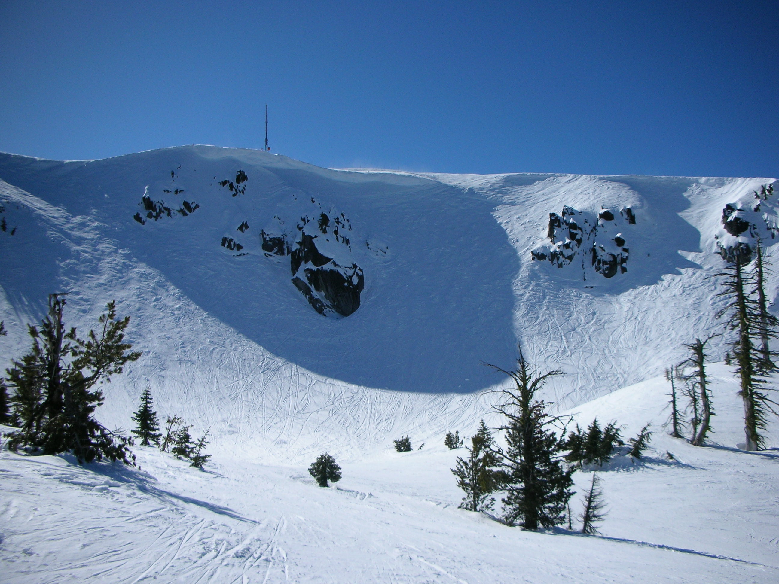
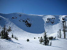 Mount Ashland's "Bowl"
Contents
History
 Mount Ashland's Lodge
During the 1950s, the mountain was a popular destination for local back country ski enthusiasts, some of whom built the lodge and one lift in 1963. In the 1970s, the area was managed by the Southern Oregon College Foundation (now Southern Oregon University) until it was purchased by Dick Hicks, a local businessman, in 1977. In 1983, the ski area was sold to Harbor Properties of Seattle, the owners of Stevens Pass Ski Area. Two new lifts were built during their ownership and night skiing lights were installed. In 1991, the City of Ashland purchased the ski resort through a community fundraising campaign and a grant from the Oregon Economic Development Fund. The slogan of the community fundraising campaign was "Save Mount Ashland."
In 1929 the City of Ashland got the Forest Service to agree that the city would participate in any forest management that might impact water quality of the 15,000-acre (61 km2) Ashland Creek watershed, the city's sole municipal water supply.
Throughout the 1940s and 1950s backcountry skiing on Mount Ashland grew in popularity among local residents, prompting some to envision a developed ski area.
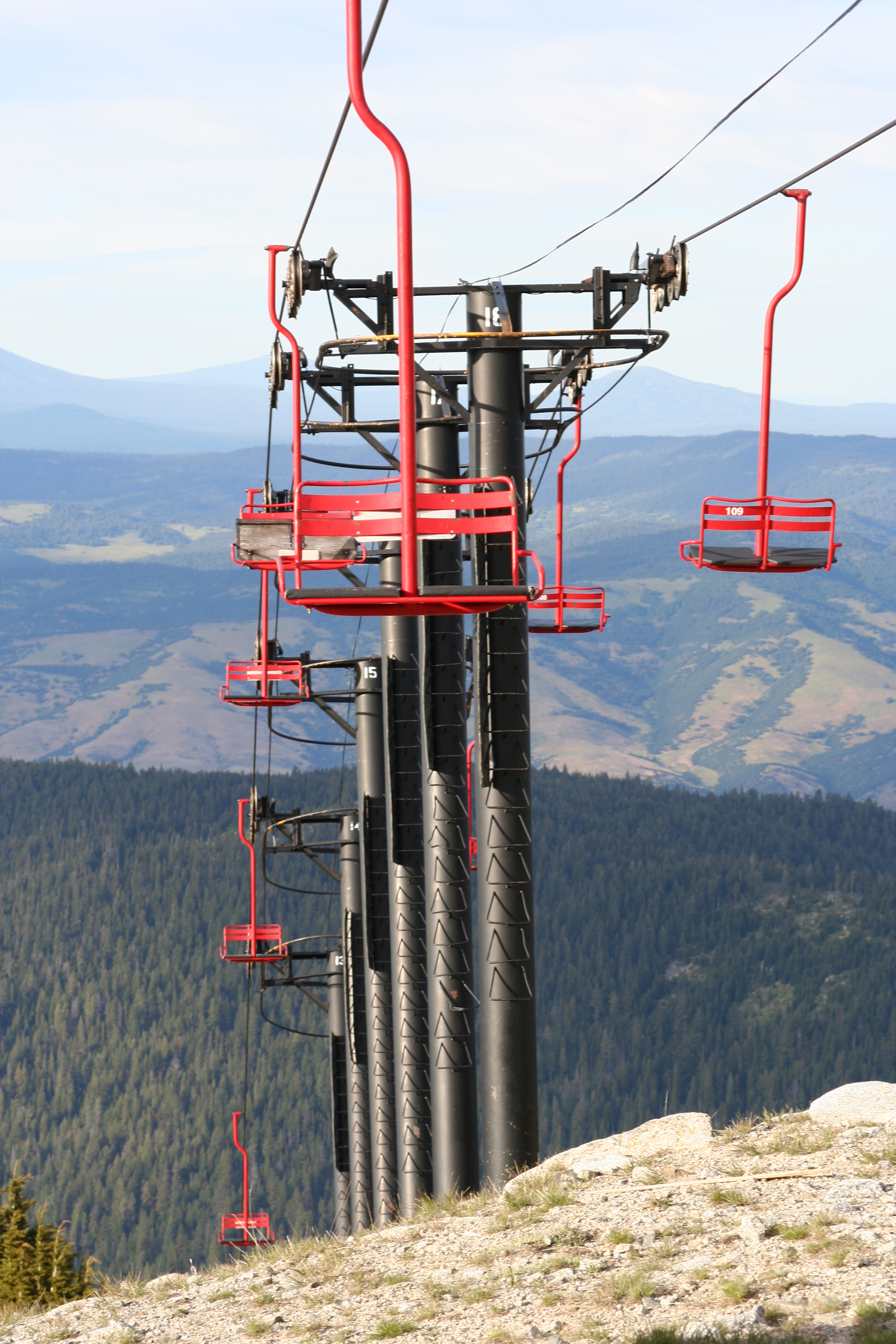
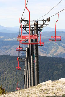 Mount Ashland chairlift in summer
During 1961 to 1963, the Mount Ashland Corporation raised money to clear trees, grade terrain, build roads, and develop a ski area. It includes a ski lodge, the Ariel chairlift, a T-bar lift, and a rope tow on the north face of the mountain. Medford businessman Glenn Jackson provided more than half of the $120,000 that financed construction of the lodge.
In 1970, after three consecutive years of winter drought deprived the mountain of adequate snowfall to continue operations, the Mount Ashland Corporation folded. The Southern Oregon College Foundation took over management the ski area after the people of Jackson County financed the purchase of ski area resources in the first of two public bailouts in the operation's history.
In 1975, the City of Ashland signed a new Memorandum of Understanding with USFS in which the city agreed to hire consultants to monitor conditions in the Ashland Creek watershed and USFS agreed to implement any measures necessary to maintain watershed quality.
In 1977, Dick Hicks purchased the ski area from Jackson County and incorporated it as Ski Ashland, Inc.
In 1978, Ski Ashland installed the Windsor chairlift. The monitoring effort led by USFS Ashland district ranger, Glendon Jefferies, observed the East Fork of Ashland Creek flowing "a solid reddish brown" below the ski area. Jefferies wrote to Ski Ashland in 1978, "The Mount Ashland Ski Area is a major source of sediment pollution in the East Fork of Ashland Creek." A 1979 report by James Montgomery to the city administrator made a similar finding.
In 1983, Harbor Properties of Seattle purchased Ski Ashland from Hicks. Over the next four years, Harbor developed on-slope lighting, a vehicle shop, and the Sonnet and Comer chair lifts.
Drought struck again in 1988–1991 and skier use declined. In 1991 a grassroots effort raised two million dollars to save Mount Ashland from bankruptcy. Money for the purchase came from donor restricted contributions and a grant from the Oregon Economic Development Fund channeled through the City of Ashland. The city accepted donated funds and purchased Ski Ashland from Harbor Properties. The city then hired Mount Ashland Association (MAA), a newly formed non-profit corporation, to maintain and operate the ski area.
In 1992, the City of Ashland entered a lease agreement with MAA. The lease expires on June 30, 2017, with an option to be renewed or terminated.
In 1998 the MAA unveiled a seventeen million dollar expansion plan to double the size of the ski area by building north and west of the existing ski area into the middle branch of the East Fork of Ashland Creek. The proposal includes construction of a second new lodge near the base of the glacial moraine known as The Bowl, a new chairlift in the middle branch serving 72 acres (290,000 m2) of new intermediate and advanced terrain, and 200 additional parking spaces.
In 2000, the Forest Service issued its first draft environmental impact statement (EIS) considering the MAA expansion proposal. The EIS drew over 6,000 public comments, about half of which supported the MAA plan and half opposed. In 2001 the Rogue-Siskiyou National forest supervisor, Jack Williams, announced that USFS would prepare a new draft EIS to address serious shortcomings in the first study identified by public comments.
In 2003, the Forest Service issued its second draft EIS on expansion, this one with a significantly broader range of alternatives including a community proposal (Alternative 5) to develop the existing ski area largely within its existing footprint. New alternative 3 would develop half of the MAA proposal in the middle branch watershed and avoid development on the west side of the creek. Alternative 4 would develop additional ski facilities east of the existing ski area on The Knoll. The second EIS drew a similar level of public comment with about 50 percent favoring the MAA plan.
In 2004, the final EIS was issued and a decision approving a modified version of the MAA plan's alternative 2 that included every major component of the original 1998 expansion proposal.
In 2005, the City of Ashland requested that MAA cooperate with it to create a quality assurance panel to assure proper implementation of watershed mitigation, as well as provide a business plan showing capital expenditure and operating projections for the planned expansion, including:
- projected construction expenditures for each year of the expansion
- projected sources of funds for financing the expansion for each year
- projected operating revenues and expenses reflecting historic skier visitation variability for at least a 10-year time frame during and after the expansion
- sources of funding for financing restoration and rehabilitation reserves
- sources of funding for financing the quality assurance team
In August 2006, MAA responded to the city's request with an abbreviated business plan. MAA declined to release many financial details publicly, citing obligations to stakeholders.
In September 2006, the City of Ashland hired an attorney to represent public interests to MAA, which in turn vowed to sue the city for violating the lease agreement that allows MAA to operate the city-owned ski area.
In October 2006, the city revoked MAA authority to deal directly with USFS on matters related to the approved expansion and MAA was informed that no construction or logging will be allowed until a proper business plan is submitted.
In September 2007, the Ashland City Council voted to empower the City Administrator to negotiate a transfer of the Special-use permit authorizing ski area operation on national forest land to MAA in return for unspecified concessions.

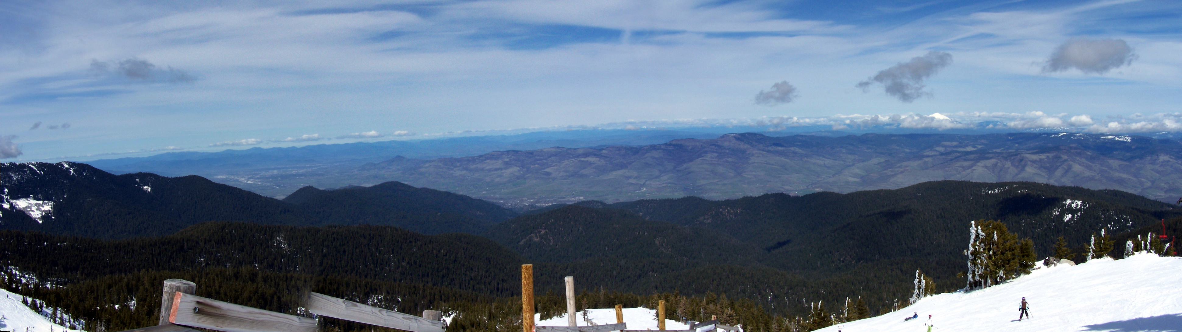
Looking north from near the summit Expansion
In 1998, the Mount Ashland Association (MAA) proposed an expansion plan downslope of the existing ski area in the middle branch of the East Fork of Ashland Creek. Local conservationists objected to the plan, citing concerns about soil erosion effects on streams and wetlands in the City of Ashland's municipal watershed as well as concerns for old-growth forest, the McDonald Peak Inventoried Roadless Area, and endangered wildlife.
In December 2004, the United States Forest Service approved the MAA proposal including a new chairlift accessing an additional 72 acres (290,000 m2) of intermediate and expert terrain, 200 more parking spaces, and a second lodge at the bottom of the glacial cirque known as The Bowl. The Forest Service received 28 notices of appeal, all of which were denied.
In January 2005, three organizations—Oregon Natural Resources Council, Headwaters and Sierra Club—and one individual (Eric Navickas) sued USFS in the U.S. District Court alleging that the decision violated the National Forest Management Act (NFMA) and the National Environmental Policy Act (NEPA). U.S. magistrate Owen Panner issued summary judgment denying the lawsuits in February 2007, noting, "You cannot make an omelet without breaking a few eggs."
ONRC, Headwaters and Sierra Club, but not Navickas, appealed Panner's judgment to the U.S. Court of Appeals for the Ninth Circuit, which in turn stayed Panner's decision and enjoined the expansion pending review. The three-judge appellate panel, which included appointees of Presidents Jimmy Carter, George H.W. Bush and George W. Bush, cited a likelihood of irreparable harm to Pacific Fisher, a rare forest carnivore known to live in the Ashland Creek watershed that USFS classifies as sensitive, and which the U.S. Fish and Wildlife Service considers endangered.
In September 2007, the appellate court ruled that USFS violated the NFMA and NEPA in four ways when it approved the expansion.
First, the court noted USFS failure to substantiate its assertion that expansion would not harm Fisher, in violation of the 1990 Rogue River National Forest Land and Resource Management Plan (LRMP) requirement to base its analysis on study of local and total populations of sensitive wildlife known to exist at sites proposed for development.
Second, the court ruled that USFS overlooked adverse cumulative effects to Fisher resulting from development in a roadless forest corridor of significant biological importance linking the Klamath-Siskiyou Mountains with the Cascade Mountains, as well as from other concurrent forest management activities planned nearby.
Third, the court rejected as unreasonable USFS claims that known landslides should be excluded from riparian reserve under the 1994 Northwest Forest Plan. It noted significant consequences to the City of Ashland's watershed resulting from the erroneous agency interpretation of riparian management criteria.
Finally, the court found that 35 acres (140,000 m2) which USFS approved for development in fact merits designation as restricted watershed under the 1990 Rogue River National Forest LRMP. That designation limits soil disturbance caused by management activities. In its 2004 decision, the Forest Service stated that it is not possible to limit soil disturbance below allowed thresholds in the course of ski area development.
Linda Duffy, ranger of the Siskiyou Mountains Ranger District, announced in October 2007 that USFS would prepare a supplemental environmental impact statement in an attempt to remedy deficiencies in the prior analysis and move the ski area expansion forward.
Other activities
Mount Ashland is a popular destination in summer for hiking, mountain biking, and sightseeing. The southernmost stretch of the Pacific Crest Trail in Oregon skirts the south and east sides of the mountain. The Spring Thaw mountain bike festival, the largest cycling event in Southern Oregon, is a series of races and events held each year in early March, starting from the town of Ashland and including the lower slopes of Mount Ashland. The Jean Chinn Memorial Mount Ashland Hill Climb Race is a hill climb, and a combination road and mountain bike race, starting from the town of Ashland and ending at the Mount Ashland ski area parking lot, with a different route for road and mountain bikes. The Siskiyou Out Back is a 50 kilometre (31 mi) ultramarathon trail run, starting and ending at the Mount Ashland ski area parking lot.
The peak is also the site of the transmitter and antenna for KTVL Channel 10 television, based in Medford, Oregon, approximately 15 miles (24 km) to the north.
References
External links
- "Mount Ashland". Geographic Names Information System, U.S. Geological Survey. http://geonames.usgs.gov/pls/gnispublic/f?p=gnispq:3:::NO::P3_FID:1158108. Retrieved 2008-11-07.
- Mount Ashland Ski Area, official website
- Rogue-Siskiyou National Forest
- Spring Thaw mountain bike festival
- Callahan's Challenge Hill Climb Time Trial Series
- Jean Chinn Memorial Mount Ashland Hill Climb Race
- Siskiyou Out Back
- MountAshland.com, opposition to expansion
- Ashlanders for Mt. Ashland, support for expansion
Ski areas and resorts in Oregon Mount Hood Region Central Oregon Hoodoo • Mount Bachelor • Willamette PassEastern Oregon Anthony Lakes • Ferguson Ridge • Spout SpringsSouthern Oregon Mount Ashland • Warner Canyon • Mount Bailey Cat SkiingCategories:- Visitor attractions in Jackson County, Oregon
- Landmarks in Oregon
- Ski areas and resorts in Oregon
- Cirques
- Ashland, Oregon
- Buildings and structures in Jackson County, Oregon

Wikimedia Foundation. 2010.