- The Moss
-
The Moss 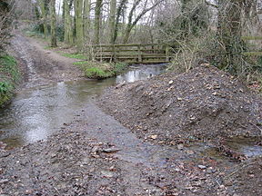
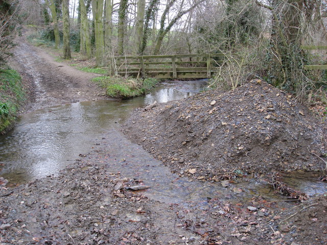
The Moss, just to the north of Troway.Origin Coalpit Wood, Coal Aston, Derbyshire Mouth River Rother at Eckington Basin countries  United Kingdom
Length 4.8 miles (7.7 km) Source elevation 518 feet (158 m) The Moss is a brook in North East Derbyshire, England.
When Rother Valley Country Park was built in 1980s, they used water from The Moss to fill the lakes.[1]
Contents
Name
The name of the river derives from Moss Beck, which means 'stream through marshy ground'.[2]
Course
The Moss' source can be found just to the east of Jordanthorpe Parkway (B6057 road). The source is a natural spring which lies in an area of woodland called Coalpit Wood.
The river flows through the Moss Valley and through the villages of Geerlane, Birleyhay, Ford and Eckington. Several areas of woodland are traversed, these include Coalpit Wood, Long Wood and Eckington Park.The main tributaries of The Moss are the Robin Brook, the Owler Car Brook, Sickle Brook, Troway Brook, Sloadlane Brook, and Ridgeway Brook.
The Moss flows into the River Rother in Eckington, Derbyshire, near Eckington Mine.
Moss Valley
Moss Valley is the name of the valley carved out by The Moss, located in North East Derbyshire, just south of Sheffield, England. Nearby settlements include Charnock, Troway, Eckington, Mosborough, and Ridgeway.
Moss Valley is home to the Eckington Woods and Bluebell Woods, the latter being a local term coined because of the quantity of bluebells which cover the woods in the springtime.
The valley, which is formed by The Moss and its tributaries, covers an area of about 10 square kilometres (3.9 sq mi).[3][4]
Industry
Moss Valley, due to its location next to a river near several coal seams and rock outcrops, has seen lots of industry over its history.
Moss Valley has a long history of quarrying and mining. Most of the quarries and mines are now closed, but several are still open. The coal mine near to where The Moss flows into the River Rother, Eckington Coal Mine (a drift mine operated by Moorside Mining Co. Ltd.), is still open; as is Sicklebrook Quarry in Sicklebrook (near Troway).
There are also several mills in the valley. In several locations, The Moss has been dammed to create reservoirs and mill ponds.
Moss Valley used to be renowned for its excellent sickle and scythe production.
Sport and recreation
Moss Valley is popular among walkers, ramblers and cyclists.[citation needed] On a bank holiday the woods can be very busy with people, families and groups exploring the woods or linking the woods into a wider walk. Mountain bikers are a common sight in the area, and several trails are popular amongst local cyclists on both the Mosborough and the Eckington sides of the valley. The two ponds on the Ridgeway side are used for private fishing, and there is a car park at this end, as well as the Bridge Inn public house.
Wildlife
A 25.9 hectare strip of land along the southern bank of The Moss in the Moss Valley has been designated a Site of Special Scientific Interest by English Nature, particularly due to its value as a high quality habitat for invertebrates.[3] This also includes about 5 hectares of the increasingly rare floodplain grazing marsh habitat.
There is a variety of common English woodland wildlife in the woods. Species often seen include; badgers, hares, roe deer,[5] foxes, rabbits and owls. The 85 species of moths and butterflies includes the White-letter Hairstreak.[5]
References
- ^ "Rother Valley Country Park History". Rother Valley Country Park. http://www.rothervalley.f9.co.uk/history.htm. Retrieved 26 February 2011.
- ^ Cameron, Kenneth (1959). The Place-Names of Derbyshire. Cambridge University Press. p. 13.
- ^ a b "Moss Valley". Sites of Special Scientific Interest. Natural England. http://www.english-nature.org.uk/citation/citation_photo/1000381.pdf. Retrieved 26 February 2011.
- ^ "Moss Valley Meadows". Sites of Special Scientific Interest. Natural England. http://www.sssi.naturalengland.org.uk/citation/citation_photo/1004522.pdf. Retrieved 26 February 2011.
- ^ a b Moss Valley Woodlands, WildSheffield, accessed 1 September 2009
Categories:- Sites of Special Scientific Interest in Derbyshire
- Rivers of Derbyshire
- Valleys of Derbyshire
Wikimedia Foundation. 2010.