- Montecristo Trifinio National Park
-
For the national park in El Salvador, see Montecristo National Park.
Montecristo Trifinio National Park IUCN Category II (National Park)Location of Montecristo Trifinio in Honduras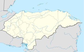

Location Honduras Coordinates 14°26′31″N 89°19′32″W / 14.44194°N 89.32556°WCoordinates: 14°26′31″N 89°19′32″W / 14.44194°N 89.32556°W[1] Area 54 km2 (21 sq mi)[1] Established 1 January 1987[1] Montecristo Trifinio National Park is a national park in Honduras. It was established on 1 January 1987 and covers an area of 54 square kilometres.[1]
The Montecristo massif is an area where the borders of Honduras, Guatemala and El Salvador meet, and its protection was a joint initiative of these three countries, which resulted in the creation of the national parks in Honduras and El Salvador, as well as the Guatemalan Trifinio biosphere reserve.
References
- ^ a b c d "Honduras - Montecristo Trifinio". United Nations Environment Programme. http://sea.unep-wcmc.org/wdbpa/sitedetails.cfm?siteid=18804. Retrieved 1 March 2010.
Capiro Calentura · Celaque · Cerro Azul de Copán · Cerro Azul Meámbar · Cusuco · Jeanette Kawas · La Muralla · La Tigra · Montaña de Comayagua · Montaña Santa Bárbara · Montaña de Yoro · Montecristo Trifinio · Patuca · Pico Bonito · Pico Pijol · Port Royal (proposed) · Río Plátano (proposed) · Sierra de AgaltaCategories:- IUCN Category II
- National parks of Honduras
- Protected areas established in 1987

Wikimedia Foundation. 2010.