- Río Plátano Biosphere Reserve
Infobox protected area
name = Río Plátano Biosphere Reserve
iucn_category = II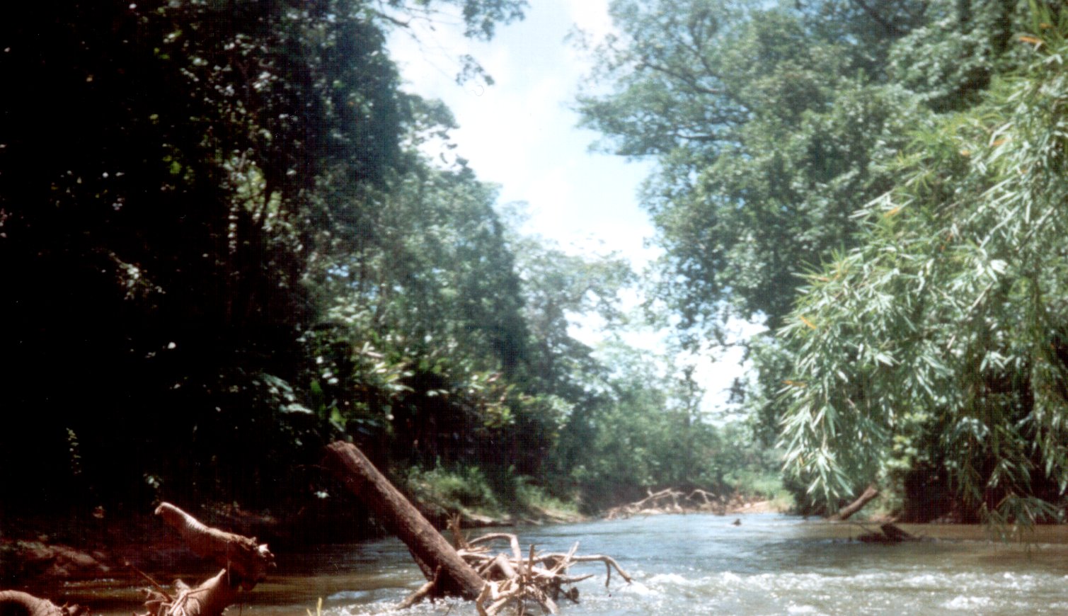
locator_x= |locator_y=
location = north-easternHonduras
nearest_city = Palacios
lat_degrees=15 |lat_minutes=44 |lat_seconds=40 |lat_direction=N
long_degrees=84 |long_minutes=40 |long_seconds=30 |long_direction=W
area = 1,297,303.25 acres (5,250 km²)
established =1982
governing_body = Department of Protected Areas & Wildlife, State Forestry Administration
world_heritage_site = 1982The Río Plátano Biosphere Reserve is 5,250 sqkm of preserved land in theLa Mosquitia region on the Caribbean coast ofHonduras . Most of the land runs along theRío Plátano . The reserve has a number of endangered species and some of Honduras largest sections of forest. It has been a World Heritage site and biosphere reserve since 1982. The reserve encompasses both mountainous and lowland tropical rainforest, full of diverse wildlife and plant life, and has more than 2000 inhabitants. The reserve is part of theMesoamerican corridor land that stretches across America.Although the reserve covers over a large portion of Honduras, very little is recorded about the diverse biology within it. While current management plans have proven successful, a continued investigation into management plans and future conservation issues will be necessary to keep this valuable reserve safe.
History
In 1969, the land was set aside as an archaeological national park. A management and development was designed in 1980 and implemented in 1987 by the Department of Natural Renewable Resources. In 1997, an additional 3250 km² was designated as a buffer zone for the reserve. In 1997 the
German Development Bank began a plan that would significantly expand the reserve to the Patuco River and the Bosawas Biosphere Reserve in Nicaragua. Currently, the German plan has been delayedcite web
last = UNEP-WCMC
title = Natural Site Data Sheet: Rio Platano Biosphere Reserve
url=http://www.unep-wcmc.org/sites/wh/rioplata.html
accessdate = 2008-04-01 ] .Archeological sites
The reserve still has over 200 archeological sitescite web
last = UNESCO-MAB
title = Biosphere Reserve Information
url=http://www.unesco.org/mabdb/br/brdir/directory/biores.asp?mode=all&code=HON+01
accessdate = 2008-04-01 ] , including the point where Christopher Columbus first discovered America. The reserve also contains Mayan ruins, including stone from buildings and roads, rock carvings, and other remainscite journal
first = Jens
last = Yde
title = Review: [untitled]
journal = American Antiquity
volume = 23:2
pages = 196 ] . Ciudad Blanca was a Mayan city that once stood where the reserve currently protectscite web
last = McGinley
first = Mark
title = Rio Platano Biosphere Reserve
url=http://www.eoearth.org/article/R%C3%ADo_Pl%C3%A1tano_Biosphere_Reserve,_Honduras
accessdate = 2008-04-01 ] . The archeological site is still being excavated.Few of these sites are protected, and many are a significant factor for tourism. Although the archeological value of the region initially played a large part in the formation of the reservation, the reservation currently focuses mostly on the protection of the forests.
Local population
The reserve is home for more than 2,000 indigenous people and a growing number of migrant inhabitants. The population includes four very different and unique cultural groups:
Miskito Amerindians ,Pesh ,Garifunas , and theladino . The smaller groups, the Pesh, Garifunas, and Miskito inhabitants live mostly in the north, alongside the river. These people have a variety of rights to the land and mostly use the land for agriculture. The smaller-scale agriculture of the Pesh is easily made sustainable. Many of the largest group, the ladino, entered the reserve from the south. Conflict over land rights is a prominent source of conflict between ethnic groups.Conservation
In 1996 the reserve received the
World Heritage in Danger designation, but was removed from the list in 2007 recognizing a significant improvement in conservation efforts. This removal recognizes the substantial improvement in the conservation efforts in the reservation.The area is protected by policy from the Department of Protected Areas & Wildlife, State Forestry Administration in Honduras, and receives some funding from the World Wildlife Fund and other private organizations. A number of governmental and non-governmental organizations and committees have developed and implemented conservation plans in the region. The main goal of the reserve is to protect the land from deforestation and development.
The reserve’s conservation plan also aims to integrate local inhabitants into their environment via sustainable agricultural practices. Indigenous populations play a large part into the success of the conservation plan, both inside the reservation and outside the reservation in the buffer zones. Assigning titles and recognizing de facto property rights played an important part of the beginning of the conservation plan in the reserve.
A reserve management plan, implemented in 2000, included macrozoning, subzoning, and specific plans for conservation issues. cite web
last = Ohnesorge
first = Bettina
title = State of Conservation of the Río Plátano Biosphere Reserve and World Heritage Site, Honduras, Central America
url=http://whc.unesco.org/download.cfm?id_document=9013
accessdate = 2008-04-01 ] The macrozoning plan established buffer zones, cultural zones, and nucleus zones. The overall threat, especially in the nucleus zones, had decreased in 2006 leading to the removal of the World Heritage in Danger designation in 2007.The conservation plan also requests continued commitment to clarifying land ownership in and around the reserve. More research needs to be done to understand the value of the reserve and the potential threats it faces.Climate
The annual participation is between 2850mm to 4000mm annually, and the local inhabitants have noticed a trend towards dryer seasons . The climate in the region is key to preserving the valuable wet forests and important for the agriculture upon which the indigenous people depend.
The reserve also receives an average of four severe tropical storms every ten years . The tropical storms echo through the rest of the reserve through the numerous waterways. Development plans and agriculture depend upon the river’s natural levees to drain water from low-lying areas. The aftereffects of the Hurricane Mitch in 1998 disrupted the development of the Patuca II hydroelectric facility .
Geography
The land stretches from La Moskitia coast through lagoons and along the Río Plátano up into the mountains. The buffer area also includes the Paulaya and Sico valley, and will eventually extend to the Patuca River. The reserve is mostly mountainous, including Pico Dama, a giant granite formation, and Punta Piedra, the highest peak at 1326m.
The reserve includes nearly the entire watershed of the Río Plátano, and many other smaller waterways. Much the region is covered with mountainous terrain. The rivers wind through both the lower and mountainous regions. The forms many oxbows as it crosses the long stretch of flat lowland that separates the foothills from the lagoons. The river has created oxbow lakes, marshes, and natural levees.
The geography of the region makes agriculture and conservation especially complicated. The low-land areas covered with water throughout the winter, and the rivers and the various tributaries house a wide variety of flora. The coastal region to the north is more commonly documented, so the rest of the region needs more thorough exploration.
Flora and Fauna
The reserve contains part of the largest surviving area of undisturbed tropical rainforest in Honduras and one of the few remaining in Central America, with numerous endangered species. Although there is a growing amount of research available on the biodiversity within the reserve, the current management plans emphasize the need for more research on the flora and fauna of the region.
Flora
The major ecosystems include Mangrove and freshwater swamps and marshes, sedge prairie, pine savanna, and gallery forest. There is a diverse amount of flora, estimated at over 2,000 species of vascular plants, although little has been written about it because many species are new or undiscovered.cite web
last = Herrera-MacBryde
first = Olga
title = CPD: Middle America, Site MA15
url=http://botany.si.edu/projects/cpd/ma/ma15.htm
accessdate = 2008-04-01 ] There are two major mangrove ecosystems along the coast: the Brus Lagoon and the Iban Lagoon. The Brus area is 120 km² and brackish, and the Ibans area is 63 km² and freshwater. The mangroves are valuable and fragile, so they are a significant part of the value of the reserve.Further in, the land becomes prairie and savannah with pine and palm, depending upon the availability of water. Along the watershed of the rivers, the vegetation is thick wet forest, which is again, unfortunately poorly studied.
Fauna
The documented fauna of the region includes 39 species of mammals, 377 species of birds and 126 species of reptiles and amphibians . The region is rich with birds, including the king vulture, harpy eagle, great curassow, crested guan, scarlet macaw, green macaw and military macaw.
The representative species include white-faceds, mantled howler and spider monkeys, three-toed sloth, paca, kinkajou, coatimundi tayra, Central American otter, puma, collared and white-lipped peccaries and red brocket deer.
Rare and endangered species
The rare or endangered species: giant anteater, jaguar, ocelot, margay, Caribbean manatee, and Central American tapir.The amount of environmental education that exists in Honduras is minimal, so it is difficult to protect these endangered species cite web
last = TAPIR SPECIALIST GROUP
title = Tapirs: Status Survey and Conservation Action Plan
url=http://www.tapirback.com/tapirgal/iucn-ssc/tsg/action97/ap97-10.htm
accessdate = 2008-04-01 ] . The widespread poverty and lack of accurate research on the ecosystems makes protection increasingly difficult. While the conservation programs are reaching their goals, it is difficult to tell whether or not the management plans are successfully protecting these species directly. Protecting the ecosystems, like the rainforest, upon which the endangered species depend serves as an important indirect benefit.Tourism
The high density of wildlife along La Mosquitia coast makes it a popular destination for ecotourists. Although private organizations are launching ecotourism enterprises throughout the region cite news
last = Crockett
first = Carrie
publisher = Motly Fool
title = Where are they now?
url=http://www.fool.com/investing/general/2007/07/24/where-are-they-now.aspx
accessdate = 2008-04-01 ] , the government does not have a comprehensive plan to control or benefit from ecotourists . Ecotourism can offer relief for poverty stricken local populations, increased awareness of biological value, and can generate income that can be used to fund projects for the reserve.Although a properly implemented tourist industry could benefit the reserve, the currently unregulated industry has created a large amount of traffic and damaged archeological sites. The tourism industry has an impact across the entire reserve, but the unprotected archeological sites are especially hurt. Without developing infrastructure, it is difficult to have a profitable and sustainable ecotourism industry, especially in a reserve with difficult conservation issues.
Conservation Issues
Despite its removal from the World Heritage in Danger designation, the reserve still faces a few conservation threats. Logging and development continue to be problems, and the situation is exacerbated by an increasing population from poorer parts of Honduras or refugees from Nicaragua.
Logging
The government regulates the logging industry in Honduras through the Honduran Cooperation for Forestry Development. Despite oversight of these and other organizations and a moratorium on logging inside the reserve, mahogany continues to be cut and removed cite web
last = TED Case Studies
title = Honduras and Deforestation
url=http://www.american.edu/TED/honduras.htm
accessdate = 2008-04-01 ] . The Honduran government has failed to pass laws strict enough to have a substantial impact on preventing deforestation. The entire reserve could quickly disappear, even through unregulated deforestation.Local populations admit that a large amount mahogany is leaving the reserve, but many poorer sections of the economy see the high price of mahogany as enough incentive to clear away valuable ecosystems that provide irreplaceable services to the water and soil. The loggers behind much of the reserve’s deforestation is still mostly unknown .
In order to curb the logging problems, the reserve needs to establish stricter regulations. When logs are typically transported out through waterways, it should be relatively easy to monitor the logging activity. If the local populations were also better informed on the importance of the forests, alternative ways to earn a living, and more sustainable methods of extracting mahogany, the problem could be addressed. The current management plan establishes more organization to approach the logging problem as it approaches.
Development
Development within and around the reserve poses a problem for the conservation plans. The construction of the Patuca II hydroelectric plant in the Patuca river highlights the elements of the debate. A hydroelectric plant does more than affect the waterway where it is build. It also requires infrastructure that disturbs the environment around it. A lot of the reserve does not have developed roadways or power. A hydroelectric facility would require cause development throughout the reserve.
Agriculture throughout the reserve poses a more direct threat. As the populations expand within the reserve, so do their agricultural operations. Much of the wetland area is unsuitable for agriculture, needing levees and continued development to be productive. Much of the non-legal de facto ownership has spurred conflict, sometimes violent, among different cultural groups over rights to agriculturally productive areas .
Poorer farmers resort to destructive techniques, like slash-and-burn, that are particularly damaging to the savannah and prairie land cite book
last = Youth
first = Howard
title = Green awakening in a poor country
publisher = World Watch
date = September 1, 1998
location = Honduras] . Although the current management plan aims to educate farmers about these destructive practices, they continue. Future management goals aim to promote sustainable technique among a larger number of the traditional farmers.
Refugees
Conflict in Nicaragua, poverty in Honduras, and an increasing number of hurricanes have driven many refugees into the reserve cite news
last = Weinberg
first = Boll
title = Indigenous Peoples, Civil Society under Attack in Colombia's Oil Zone
publisher = Knight Ridder/Tribune Business News
date = October 15, 2003] , making conservation efforts increasingly complicated. These refugees often enter through the south of the reserve, and sometimes create more conflict integrating with the indigenous populations. While traditional farming practices can be somewhat destructive, the stress created by larger populations is much more damaging to the reserve.Currently, the Honduran Corporation for Forestry Development with the help of the Honduran Public Safety Force polices the reserve, hoping to decrease the number of people who invade. Regardless of their efforts, refugees continue to enter. The reservation considered a plan to relocate refugees outside the reserve, creating both an increased buffer and reducing the stress within the reserve. This plan was met with political opposition.
References
ee also
Honduras La Mosquitia List World Heritage Sites External links
* http://whc.unesco.org/en/news/365
* http://whc.unesco.org/en/list/196
* http://botany.si.edu/projects/cpd/ma/ma15.htm
Wikimedia Foundation. 2010.