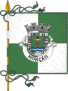
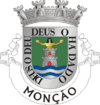
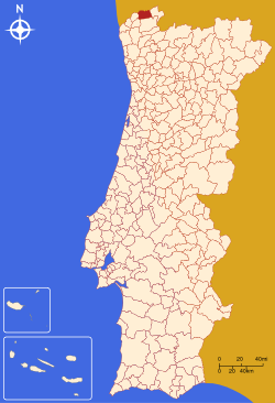
- Monção Municipality
-
Monção — Municipality — 
Flag
Coat of armsLocation in Portugal Coordinates: 42°04′N 8°29′W / 42.067°N 8.483°WCoordinates: 42°04′N 8°29′W / 42.067°N 8.483°W Country  Portugal
Region Norte, Portugal Subregion Minho-Lima District/A.R. Viana do Castelo Government - Mayor José Moreira (PS) Area - Total 211.3 km2 (81.6 sq mi) Population (2006) - Total 19,738 - Density 93.4/km2 (241.9/sq mi) Parishes (no.) 33 Municipal holiday
March 12Website http://www.cm-moncao.pt/ Monção (Portuguese pronunciation: [mõˈsɐ̃w]) is a municipality in Portugal with a total area of 211.3 km² and a total population of 19,738 inhabitants (2006).
The municipality is composed of 33 freguesias (parishes), and is located in the district of Viana do Castelo.
The current Mayor is José Emílio Pedreira Moreira, elected by the Socialist Party.
The municipal holiday is March 12.
It is the place of birth of José Gomes Temporão, current Minister of Health of Brazil.
Contents
Population
Population of Monção Municipality (1801–2004) 1801 1849 1900 1930 1960 1981 1991 2001 2004 12,095 14,983 26,077 24,585 27,393 23,799 21,799 19,956 19,842 Parishes
- Abedim
- Anhões
- Badim
- Barbeita
- Barroças e Taias
- Bela
- Cambeses (Monção)
- Ceivães
- Cortes (Monção)
- Lapela
- Lara (Monção)
- Longos Vales
- Lordelo (Monção)
- Luzio
- Mazedo
- Merufe
- Messegães
- Monção (freguesia)
- Moreira (Monção)
- Parada (Monção)
- Pias (Monção)
- Pinheiros (Monção)
- Podame
- Portela (Monção)
- Riba de Mouro
- Sá (Monção)
- Sago
- Segude
- Tangil
- Troporiz
- Troviscoso
- Trute
- Valadares (Monção)
See also
- Vinho Verde
- Brejoeira Palace
- Mercy Charitys's Church of Valadares
- Longos Vales's Monastery
External links
Arcos de Valdevez · Caminha · Melgaço · Monção · Paredes de Coura · Ponte da Barca · Ponte de Lima · Valença · Viana do Castelo · Vila Nova de Cerveira Categories:
- Monção
- Portugal geography stubs
Wikimedia Foundation. 2010.

