- Mokattam
-
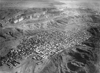
 The Moqattam Hills (upper area), above the City of the Dead—Cairo necropolis, in 1904 aerial view by Eduard Spelterini from a hot air ballon.
Mokattam and the Moqattam Hills, (Arabic: المقطم), also Muqattam and Moqattam Mountain, is the name of a hill range and a suburb in them, located in southeastern Cairo, Egypt.[1][2][3]
Contents
Landform
The Arabic name Mokattam, which means "cut up" in English, refers to how the low mountain range of hills is divided into three sections. The highest segment is a low mountain landform called Moqattam Mountain.[4] In the past the low mountain range was an important ancient Egyptian quarry site for limestone, used in construction of the temples and pyramids. [2][2][5]
Settlement
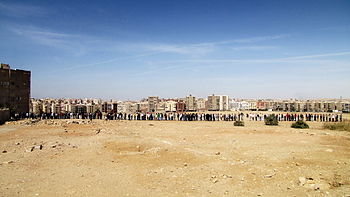
The hills are in the region of ancient Fustat, the new capital founded by 'Amr ibn al-'As after the Arab conquest of Egypt in 642 CE. A section of the Mokattam Hills contains Muqattam, an affluent suburb of Cairo.[3] Other sections have slums. The Zabbaleen people, who are an integral part of collecting and processing Cairo's municipal solid waste, live in Manshiyat Nasser, Garbage City, at the foot of the Mokattam Hills. [6]
Media
Moqattam is the name of a documentary film about the garbage collecting Manshiyat naser village and its Zabbaleen people, directed by Jehane Noujaim.
See also
in Moqattam Hills foothills
- City of the Dead (Cairo) - Cairo Necropolis
- City of the Dead (slum)
- Manshiyat Nasser - Garbage City
- List of types of limestone - ancient Egyptians quarried limestone in the hills
References
- ^ "Extraordinary Grace in Cairo: The Garbage Village of Muqattam". http://blog.siena.org/2008/02/extraordinary-grace-in-cairo-garbage.html. Retrieved 2009-02-05.
- ^ a b c Kamel, Seif. "Al Mokattam Mountain: On top of Cairo". http://www.touregypt.net/featurestories/mokattam.htm. Retrieved 2009-02-05.
- ^ a b "The Address Hotels & Resorts unveils first property in Emaar Misr’s Uptown Cairo". 2008-07-20. http://www.albawaba.com/en/countries/Egypt/232354. Retrieved 2009-02-05.
- ^ "Cave Church". http://www.cavechurch.com/miracle/index.asp. Retrieved 2009-02-05.
- ^ Sir Philip de M. Grey Egerton, Bart, M.P., F.R.S., F.G.S., P. d. M. G. (1854). "Palichthyologic Notes. No. 8. On some Ichthyolites from the Nummulitic Limestone of the Mokattam Hills, near Cairo". Quarterly Journal of the Geological Society 10: 374. doi:10.1144/GSL.JGS.1854.010.01-02.42.
- ^ Gauch, Sarah (January 6, 2003). "Egypt dumps 'garbage people'". The Christian Science Monitor. http://www.csmonitor.com/2003/0106/p07s02-woaf.html. Retrieved 2009-02-05.
Coordinates: 30°01′N 31°18′E / 30.02°N 31.30°E
Districts of Greater Cairo Cairo Abbassia · Ain Shams · Azbakeya · Boulaq · Daher · El-Manial · El-Marg · Mokattam area (Muqatam · City of the Dead · Manshiyat naser) · Nasr City · Obour City · El-Quba · Rhoda · El-Sakakini · Shobra area (Shobra · Elsahel · Road El Farag) · Shubra El-Kheima · Zeitoun
HistoricalAffluent
Giza Agouza · Giza · Haram · Imbaba
AffluentCategories:- Districts of Cairo
- Mountains of Egypt
- Geography of Cairo
- Egypt geography stubs
Wikimedia Foundation. 2010.

