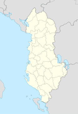
- Lunxhëri
-
Lunxhëri — Municipality — Coordinates: 40°7′N 20°11′E / 40.117°N 20.183°ECoordinates: 40°7′N 20°11′E / 40.117°N 20.183°E Country  Albania
County Gjirokastër County District Gjirokastër District Time zone Central European Time (UTC+1) – Summer (DST) CEST (UTC+2) Car Plates GJ Lunxhëri[1] (Greek: Λιούντζη) is a municipality in the district of Gjirokastër, Gjirokastër County, Albania. The municipality consists of the villages Qestorat, Dhoksat, Këllëz, Mingul, Nokovë, Erind, Gjat, Kakoz, Karjan and Valare.[2]
Apart from the municipality, Lunxhëri, traditionally incorporates a wider region that extends from Hormovë west, Gryka e Suhës south, the crest of Mount Lunxhëri east and the valley of the Drino west. The region has some rivers and streams (Përroi i Dhoksatit, Përroi i Qestoratit, and the river of Nimica). Additionally there are archeological sites near Këllez, Dhoksat, Erind as well the ancient Greek city of Antigonia, today a National Park.[3]
During World War I and the interwar period, many families, both of Albanian and Greek origin left the area.[4]
Contents
Notable people
- Koto Hoxhi, Rilindas.
- Nase Jani, Albanian poet.
- Kyriakos Kyritsis lawyer and member of the Greek Parliament (1915–1917) for the Argyrokastron Prefecture.
- Thanas Nano, from Nokovë, the father of Fatos Nano and writer [5].
- Mihal Prifti, first Albanian ambassador to the Soviet Union.[6]
- Ioannis Poutetsis (-1912), revolutionary.
- Petro Poga, former Albanian Rilindas and acting Prime Minister of Albania.
- Urani Rumbo (1895–1936), Albanian feminist, teacher and playwright.
- Pandeli Sotiri, Albanain Rilindas and director of the first Albanian school of modern times.
- Kristo Stoja, journalist.
- Christakis Zografos (1820–1898), benefactor and entrepreneur. Founder of a number of Greek schools (called Zografeia schools) in Qestorati, Gjirokastër and Constantinople.
- Georgios Christakis-Zografos (1863–1920), son of the above mentioned. Head of the Autonomous Republic of Northern Epirus.
External links
Traditional costumes
- Women's feast and bridal costume. Regional Guide of West Macedonia.
Traditional music
References
- ^ Albanian government budget legislation
- ^ Greece – Albania Neighbourhood Programme
- ^ Antigonea Archaeological Park website
- ^ http://hal.archives-ouvertes.fr/docs/00/16/57/25/PDF/de_Rapper_2005a.pdf p.10 These fluid identities were to be crystallised at the time of the creation of the Albanian state (1913) and during the process of Albanisation that followed. Lunxhëri was actually included in the definition of Northern Epirus as a land of Hellenism that should have been given to the Greek state in 1913, and many families left the area, and Albania,during and after the First World War, to avoid becoming citizens of the new Albanian state. These people are called in Albanian propaganda filogrek and seem to have been powerful enough at some times to force pro-Albanian families to leave Lunxhëri...
- ^ [1]
- ^ [2]
Municipalities of Gjirokastër County Capital: GjirokastërGjirokastër District Antigonë · Cepo · Dropull i Poshtëm · Dropull i Sipërm · Gjirokastër · Lazarat · Libohovë · Lunxhëri · Odrie · Picar · Pogon · Qendër Libohovë · Zagori
Përmet District Tepelenë District Categories:- Populated places in Gjirokastër County
Wikimedia Foundation. 2010.

