Milliken Mine

Milliken Mine
Milliken Mine
Location
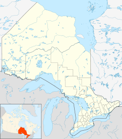
Milliken Mine is located in Ontario
Milliken Mine
Location in Ontario

46°24′12.89″N 082°37′40.10″W / 46.4035806°N 82.627806°W / 46.4035806; -82.627806Coordinates: 46°24′12.89″N 082°37′40.10″W / 46.4035806°N 82.627806°W / 46.4035806; -82.627806

Location Elliot Lake
Province Ontario
Country Canada
Owner
Company Rio Algom
Production
Products Uranium
Production 6.3 Mt ore
History
Opened 1958
Closed 1964

The Milliken Mine is an abandoned uranium mine located approximately 2.5 km northeast of Elliot Lake, Ontario, owned and operated by Rio Algom Ltd. The site has been rehabilitated and its tailings facility is currently undergoing environmental monitoring by Denison Environmental Services as part of the monitoring of the Stanleigh Mine and tailings facility.

The site was in operation from 1958 to 1964,[1] during which time it produced 6.3 million tonnes of ore[citation needed]

Contents

History

Geology

Other mines in the area

  • Stanleigh Mine
  • Spanish American Mine
  • Can-Met Mine
  • Panel Mine
  • Denison Mine
  • Stanrock Mine
  • Quirke Mine(s)
  • Pronto Mine
  • Buckles Mine
  • Lacnor Mine
  • Nordic Mine

See also

References

External links


Wikimedia Foundation. 2010.

Игры ⚽ Поможем решить контрольную работу

Look at other dictionaries:

  • Nordic Mine — Location …   Wikipedia

  • Denison Mine — Location …   Wikipedia

  • Land mine — For other uses, see Land mine (disambiguation). Minefield redirects here. For other uses, see Minefield (disambiguation). Examples of anti personnel mines. From left to right: an M14, Valmara 69 (a bounding mine), and VS 50 …   Wikipedia

  • Elliot Lake — Infobox Settlement official name = City of Elliot Lake other name = native name = nickname = settlement type = motto = imagesize = 300px image caption = The city of Elliot Lake; the lake on the right flag size = image seal size = image shield =… …   Wikipedia

  • Johnstone — infobox UK place country = Scotland official name= Johnstone gaelic name=Baile Eòin scots name= os grid reference= NS434628 map type= Scotland latitude=55.83333 longitude= 4.51667 population= 16,847 [… …   Wikipedia

  • List of minor characters in 24 — This is an incomplete list, which may never be able to satisfy particular standards for completeness. You can help by expanding it with reliably sourced entries. See also: List of 24 characters The following is a list of recurring and minor… …   Wikipedia

  • Siege of Vicksburg — As the Union forces approached Vicksburg, Pemberton could put only 18,500 troops in his lines. Grant had over 35,000, with more on the way. However, Pemberton had the advantage of terrain and fortifications that made his defense nearly… …   Wikipedia

  • Liste Des Batailles De La Guerre De Sécession — Cette liste des batailles de la guerre de Sécession répertorie les 391 principales batailles ayant opposés les États confédérés aux États de l Union durant la guerre de Sécession. Ces 391 batailles sont considérées par le National Park Service… …   Wikipédia en Français

  • Liste des batailles de la guerre de Secession — Liste des batailles de la guerre de Sécession Cette liste des batailles de la guerre de Sécession répertorie les 391 principales batailles ayant opposés les États confédérés aux États de l Union durant la guerre de Sécession. Ces 391 batailles… …   Wikipédia en Français

  • Liste des batailles de la guerre de Sécession — Théâtre des opérations Cette liste des batailles de la guerre de Sécession répertorie les 391 principales batailles ayant opposés les États confédérés aux États de l Union durant la guerre de Sécession. Ces 391 batailles sont considérées par le… …   Wikipédia en Français

Share the article and excerpts

Direct link
Do a right-click on the link above
and select “Copy Link”