- Milbrodale, New South Wales
-
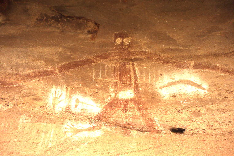
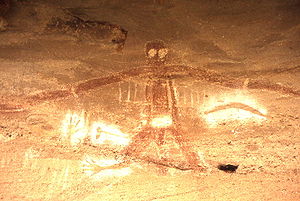 Main figure, Baiame Cave
Milbrodale is a village in the Hunter Valley of New South Wales, Australia. It is located in the Local Government Area of Singleton Shire Council.
Contents
Description
Milbrodale is set in a rural area twenty-three kilometres south of Singleton. To the north of Milbrodale is Darkey Creek, while to the east is Wollombi Brook. To the west is the rugged sandstone wilderness of the Wollemi National Park, the second-largest national park in New South Wales. Milbrodale is approximately twenty-nine kilometres from Singleton and seventy-eight kilometres from the city of Newcastle.[1]
History
Milbrodale was first established by the Rev. Richard Hill in 1832. Hill had arrived from England to assist with the ministering of the colony at Sydney, and worked as assistant to the minister at St Philip's Church in Sydney. Later, he became minister at St James's Church, Sydney (designed by Francis Greenway). Eventually, Governor Lachlan Macquarie gave him a land grant of 1,200 acres (4.9 km2) in the Hunter Valley. After journeying along a track that was the beginning of the Great North Road, Hill arrived in the Hunter Valley and built a stone house at the junction of Wollombi Brook and Parsons Creek. He named his property Milbro Dale, after his mother (her name had been Marlborough, which was commonly shortened to Milbro). Hill died in 1836 and his wife Phoebe Sapphira returned to Sydney after selling the farm.[2] The property changed hands several times over the years but eventually deteriorated and was demolished in 1978.[3]
The village grew as time went by, but the local children had to go to school at the nearby village of Bulga, transported by a horse and cart service subsidised by the Government. A public school was finally opened at Milbrodale in 1921 on a 5-acre (20,000 m2) property obtained by Government grant.[4]
Aboriginal site
The most significant feature of Milbrodale is an eighty-hectare site containing rock shelters with many signs of Aboriginal occupation. Excavations carried out by staff from the Australian Museum, Sydney, produced much evidence of the "Small Tool Phase" of Aboriginal history. One of the main features is a rock shelter popularly known as Baiame Cave, which contains a group of Aboriginal paintings. The central figure is a large male figure that may represent Baiame, the Sky Father.[5] The site is on private property and is listed on the Register of the National Estate.[6]
Gallery
-
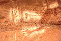
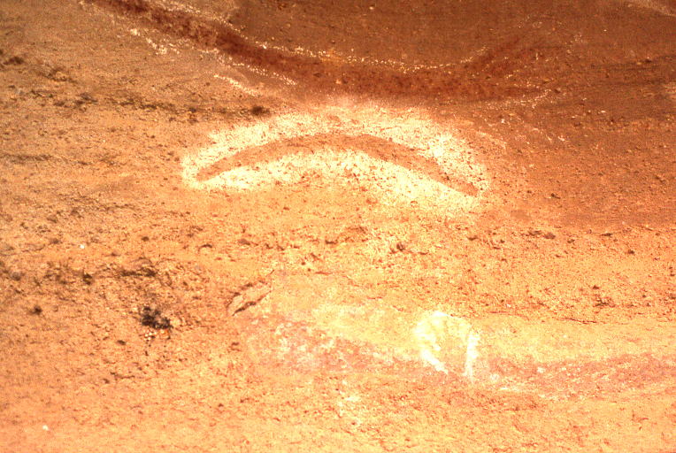
Detail, Baiame Cave
-
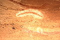
Detail, Baiame Cave
-
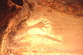
Detail, Baiame Cave
See also
- Aboriginal sites of New South Wales
- Great North Road, Australia
References
- ^ Gregory's State Road Map of New South Wales, Map 220, 11th Edition
- ^ Milldale Website:Retrieved 21st December 2009
- ^ Tocal Website:Retrieved 22nd December 2009
- ^ Milbrodale School:Retrieved 21st December 2009
- ^ Singleton Tourism:Retrieved 22nd December 2009
- ^ Heritage of Australia, published by Macmillan Company, 1981, p.2/211
Coordinates: 32°45′S 151°06′E / 32.75°S 151.1°E
Towns, suburbs and localities of Singleton Shire | Hunter Region | New South Wales Towns, suburbs
& localitiesAbbey Green • Appletree Clearing • Appletree Flat • Archerfield Estate • Baxter Junction • Belford • Big Ridge • Bowmans Creek • Box Tree Clearing • Branxton • Bridgman • Broke • Bulga • Camberwell • Carrowbrook • Caswell • Clydesdale • Combo • Comleroi • Dalwood • Darlington • Dawsons Hill • Dellhurst • Dights Crossing • Doyles Creek • Dunolly • Dural • Dyrring • Elderslie • Falbrook • Fern Gully • Fern Hill • Fordwich • Garland Valley • Glendon • Glendon Brook • Glendonbrook • Glennies Creek • Glenridding • Goorangoola • Gouldsville • Gowrie • Greenland • Gum Tree Hole • Hambledon Hill • Hebden • Howes Valley • Howick • Hunterview • Ingar • Jerrys Plains • King Junction • Kings Cross • Lambs Creek • Lambs Valley • Leconfield • Lemington • Liddell • Loders Creek • Long Point • Lower Belford • Lucernia • Maison Dieu • Mcdougalls Hill • Middle Falbrook • Milbrodale • Minimbah • Mirannie • Mitchells Flat • Mount Olive • Mount Pleasant • Mount Royal • Mount Thorley • North Rothbury • Nundah • Obanvale • Owendale • Paynes Crossing • Pokolbin • Putty • Radfordslea • Raspberry Clear • Ravensworth • Redbournberry • Redmanvale • Reedy Creek • Rixs Creek • Rothbury • Roughit • Scotts Flat • Sedgefield • Singleton • Singleton Heights • Singleton Military Area • Singleton South • St Clair • Stanhope • Three Ways • Wambo • Wambo South • Warkworth • Wattle Ponds • Westbrook • Whittingham • Wollemi • Wylies Flat
Other places &
points of interestHunter River • Lone Pine Barracks • Wollemi National Park
Categories:- Suburbs of the Hunter Region, New South Wales
- Towns in the Hunter Region, New South Wales
-


Wikimedia Foundation. 2010.