- Metzudat Ze'ev
-
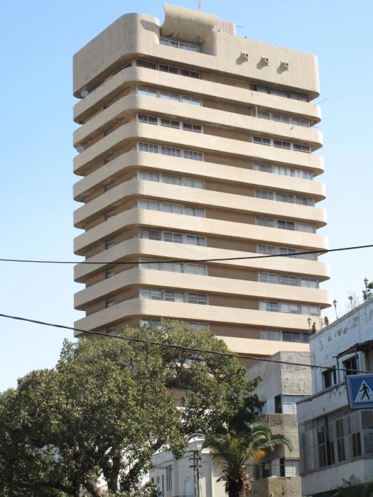
 Metzudat Ze'ev, a view from King George Street, Tel-Aviv
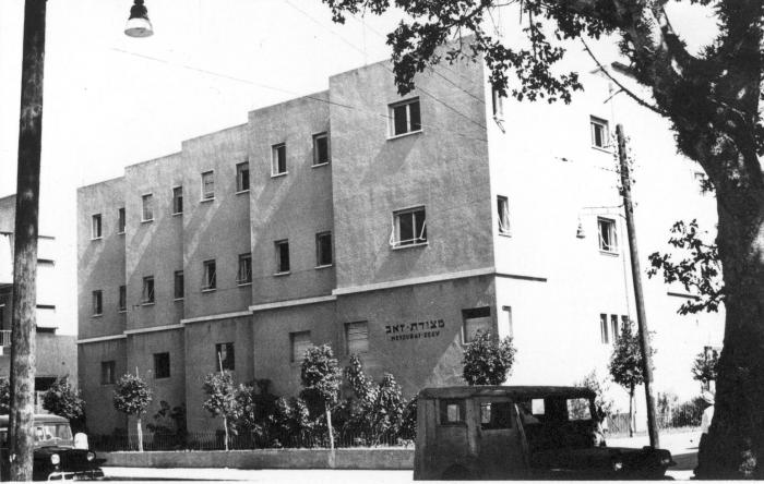
 Metzudat Ze'ev before the construction of the tower
Metzudat Ze'ev (Hebrew: מצודת זאב, lit. "Ze'ev's fortress / stronghold") is an office building located on 38 King George Street in Tel-Aviv, Israel. It is also known as Beit Jabotinsky (Hebrew: בית ז'בוטינסקי, lit. "Jabotinsky's House") or sometimes simply as HaMetzuda (Hebrew: המצודה, lit. "the fortress / stronghold").
Built in a Brutalist style, the building was planned in 1936 and its construction lasted until 1963. Upon completion, at 60 metres (200 ft), it was one of the tallest buildings in Tel Aviv. The building is named after the founder of the Revisionist Zionism movement, Ze'ev Jabotinsky and serves as the headquarters of the Israeli right-wing Likud party.
History
Metzudat Ze'ev is one of the oldest towers in Tel Aviv. It is built on the site of the shack that, during the 1930s, served as the headquarters of the Revisionist Zionism movement, Betar youth movement, and as the secret meeting place of the Irgun fighters. In 1936, these movements consolidated a plan for a new building. The building's architect was Mordechai Ben-Horin, and the construction work lasted for a considerable number of years. It is said that during the years when it was still a three-floor building, the Betar youth conducted their meetings within the inner courtyard, where a big mural slogan stated:
"The Betar Bow has not turned back, and the sword-head of Betar shall not return in vain, Amen!"
—Metzudat Ze'ev's mural-slogan, 1930s
In 1963, construction work ended, and since then the building has been a center of activity for the right-wing Herut movement and political party (the predecessor of the Likud party), and other related bodies. On the night of the 1977 "revolution", when for the first time in Israel's history, the right wing won an election, Menachem Begin delivered his victory speech to an audience of party activists in the Independence Hall of the building.
Today, the building houses the Likud party's staff, the Betar movement, the Herut Women organization, the Mishkei Herut Betar settlement movement, the Jabotinsky Institute in Israel and Jabotinsky Museum, the Irgun Museum and the Partisans and Fighters Museum. The rest of it is occupied by businesses.
Coordinates: 32°4′22.56″N 34°46′29.85″E / 32.0729333°N 34.7749583°E
Categories:- Museums in Tel Aviv
Wikimedia Foundation. 2010.