- Melut County
-
Melut — Town — Location in South Sudan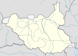
 Melut
MelutCoordinates: 10°26′26″N 32°12′06″E / 10.440419°N 32.201529°ECoordinates: 10°26′26″N 32°12′06″E / 10.440419°N 32.201529°E Country  South Sudan
State Upper Nile Population (2008) – Total 49,242 Melut County is an administrative area in the Upper Nile state of South Sudan, with headquarters at Melut.
Contents
Location
Melut County is bordered by Manyo County across the Nile in the west, Maaban County in the east, Baliet County in the south and Renk County in the north, all in Upper Nile state. The county contains the Payams of Melut, Paloch, Bemichuk, Galdora, Wunamom and Panamdit[1] The region is one of wide, flat and low lying plains with black cotton soils, covered by Savannah grasslands and acacia trees. The river Nile is the main transportation route.[1]
People
The largest communities in the county are Dinka, Shilluk, Burun, Fur, Nubian and Nuer people. There are many migrants in the towns of Melut, Paloch and Galdora.[1]
In September 2010 a traditional leadership council in the county condemned inappropriate dressing in the public, saying that young women who dressed in an alluring way wanted to pass on the HIV virus. A community elder said "If women start dressing decently no man will have to look at them and people will only have their wives. The way they are dressing today, they are leading young men astray". Local authorities are trying to counter negative attitudes such as this through education.[2]
Economy
The River Nile and its small seasonal tributaries are the main sources of drinking water, fishing grounds and water for cattle, particularly in the dry season. Most people relay on agro-pastoralism for a living, and engage in small scale trading. The main seasonal crop is sorghum, and to a lesser extent maize. Crops grown on a small scale throughout the year include tomatoes, okra and onions.[1] NGOs such as the Fellowship for African Relief (FAR) have provided agricultural training, particularly for young adults who have returned to the county, and during their time in Khartoum or in refugee camps did not learn the required skills.[3]
Melut gives its name to the Melut Basin. Chevron discovered a major oil field in this basin.[4] Major oil wells were drilled on lands that were previously used for cultivation and cattle grazing have directly affected the livelihood of the population.[1]
Health
Water supplies are untreated and there is no treatment of human waste, leading to extensive disease. As of March 2006, of 20% of the population suffered from Global Acute Malnutrition and 1.7% from Severe Acute Malnutrition. Other than malnutrition, common causes of death are chest infections in the dry season, and malaria and diarrhoeal diseases during the wet season.[1]
The government-run Melut Hospital has been open since February 2005 with two doctors, one medical assistant, one pharmacist, one laboratory technician and ten nurses. The hospital has one male ward and two female wards, and a theatre which performs minor surgeries. The laboratory is not equipped for comprehensive diagnosis. Medair opened a Primary Health Care Center in Melut Payam in February 2007.[1] As well as the main clinic, Medair has supported six primary health care units run by the Ministry of Health in remote areas of the county.[5]
References
- ^ a b c d e f g "Sudan: Nutritional anthropometric survey, children under five years old - results summary Melut, Paloch, Galdora and Bemichuk Payams, Melut County, UpperNile State". ReliefWeb. http://reliefweb.int/sites/reliefweb.int/files/reliefweb_pdf/node-232287.pdf. Retrieved 2011-08-08.
- ^ "Traditional leaders in Melut County of Upper Nile deplore public indecent dressing". Sudan Tribune. September 10, 2010. http://www.sudantribune.com/Traditional-leaders-in-Melut,36240. Retrieved 2011-08-08.
- ^ Chris Mariano. "FAR's Community Animal Health Worker and Agricultural Extension worker programmes". FAR. http://farsudan.org/agriculture-in-melut-p79.php. Retrieved 2011-08-08.
- ^ Jemera Rone (2003). Sudan, oil, and human rights. Human Rights Watch. p. 127. ISBN 1564322912. http://books.google.ca/books?id=3WQkACoP3FkC&pg=PA317.
- ^ "South Sudan: Growing Independence". Medair. 20 July 2011. http://www.medair.org/nc/en/infochanel/news/detail/article/growing_independence/. Retrieved 2011-08-08.
Categories:- Populated places in South Sudan
- Upper Nile (state)

Wikimedia Foundation. 2010.