- Melut
-
Melut — Town — Location in South Sudan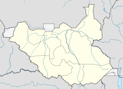
 Melut
MelutCoordinates: 10°26′26″N 32°12′06″E / 10.440419°N 32.201529°ECoordinates: 10°26′26″N 32°12′06″E / 10.440419°N 32.201529°E Country  South Sudan
State Upper Nile County Melut County Melut is a community in the Upper Nile state of South Sudan, headquarters of Melut County.
Contents
Location
The town is on the east bank of the White Nile, just below the point where the Adar River enters the Nile.[1] The region is one of wide, flat and low lying plains with black cotton soils, covered by Savannah grasslands and acacia trees. The River Nile and its small seasonal tributaries are the main sources of drinking water, fishing grounds and water for cattle, particularly in the dry season. The river Nile is also the main transportation route. The largest communities in the county are Dinka, Shilluk, Burun, Fur, Nubian and Nuer people. Most people relay on agro-pastoralism for a living, and engage in small scale trading.[2]
Melut gives its name to the Melut Basin. Chevron discovered a major oil field in this basin in 1981.[1] In October 1996 the GPC consortium drilled and reopened Chevron's wells and built an all-weather road connecting the Adar oilfield to Melut.[3]
Facilities
Elim International Missions was running the Gideon Theological College at Melut before the start of the Second Sudanese Civil War (1983-2005), but in 1988 shifted north to Khartoum due to heavy fighting in the area. The college moved back in 2007. The compound had been used and misused by the army during the war and required extensive rebuilding.[4] In November 2007 Medair moved its Primary Health Care Center at Melut into a new building. Until then the Center, the only source of health care in the town, had been operating out of tents.[5]
Security
On 10 November 2010, the Sudan Armed Forces (SAF) component of the Joint Integrated Units opened fire on positions of the Sudan People's Liberation Army (SPLA) component and the United Nations Mission in Sudan (UNMIS) in Melut, killing a teenage girl and wounding others. SAF attributed this violation of the ceasefire to drunken soldiers. To avoid any risk of escalation, the SPLA did not respond.[6]
References
- ^ a b Jemera Rone (2003). Sudan, oil, and human rights. Human Rights Watch. p. 127. ISBN 1564322912. http://books.google.ca/books?id=3WQkACoP3FkC&pg=PA317.
- ^ "Sudan: Nutritional anthropometric survey, children under five years old - results summary Melut, Paloch, Galdora and Bemichuk Payams, Melut County, UpperNile State". ReliefWeb. http://reliefweb.int/sites/reliefweb.int/files/reliefweb_pdf/node-232287.pdf. Retrieved 2011-08-08.
- ^ "OIL DEVELOPMENT in northern Upper Nile, Sudan". European Coalition on Oil in Sudan. May 2006. http://www.ecosonline.org/reports/2006/ECOS%20Melut%20Report%20final%20-text%20only.pdf. Retrieved 2011-08-09.
- ^ "Gideon Theological College, Melut". Elim International Missions. http://www.elimmissions.co.uk/library/mission.asp?categorycode=ART00474. Retrieved 2011-08-08.
- ^ "Sudan: A new day in Melut town". Relief Web. 11 Jan 2008. http://reliefweb.int/node/254259. Retrieved 2011-08-08.
- ^ "Upper Nile Melut: Sudan Arm Forces Went Shooting Left One teen Dead". SoSaNews. 10 Nov 2010. http://sosanews.com/2010/11/10/upper-nile-melut-sudan-arm-forces-went-shooting-left-one-teen-dead/. Retrieved 2011-08-08.
Categories:- Populated places in South Sudan
- Communities on the Nile River

Wikimedia Foundation. 2010.