- Matagorda Island Air Force Base
-
Matagorda Island Air Force Base 
Matagorda Island, Calhoun County, Texas 
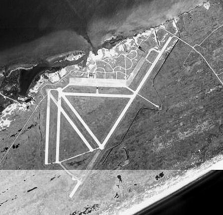
1995 USGS photoType USAAF Training Airfield/Gunnery Range Coordinates Coordinates: 28°20′N 96°28′W / 28.33°N 96.46°W Built 1942 In use 1942-1975 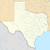
 Matagorda Island AFBLocation of Matagorda Island Air Force Base, Texas
Matagorda Island AFB is an abandoned airfield located northeast of Corpus Christi, Texas.
Contents
History
In 1943 a bombing and gunnery range was constructed on the north end of Matagorda Island. It was deactivated after World War II and reactivated for the Strategic Air Command from 1949 until 1975.
The Matagorda Island Bombing Range was controlled at one time or another various Air Force bases in Texas and Louisiana as a satellite base. It had up to five active runways at one time or another and was used for various deployments. However, after 1975, the property was turned over to the Department of the Interior as a federal wildlife refuge, and the airfield is now completely abandoned.
Today, the runways and taxiways, although infested with vegetation, are in very good condition. There are several structures, hangars, and buildings of various types in various stages of deterioration. Also there is a usable dock and a small port facility.
See also
References
 This article incorporates public domain material from websites or documents of the Air Force Historical Research Agency.
- Shaw, Frederick J. (2004), Locating Air Force Base Sites History’s Legacy, Air Force History and Museums Program, United States Air Force, Washington DC, 2004.
- Thole, Lou (1999), Forgotten Fields of America : World War II Bases and Training, Then and Now - Vol. 2. Publisher: Pictorial Histories Pub, ISBN 1575100517
External links
 Army Air Forces Training Command
Flying Training Flying Schools Eastern Flying Training Command · Central Flying Training Command · Western Flying Training CommandSpecialized Schools Bombardier · Contract Flying · Glider Training · Gunnery · Navigator
Technical Training Eastern Technical Training Command · Central Technical Training Command · Western Technical Training CommandExternal links
Army Air Forces Training CommandFlying Training Flying Schools Eastern Flying Training Command · Central Flying Training Command · Western Flying Training CommandSpecialized Schools Bombardier · Contract Flying · Glider Training · Gunnery · NavigatorTechnical Training Eastern Technical Training Command · Central Technical Training Command · Western Technical Training CommandCategories:- 1943 establishments
- USAAF Gulf Coast Training Center
- USAAF Gunnery School
- Airfields of the United States Army Air Forces in Texas
- Airports in Texas
- Buildings and structures in Calhoun County, Texas


Wikimedia Foundation. 2010.