- Matagorda Island
-
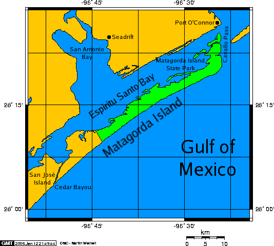
 A map of Matagorda Island.
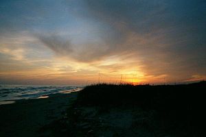 Sunset on Matagorda Island, Texas.
Matagorda Island, Spanish for "thick brush," is a 38 mile (61 km) long barrier island on the Texas Gulf coast, about seven miles south of Port O'Connor, in the southernmost part of Calhoun County. The island is oriented generally northeast-southwest, with the Gulf of Mexico on the east and south, and Espiritu Santo Bay on the west and north. It is separated from San José Island to the south by Cedar Bayou, and is separated from the Matagorda Peninsula to the north by Pass Cavallo. It has no permanent residents and is accessible only by private boat and passenger ferry. It has a land area of 157.25 km² (60.7 sq mi).
Matagorda Island State Park occupies 7325 acres (29.64 km²) on the northeastern end of the island. The remainder of the island is devoted to wildlife refuges managed by the Texas Parks and Wildlife Department and the United States Fish and Wildlife Service and is known as Matagorda Island National Wildlife Refuge and State Natural Area.
The land that is now Matagorda Island State park was acquired in 1940 by condemnation from the Hawes, Hill, and Little families (but not the Wynne-Murchison interests) for use as a temporary training facility for the WWII era.[1]
Matagorda Island State Park was featured as a "survival location" by the main characters in the book, 'Day by Day Armageddon' by J.L. Bourne.
References
- Matagorda Island: Block 2201, Census Tract 9905, Calhoun County, Texas United States Census Bureau
- 2004 Rand McNally Atlas
External links
- Matagorda Island State Park (Texas Parks and Wildlife)
- Aransas National Wildlife Refuge Complex: Matagorda Island Unit
Coordinates: 28°13′38″N 96°38′25″W / 28.22722°N 96.64028°W
Categories:- Texas geography stubs
- Barrier islands of Texas
- Geography of Calhoun County, Texas
- Protected areas of Calhoun County, Texas
- Nature reserves in Texas
- National Wildlife Refuges in Texas

Wikimedia Foundation. 2010.