- Borj El Amri Airport
-
Borj El Amri Airport
مطار برج العامري
Maṭār Burj al-‘ĀmrīIATA: none – ICAO: DTTE Summary Airport type Public Operator Government of Tunisia Serves Borj El Amri Elevation AMSL 108 ft / 33 m Coordinates 36°43′16″N 09°56′35″E / 36.72111°N 9.94306°ECoordinates: 36°43′16″N 09°56′35″E / 36.72111°N 9.94306°E Map Location in Tunisia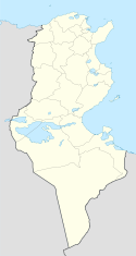
 DTTE
DTTERunways Direction Length Surface m ft 13/31 1,050 3,445 Asphalt Source: DAFIF[1][2] Borj El Amri Airport (ICAO: DTTI) is a small airport serving Borj El Amri, a city in the Manouba Governorate of Tunisia. The airport is located 23 kilometres (14 mi) southwest of Tunis and has a functional asphalt runway.
World War II
During World War II, the airport was known as Massicault Airfield and was used by the United States Army Air Force Twelfth Air Force during the North African Campaign. Known units assigned were:[3]
- 2d Bombardment Group, 31 Jul-2 Dec 1943, B-17 Flying Fortress
- 320th Bombardment Group, 29 Jun-28 Jul 1943, B-26 Marauder
- 68th Reconnaissance Group, Oct-Nov 1943, F-4/F-5 Lightning
Today in aerial photography, the wartime bomber base can clearly be seen, with the smaller civil airport using only a part of its former size. A much longer runway, taxiways and dispersal pads are visible with the main airport terminal and support buildgs being built on the former wartime technical support station.
External links
References
- ^ Airport information for DTTI at World Aero Data. Data current as of October 2006.Source: DAFIF.
- ^ Airport information for DTTI at Great Circle Mapper. Source: DAFIF (effective Oct. 2006).
- ^ Maurer, Maurer. Air Force Combat Units of World War II. Maxwell AFB, Alabama: Office of Air Force History, 1983. ISBN 0-89201-092-4.
Links to related articles  USAAF Twelfth Air Force in World War II
Stations French Morocco Berguent · Berrechid · Casablanca · Guercif · Louis Gentil · Marnia · Médiouna · Port Lyautey · Oujda · Rabat Sale · Ras el Ma
Algeria Ain M'lila · Berteaux · Biskra · Canrobert · Chateau-dun-du-Rhumel · Constantine · Es Sénia (Oran) · Maison Blanche (Algiers) · Matemore · Montesquieu · Nouvion · Orleansville · Philippeville · Relizane · Rerhaia · Saint-Donat · Saint-Leu · Sedrata · Sainte-Barbe du Tlélat · Tafaraoui (Oran) · Tébessa · Telergma · Thiersville · Youks-les-Bains
Tunisia Bizerte · Dar el Koudia · Depienne · Djedeida · Djilma · Ebba Ksour · El Djem · El Bathan · Enfidaville · Goubrine · Grombalia · Hergla · Kairouan · Korba · La Marsa · La Sebala · Le Sers · Massicault · Mateur · Menzel Temime · Monastir · Oudna · Pont du Fahs · Protville · Sainte Marie du Zit · Souk-el-Arba · Souk-el-Khemis · Soliman · Sousse · Thelepte
Italy Agrigento (Sicily) · Bagnoli · Barcelona LG (Sicily) · Bari · Boccadifalco (Sicily) · Borizzo (Sicily) · Capodichino (Naples) · Castel Volturno · Castelvetrano (Sicily) · Cassibile (Sicily) · Cattolica · Catania (Sicily) · Cercola · Ciampino (Rome) · Cesenatico · Decimomannu (Sardinia) · Elmas (Sardinia) · Falconara · Fano · Florence · Foggia · Follonica · Gerbini (Sicily) · Gioia · Grosseto · Grottaglie · Iesi · Le Banca · Lecce · Licata (Sicily) · Manduria · Marcianise · Malignano · Mazzara (Sicily) · Milazzo (Sicily) · Messina (Sicily) · Montalto Di Castro · Nettuno · Montecorvino · Ombrene · Orbetello · Paestum · Pisa · Pantelleria · Pignataro Maggiore · Piombino · Pomigliano · Ponte Galeria · Pontedera · Pompeii · Ponte Olivo (Sicily) · Reggio Calabria · Rocca Bernardo · Rosia · San Pancrazio · Santa Maria · Scordia (Sicily) · Sele · Serretella · Tarquinia · Termini (Sicily) · Tortorella · Torrente Comunelli · Tre Cancello · Voltone · Vesuvius
France Aghione (Corsica) · Amberieu (Y-5) · Amiens (B-48) · Clastres (A-71) · Dijon (Y-9) · Dôle-Tavaux (Y-7) · Ghisonaccia (Corsica) · Gisonochia (Corsica) · Istres (Y-17) · La Vallon (Y-18) · Le Luc · Luneville (Y-2) · Loyettes (Y-25) · Poretta (Corsica) · Saint-Dizier (A-64) · Salon de Provence (Y-16) · Serragia (Corsica) · Solonzara (Corsica) · Tantonville (Y-1) · Toul-Ochey (A-96)
Units CommandsXII Bomber · XII Tactical Air · XXII Tactical Air
Wings5th Bombardment · 42d Bombardment · 47th Bombardment (7th Fighter) · 51st Troop Carrier · 52d Troop Carrier · 57th Bombardment · 62d Fighter · 63d Fighter · 64th Fighter · 87th Fighter · 90th Photographic
GroupsBombardment2d Bombardment · 12th Bombardment · 17th Bombardment · 47th Bombardment · 97th Bombardment · 98th Bombardment · 99th Bombardment · 301st Bombardment · 310th Bombardment · 319th Bombardment · 320th Bombardment · 321st Bombardment · 340th Bombardment · 376th Bombardment
Fighter1st Fighter · 14th Fighter · 27th Fighter · 31st Fighter · 33d Fighter · 52d Fighter · 57th Fighter · 79th Fighter · 81st Fighter · 82d Fighter · 86th Fighter · 324th Fighter · 325th Fighter · 332d Fighter · 350th Fighter
Reconnaissance3d Reconnaissance · 5th Reconnaissance · 68th Reconnaissance
Troop carrier60th Troop Carrier · 61st Troop Carrier · 62d Troop Carrier · 64th Troop Carrier · 313th Troop Carrier · 314th Troop Carrier · 316th Troop Carrier
Squadrons15th Bombardment · 414th Night Fighter · 415th Night Fighter · 416th Night Fighter · 417th Night Fighter · 427th Night Fighter
Stations Amendola · Bari · Castelltuccio · Cattolica · Celone · Cerignola · Fano · Foggia · Gioia del Colle · Grottaglie · Giulia · Lesina · Lucera · Madna · Manduria · Marcianise · Mondolfo · Pantanella · Piagiolino · Pisa · Rimini · Salsosa · San Giovanni · San Pancrazio · San Severo · Spinazzola · Sterparone · Tortorella · Torremaggiore · Torretto · Triolo · Venosa · Vincenzo
Units Wings5th Bombardment · 47th Bombardment · 49th Bombardment · 55th Bombardment · 304th Bombardment · 305th Fighter (P) · 306th FighterGroupsBombardment2nd Bombardment · 97th Bombardment · 98th Bombardment · 99th Bombardment · 301st Bombardment · 376th Bombardment · 449th Bombardment · 450th Bombardment · 451st Bombardment · 454th Bombardment · 455th Bombardment · 456th Bombardment · 459th Bombardment · 460th Bombardment · 461st Bombardment · 463rd Bombardment · 464th Bombardment · 465th Bombardment · 483rd Bombardment · 484th Bombardment · 485th BombardmentFighter 1st Fighter · 14th Fighter · 31st Fighter · 52nd Fighter · 82nd Fighter · 325th Fighter · 332nd Fighter Categories:
- North African airport stubs
- Airports in Tunisia
- Tunisia stubs
- Airfields of the United States Army Air Forces in Tunisia


Wikimedia Foundation. 2010.