- Tozeur–Nefta International Airport
-
Tozeur–Nefta International Airport
Aéroport International de Tozeur–Nefta
{{{2}}}IATA: TOE – ICAO: DTTZ Location of airport in Tunisia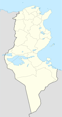
 TOE
TOESummary Airport type Public Operator Tunisian Civil Aviation & Airports Authority Serves Nefta, Tunisia Elevation AMSL 287 ft / 87 m Coordinates 33°56′23″N 08°06′38″E / 33.93972°N 8.11056°E Runways Direction Length Surface m ft 09/27 3,167 10,581 Asphalt Source: DAFIF[1][2] Tozeur–Nefta International Airport (French: Aéroport International de Tozeur–Nefta, Arabic: مطار توزر نفطة الدولي) (IATA: TOE, ICAO: DTTZ) is an airport serving Tozeur in Tunisia.[3]
Contents
History
On the airport of Tozeur in western Tunisia, two aircraft Boeing 747 of Iraqi Airways are waiting since late 1990, early 1991. Saddam Hussein had put them here to protect from the first Gulf War (January 1991). They are waiting regulations of dispute with Kuwait in a new white paint and some traces of its original green color.
We can see them since twenty years near the airport terminal, and on s atellite images.
This is Boeing 747 B-747-YI-AGP 200C (c/n 22366) and B-747SP YI-ALM (c/n 22858).
Airlines and destinations
Airlines Destinations Transavia.com France Paris-Orly Tunisair Lyon, Madrid, Nice, Paris-Orly TunisAir Express Tunis External links
- Tunisian Civil Aviation and Airports Authority (OACA)
- Current weather for DTTZ at NOAA/NWS
- Accident history for TOE at Aviation Safety Network
References
- ^ Airport information for DTTZ at World Aero Data. Data current as of October 2006.Source: DAFIF.
- ^ Airport information for TOE at Great Circle Mapper. Source: DAFIF (effective Oct. 2006).
- ^ Tozeur–Nefta International Airport at Office de l'Aviation Civile et des Aeroports (OACA)
 Categories:
- Airports in Tunisia
- North African airport stubs
- Tunisia stubs

Wikimedia Foundation. 2010.