- Marshbrook
-
Coordinates: 52°30′13″N 2°49′26″W / 52.5035°N 2.824°W
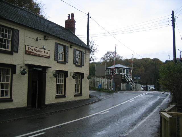
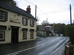 Marshbrook, including its pub and level crossing.
Marshbrook is a hamlet in Shropshire, England. It is sometimes spelt "Marsh Brook", which is also the name of a small watercourse which flows through the area.
It lies on the junction of the A49 and B4370, 3 miles to the south of the market town of Church Stretton. Three civil parishes come together in the hamlet: Church Stretton, Wistanstow and Acton Scott. The hamlet lies at 163m above sea level at the southern end of the Stretton Gap. A roman road passed through what is now Marshbrook, on its way from Leintwardine to Wroxeter.
The Welsh Marches Line runs through the hamlet and there was once a small station here. A signal box and level crossing remain. Marshbrook Signal Box is the oldest operational signal box surviving on the national railway network and was built by the London & North Western Railway in the mid 19th century. There is also a public house in the hamlet, near to the railway line, called The Station Hotel (previously known as the "Wayside Inn").[1] A small industrial estate/business park exists on land adjacent to the railway and there are roadside businesses at the A49/B4370 junction.
In 2010 a camping and outdoor activities centre opened at Marshbrook, with mountain bikes available for hire.[2]
One mile to the northwest is the hamlet of Minton and one mile to the east is the village of Acton Scott. The hamlets of Whittingslow and Cwm Head lie to the southwest along the B4370.
Notes
External links
 Media related to Marshbrook at Wikimedia CommonsCategories:
- Villages in Shropshire
- Shropshire geography stubs
Wikimedia Foundation. 2010.