- Mariscal Lamar International Airport
-
Mariscal Lamar International Airport
Aeropuerto Mariscal Lamar
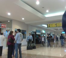
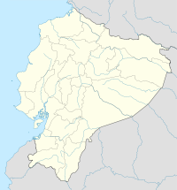
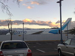
Interior of Mariscal Lamar Airport IATA: CUE – ICAO: SECU Location of airport in Ecuador Summary Airport type Public Operator Corporación Aeroportuaria de Cuenca Serves Cuenca, Ecuador Elevation AMSL 8,306 ft / 2,532 m Coordinates 02°53′22″S 078°59′04″W / 2.88944°S 78.98444°W Runways Direction Length Surface m ft 05/23 1,900 6,234 Asphalt Source: DAFIF[1][2]  Mariscal Lamar's runway
Mariscal Lamar International Airport (Spanish: Aeropuerto Internacional Mariscal Lamar) (IATA: CUE, ICAO: SECU) is an airport serving Cuenca,[1] a city in the province of Azuay in Ecuador.
Contents
Facilities
The airport resides at an elevation of 8,306 feet (2,532 m) above mean sea level. It has one runway designated 05/23 with an asphalt surface measuring 6,234 by 118 feet (1,900 × 36 m).[1]. Since 2002 the ILS system for the airport is available and fully operational.
Airlines and destinations
Airlines Destinations AeroGal Guayaquil, Quito LAN Ecuador Guayaquil, Quito TAME Guayaquil, Quito Incidents
- On 20 October 1971, a Vickers Viscount of SAETA was hijacked by six people. It landed at Cuenca Airport.[3]
- On 8 October 1982, Vickers Viscount HC-ATV of SAN Ecuador was damaged beyond economic repair.[4]
- On 11 July 1983, a Boeing 737 operating a TAME flight from Quito to Cuenca, crashed killing all 117 on board on final approach to the airport. This is the deadliest incident involving TAME ever
References
- ^ a b c Airport information for SECU from DAFIF (effective October 2006)
- ^ Airport information for CUE at Great Circle Mapper. Source: DAFIF (effective Oct. 2006).
- ^ "Accident description". Aviation Safety Network. http://aviation-safety.net/database/record.php?id=19711020-0. Retrieved 8 October 2009.
- ^ "Accident description". Aviation Safety Network. http://aviation-safety.net/database/record.php?id=19821008-0. Retrieved 8 October 2009.
External links
Categories:- Airports in Ecuador
- Azuay Province
Wikimedia Foundation. 2010.


