- Mare Australe quadrangle
-
The Mare Australe quadrangle is one of a series of 30 quadrangle maps of Mars used by the United States Geological Survey (USGS) Astrogeology Research Program. The Mare Australe quadrangle is also referred to as MC-30 (Mars Chart-30).[1] The Mare Australe quadrangle covers all the area of Mars south of 65°. Around the southern ice cap is a surface, called the Dorsa Argentea Formation that may be an old ice-rich deposit. It contains a group of sinuous, branched ridges that resembles eskers that form when streams are under glaciers. [2] The formation often contains pits: two major locations are named Cavi Angusti and Cavi Sisyphi. The pits have steep sides and an irregular shape. They are up to 50 km across and 1 km deep.[3]
Contents
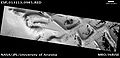
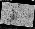
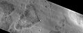
Inca City
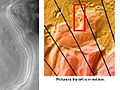
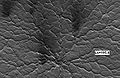
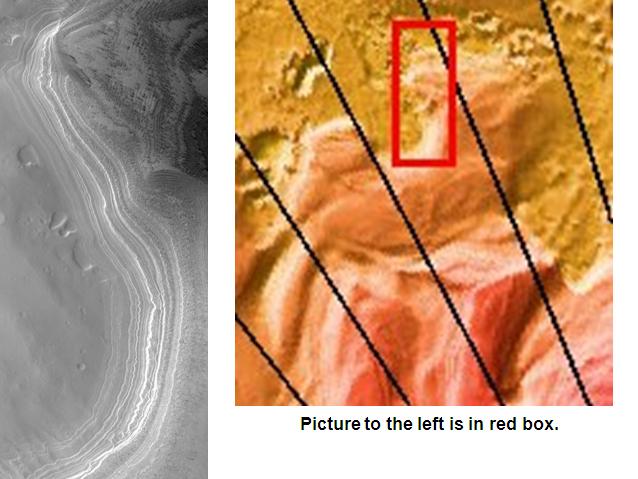
Mariner 9 showed a small area located at 82° S and 66° W that looked like the ruins of an ancient city. Mariner 9 team members named it "Inca City." It looked like sand dunes that formed from winds that blew from two different directions, but the dunes were too big. In 2002 the camera on Mars Global Surveyor revealed that Inca City was part of a large circular structure that was 86 km in diameter. So the shape meant that it was probably caused by an asteroid impact which cracked the crust. Later, magma flowed along the cracks. When the magma cooled, hard, erosion resistant walls of rock (dikes) formed. The crater was covered over, then partially exhumed. The hard walls of rock were left standing as softer surrounding material eroded away.[4]
-
Inca City as seen by HiRISE. Light patches are frost deposits.
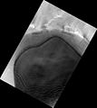
Ice Cap
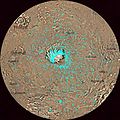
The main feature in Mare Australe is the ice cap. The south polar permanent cap is much smaller the one in the north. It is 400 km in diameter, as compared to the 1100 km diameter of the northern cap.[5] Each southern winter, the ice cap covers the surface to a latitude of 50°.[6] Part of the ice cap consists of dry ice, solid carbon dioxide. Each winter the ice cap grows by adding 1.5 to 2 meters of dry ice from precipitation from a polar-hood of clouds. In summer, the dry ice sublimates (goes directly from a solid to a gas) into the atmosphere. During each year on Mars as much as a third of Mars' thin carbon dioxide (CO2) atmosphere "freezes out" during the winter in the northern and southern hemispheres. Scientists have even measured tiny changes in the gravity field of Mars due to the movement of carbon dioxide. In other words, the winter build up of ice changes the gravity of the planet.[7] Mars has seasons that are similar to Earth's because its rotational axis has a tilt close to our own Earth's (25.19° for Mars, 23.45° for Earth). The south polar cap is higher in altitude and colder than the one in the north.[8]
Research, published in April 2011, described a large deposit of frozen carbon dioxide near the south pole. Most of this deposit probably enters Mars' atmosphere when the planet's tilt increases. When this occurs, the atmosphere thickens, winds get stronger, and larger areas on the surface can support liquid water. [9]Misplaced Ice Cap
The residual southern ice cap is misplaced. That is it is not centered on the south pole. However, the south seasonal cap is centered near the geographic pole. [5] Studies have shown that the off center cap is caused by much more snow falling on one side then the other. On the western hemisphere side of the south pole a low pressure system forms because the winds are changed by the Hellas Basin. This system produces more snow. On the other side, there is less snow and more frost. Snow tends to reflect more sunlight in the summer, so not much melts or sublimates (Mars climate causes snow to go directly from a solid to a gas). Frost, on the other hand has a rougher surface and tends to trap more sunlight, resulting in more sublimation. In other words, areas with more of the rougher frost are warmer. [10]
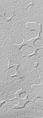
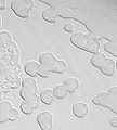
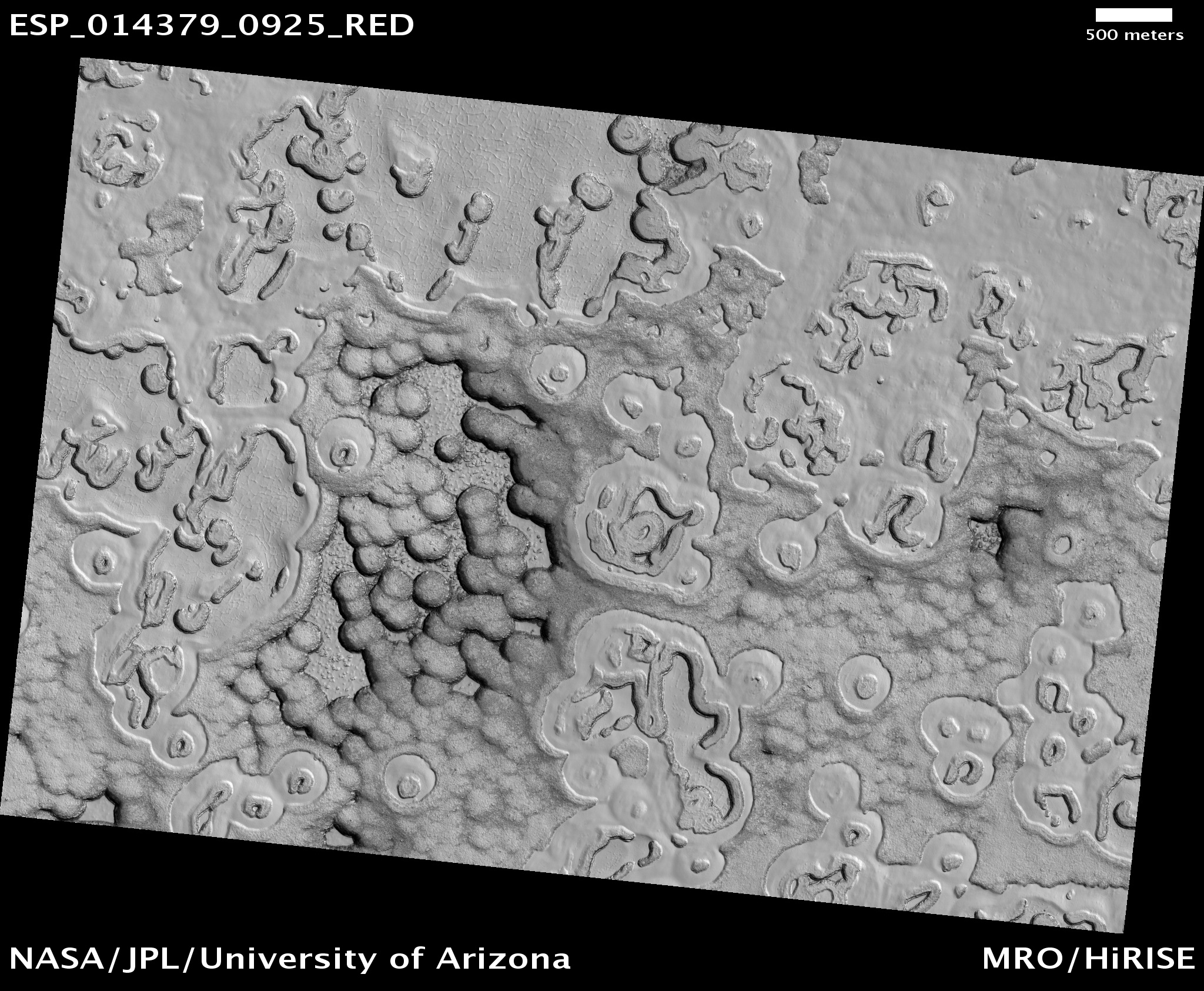
Swiss Cheese appearance
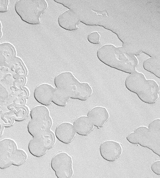
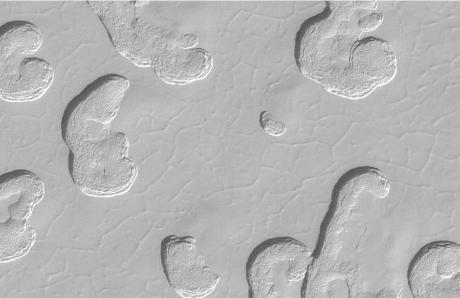
Main article: Swiss cheese featuresWhile the north polar cap of Mars has a flat, pitted surface resembling cottage cheese, the south polar cap has larger pits, troughs and flat mesas that give it a Swiss cheese appearance. The upper layer of the Martian south polar residual cap has been eroded into flat-topped mesas with circular depressions.[11] Observations made by Mars Orbiter Camera in 2001 have showed that the scarps and pit walls of the south polar cap had retreated at an average rate of about 3 meters (10 feet) since 1999. In other words, they were retreating 3 meters per Mars year. In some places on the cap, the scarps retreat less than 3 meters a Mars year, and in others it can retreat as much as 8 meters (26 feet) per Martian year. Over time, south polar pits merge to become plains, mesas turn into buttes, and buttes vanish forever. Since 2001, two additional Mars years have elapsed. The round shape is probably aided in its formation by the angle of the sun. In the summer, the sun moves around the sky, sometimes for 24 hours each day, just above the horizon. As a result the walls of a round depression will receive more intense sunlight then the floor; the wall will melt far more than the floor. The walls melt and recede, while the floor remains the same.[4] [12]
The pictures below show why it is said the surface resembles Swiss cheese; one can also observe the differences over a two-year period.
-

Changes in South Pole surface from 1999 to 2001, as seen by Mars Global Surveyor.
-
Swiss Cheese-like ice formations as seen by Mars Global Surveyor.
-
Swiss Cheese-like ice formations as seen by Mars Global Surveyor showing layers.
-

Close-up of Swiss Cheese Terrain, as seen by Mars Global Surveyor.
-
HiRISE view of South Pole Terrain.
Mars is getting warmer?
Studies suggest, at some time in the not-too-distant past, Mars had a colder climate which caused carbon dioxide to be deposited. If one takes the rate of scarp retreat and projects it backwards to fill in all of the pits and troughs with the carbon dioxide that has been removed from them, one finds that the colder climate might only have occurred a few centuries to a few tens of thousands of years ago. This kind of time scale is not unlike that of the climate changes that have been recorded on Earth, including the Ice Ages and the smaller fluctuations that have occurred since the last Ice Age (e.g., the "Little Ice Age" of the mid-14th through mid-19th centuries)."[13]
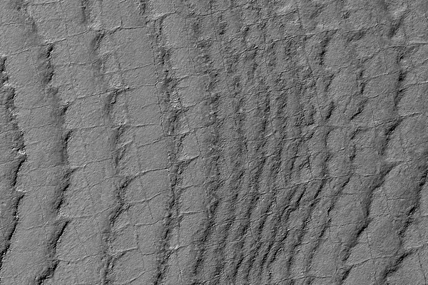
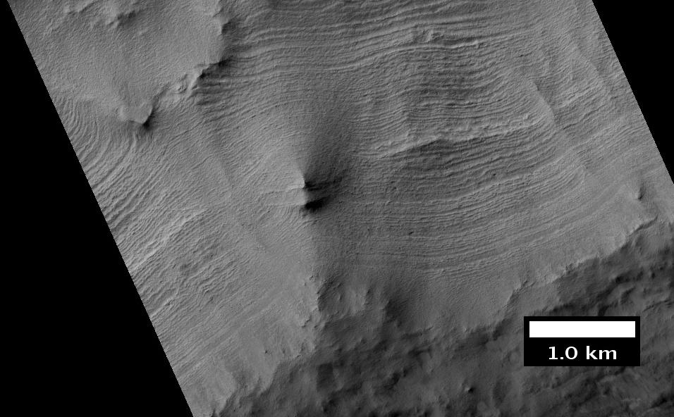
Layers
Both polar caps show layered features, called polar-layered deposits, that result from seasonal melting and deposition of ice together with dust from Martian dust storms. Information about the past climate of Mars may be eventually revealed in these layers, just as tree ring patterns and ice core data do on Earth. Both polar caps also display grooved features, probably caused by wind flow patterns. The grooves are also influenced by the amount of dust.[14] The more dust, the darker the surface. The darker the surface, the more melting. Dark surfaces absorb more light energy. There are other theories that attempt to explain the large grooves. [5]
Chasma Australe, a major valley, cuts across the layered deposits. On the 90 E side, the deposits rest on a major basin, called Prometheus.[15]
Some of the layers in the south pole also show polygonal fracturing in the form of rectangles. It is thought that the fractures were caused by the expansion and contraction of water ice below the surface.[16]
-
This HiRISE image shows layers running roughly up and down, along with faint polygonal fracturing. Polygonal fractures are mostly rectanglar.
-
South Pole layers, as seen by THEMIS.
-

Close-up of Layers in wall of McMurdo Crater, as seen by HiRISE.
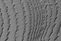
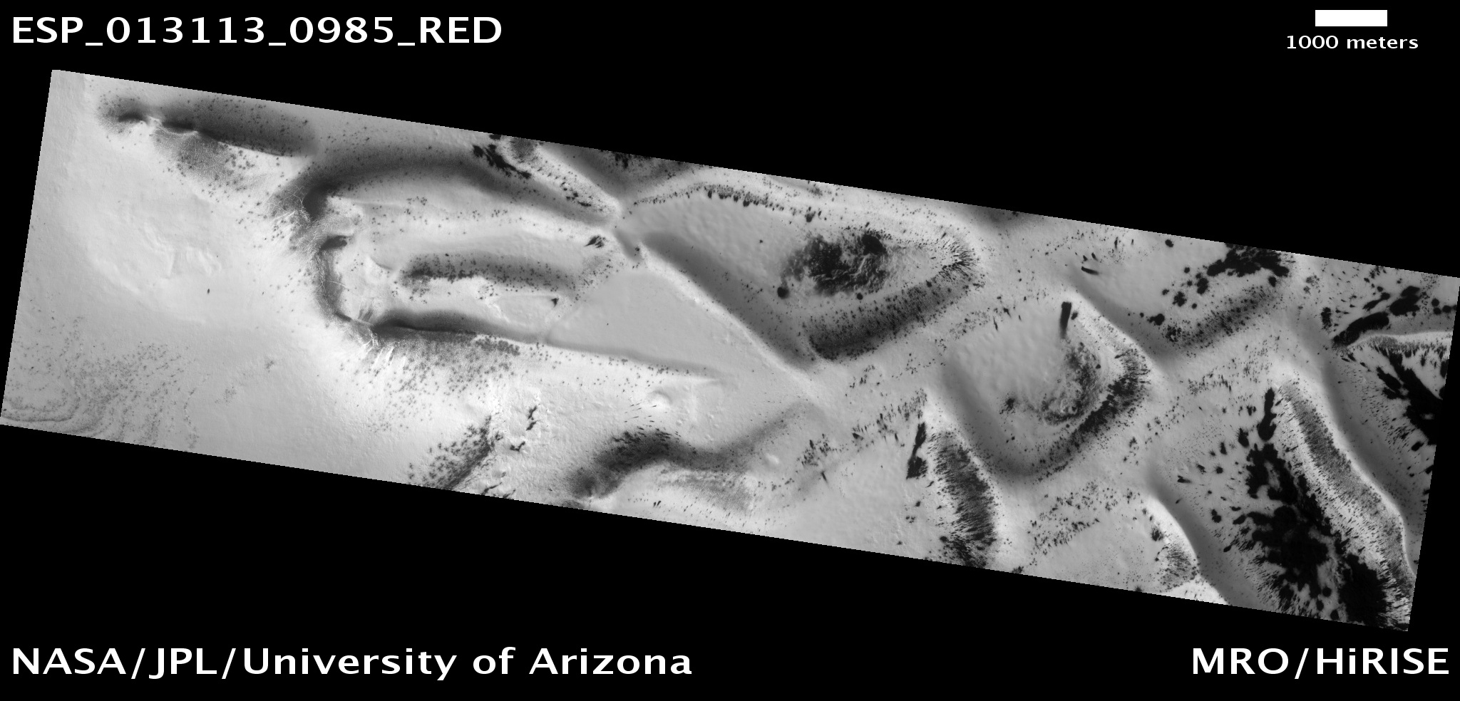
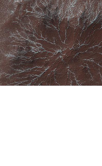
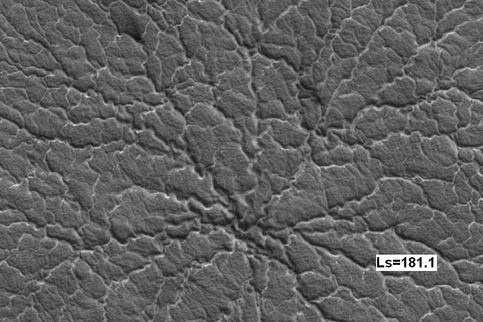
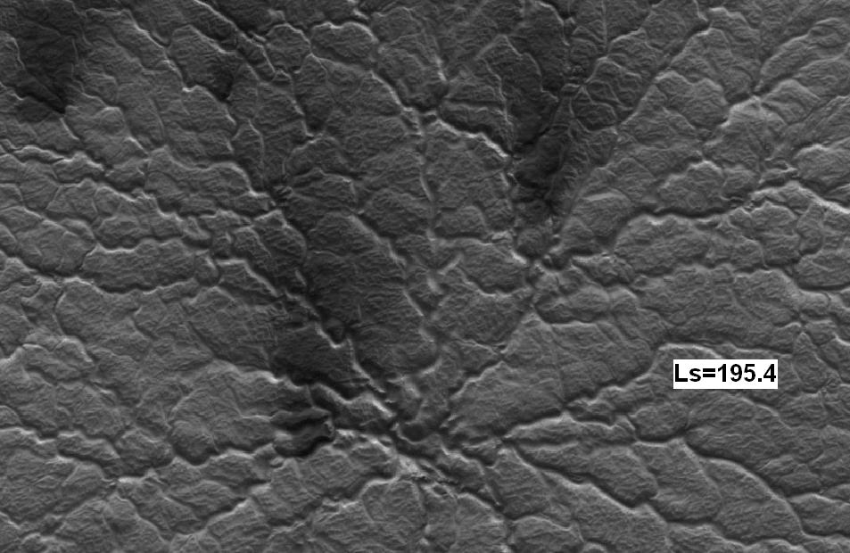
Starburst Channels (Spiders)
Starburst channels are patterns of channels that radiate out into feathery extensions. They are caused by gas which escapes along with dust. The gas builds up beneath translucent ice as the temperature warms in the spring.[17] Typically 500 meters wide and 1 meter deep, the spiders may undergo observable changes in just a few days.[18] One model for understanding the formation of the spiders says that sunlight heats dust grains in the ice. The warm dust grains settle by melting through the ice while the holes are annealed behind them. As a result, the ice becomes fairly clear. Sunlight then reaches the dark bottom of the slab of ice and changes the solid carbon dioxide ice into a gas which flows toward higher regions that open to the surface. The gas rushes out carrying dark dust with it. Winds at the surface will blow the escaping gas and dust into dark fans that we observe with orbiting spacecraft.[19] [20] The physicis of this model is similar to ideas put forth to explain dark plumes erupting from the surface of Triton. [21]
Research, published in January 2010 using HiRISE images, found that some of the channels in spiders grow larger as they go uphill since gas is doing the erosion. The researchers also found that the gas flows to a crack that has occurred at a weak point in the ice. As soon as the sun rises above the horizon, gas from the spiders blows out dust which is blown by wind to form a dark fan shape. Some of the dust gets trapped in the channels. Eventually frost covers all the fans and channels until the next spring when the cycle repeats.[6][22]
-
Star burst Channels caused by escaping gas, as seen by HiRISE. Star burst channels, also called spiders, may be about 500 meters in diameter and 1 meter deep.
-
Spider on the second Martian day of spring, as seen by HiRISE.
-
Some spider 14 Martian days later, as seen by HiRISE. Notice increased dark fans caused by outgassing of carbon dioxide and dark material.
Other Features in the Mare Australe quadrangle
-
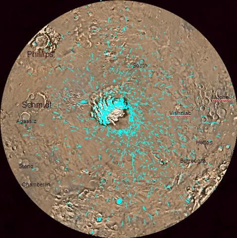
Map of Mare Australe with major features labeled.
-
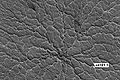
Hutton Crater Area, as seen by HiRISE. Click on image to see patterned ground.
-
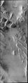
Angustus Labyrinthus, as seen by THEMIS.
-
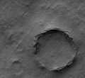
Philips Crater Area, as seen by HiRISE.
-
Pityusa Patera, as seen by HiRISE.
-
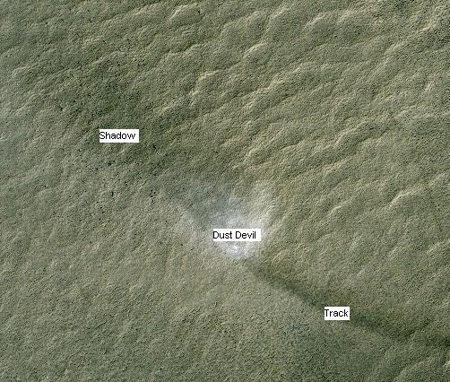
Dust Devil, as shown from HiRISE. Dust devil is moving to the upper left, leaving a dark track to the lower right. The shadow of the dust devil is to the upper left of the dust devil.
See also
References
- ^ Davies, M.E.; Batson, R.M.; Wu, S.S.C. (1992). "Geodesy and Cartography". In Kieffer, H.H.; Jakosky, B.M.; Snyder, C.W. et al.. Mars. Tucson: University of Arizona Press. ISBN 978-0-8165-1257-7.
- ^ Kargel, J.; Strom, R. (1991). "Terrestrial glacial eskers: analogs for martian sinuous ridges" (PDF). LPSC XXII: 683–684. Bibcode 1991LPI....22..683K. http://www.lpi.usra.edu/meetings/lpsc1991/pdf/1340.pdf.
- ^ Carr, Michael H. (2006). The Surface of Mars. Cambridge University Press. p. [page needed]. ISBN 978-0-521-87201-0.
- ^ a b Hartmann, W. 2003. A Traveler's Guide to Mars. Workman Publishing. NY NY.
- ^ a b c Barlow, Nadine G. (2008). Mars: an introduction to its interior, surface and atmosphere. Cambridge, UK: Cambridge University Press. pp. [page needed]. ISBN 978-0-521-85226-5.
- ^ a b Hansen, C.J.; Thomas, N.; Portyankina, G.; McEwen, A.; Becker, T.; Byrne, S.; Herkenhoff, K.; Kieffer, H. et al. (2010). "HiRISE observations of gas sublimation-driven activity in Mars' southern polar regions: I. Erosion of the surface". Icarus 205: 283–295. Bibcode 2010Icar..205..283H. doi:10.1016/j.icarus.2009.07.021.
- ^ www.gsfc.nasa.gov/topstory/20011206molaice.html
- ^ ISBN 978-0-521-82956-4
- ^ http://www.spaceref.com/news/viewpr.html?pid=33388
- ^ http://www.spaceref.com/news/viewpr.html?pid=26493
- ^ http://www.news.cornell.edu/releases/March00/Mars.NASA.deb.html
- ^ http://hirise.lpl.arizona.edu/PSP_005095_0935
- ^ http://mars.jpl.nasa.gov/mgs/gallery/PIA04295.html
- ^ http://www.windows.ucar.edu/tour/link=/mars/places/mars_polar_regions.html&edu=high
- ^ Carr, Michael H. (2006). The Surface of Mars. Cambridge University Press. p. [page needed]. ISBN 978-0-521-87201-0.
- ^ http://hirise.lpl.arizona.edu/PSP_004959_0865
- ^ http://hirise.lpl.arizona.edu/PSP_003443_0980
- ^ Hansen, C, A. McEwen and HiRISE Team. December 2007. AGU Press Conference Spring at the South Pole of Mars.
- ^ ISBN 978-0-521-86698-9
- ^ Kieffer, HH; Christensen, PR; Titus, TN (2006). "CO2 jets formed by sublimation beneath translucent slab ice in Mars'seasonal south polar ice cap". Nature 442 (7104): 793–796. Bibcode 2006Natur.442..793K. doi:10.1038/nature04945. PMID 16915284.
- ^ Soderblom, L. A.; Kieffer, S. W.; Becker, T. L.; Brown, R. H.; Cook, A. F.; Hansen, C. J.; Johnson, T. V.; Kirk, R. L. et al. (1990). "Triton's geyser-like plumes: discovery and basic characterizations". Science 250 (4979): 410–415. Bibcode 1990Sci...250..410S. doi:10.1126/science.250.4979.410. PMID 17793016.
- ^ Thomas, N.; Hansen, C.J.; Portyankina, G.; Russell, P.S. (2010). "HiRISE observations of gas sublimation-driven activity in Mars' southern polar regions: II. Surficial deposits and their origins". Icarus 205: 296–310. Bibcode 2010Icar..205..296T. doi:10.1016/j.icarus.2009.05.030.
Quadrangles on Mars MC-01 Mare Boreum
(features)MC-05 Ismenius Lacus
(features)MC-06 Casius
(features)MC-07 Cebrenia
(features)MC-02 Diacria
(features)MC-03 Arcadia
(features)MC-04 Acidalium
(features)MC-12 Arabia
(features)MC-13 Syrtis Major
(features)MC-14 Amenthes
(features)MC-15 Elysium
(features)MC-08 Amazonis
(features)MC-09 Tharsis
(features)MC-10 Lunae Palus
(features)MC-11 Oxia Palus
(features)MC-20 Sinus Sabaeus
(features)MC-21 Iapygia
(features)MC-22 Mare Tyrrhenum
(features)MC-23 Aeolis
(features)MC-16 Memnonia
(features)MC-17 Phoenicis Lacus
(features)MC-18 Coprates
(features)MC-19 Margaritifer Sinus
(features)MC-27 Noachis
(features)MC-28 Hellas
(features)MC-29 Eridania
(features)MC-24 Phaethontis
(features)MC-25 Thaumasia
(features)MC-26 Argyre
(features)MC-30 Mare Australe
(features)Categories: -


Wikimedia Foundation. 2010.