- Dust Devil Tracks
-
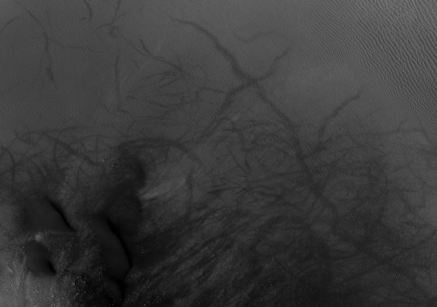
Many areas on Mars experience the passage of giant dust devils. A thin coating of fine bright dust covers most of the Martian surface. When a dust devil goes by it blows away the coating and exposes the underlying dark surface, which within a few weeks assumes its former bright colour, either from being re-covered through wind action or some form of oxidation through exposure to sunlight and air. Dust devils occur when the sun warms up the air near a flat, dry surface. The warm air then rises quickly through the cooler air and begins spinning while moving ahead. This spinning, moving cell may pick up dust and sand and leave behind a clean surface.[1]
These dust devils have been seen from the ground and high overhead from orbit. They have even blown dust off the solar panels of the two Rovers on Mars, thereby greatly extending their usefulness.[2] The pattern of the tracks has been shown to change every few months.[3]
-
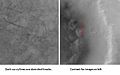
Kepler (Martian crater) showing dust devil tracks, as seen by Mars Global Surveyor.
-
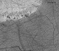
Pattern of large and small tracks made by giant dust devils.
-
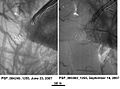
Russell Crater Dust Devil Changes in Noachis quadrangle, as seen by HiRISE. Click on image to see changes in dust devil tracks in just 3 months.
-
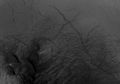
Milankovic Crater central area, as seen by HiRISE. Click on image to see more details: dark dunes, clear dust devil tracks, and boulders (small bright dots).
References
- ^ HiRISE | (PSP_00481_2410). Hirise.lpl.arizona.edu. Retrieved on 7 August 2011.
- ^ Mars Exploration Rover Mission: Press Release Images: Spirit. Marsrovers.jpl.nasa.gov. Retrieved on 7 August 2011.
- ^ [1][dead link]
Categories:- Planetary geology
- Surface features of Mars
- Mars stubs
-


Wikimedia Foundation. 2010.