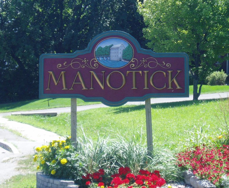
- Manotick
-
Manotick — Community —  Location in Ottawa
 Manotick
Coordinates: 45°13′35″N 75°41′11″W / 45.22639°N 75.68639°W Country Canada Province Ontario City Ottawa Established 1830s Incorporated 1903 (Police Village of Manotick) Amalgamation 1974 (Township of Rideau)
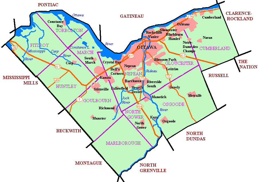
2001 (City of Ottawa)Government - Mayor Jim Watson - MPs Pierre Poilievre - MPPs Lisa MacLeod - Councillors Scott Moffatt Area - Total 6.69 km2 (2.6 sq mi) Elevation 95 m (312 ft) Population (2006) - Total 4,623 - Density 690.6/km2 (1,788.6/sq mi) Canada 2006 Census Time zone Eastern (EST) (UTC−5) - Summer (DST) EDT (UTC−4) Manotick, Ontario is an exurb in Eastern Ontario on the Rideau River, located on the south edge of Ottawa's urban area. Manotick is located immediately south of the booming suburbs Barrhaven and Riverside South and is about 25 km (16 mi) from downtown Ottawa.[1] It has been part of the City of Ottawa since amalgamation in 2001. It had a 2006 population of 4623.[1]
In the 1830s, a small settlement formed in the area of the newly constructed Long Island locks on the Rideau Canal, but no development was done in the area of present day Manotick. In 1858, when a bulkhead was constructed across the west branch of the Rideau River in the location of present day Manotick, entrepreneur Moss Kent Dickinson and his partner Joseph Merrill Currier obtained the water rights and constructed a mill. It was Dickinson, who in 1864 named the new village "Manotick," after the Ojibwa word meaning "island in the river". Mills established by Dickinson and Currier helped spur the development of the settlement. One of these, Watson's Mill, survives today (open to the public). As commercial traffic on the Rideau became less important, the population in the village declined. The population in the village rebounded as Manotick came to be viewed by some as a bedroom community for Ottawa, joining the City of Ottawa in 2001.
With over-development of housing in south Ottawa, and Barrhaven rapidly growing, Manotick is maintaining its character by carefully managing growth and working closely with developers. Large mass production developments south of Ottawa often advertise as being located in Manotick during early development which can lead to confusion on the borders of Manotick.
Contents
Schools
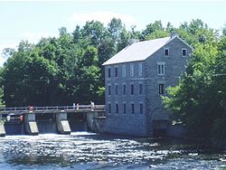 Watson's Mill
- Manotick Public School - The only public elementary school in Manotick, teaches kindergarten to grade 5 in English and French.[2]
- St. Leonard Catholic School - Teaches over 500 kindergarten, primary and junior students in English and French.[3]
- St. Mark Catholic High School - Teaches grades 7-8 and 9-12 in English and French[4]
- South Carleton High School - Teaches over 1300 grade 9-12 students, located in Richmond. It is the primary public high school for the region.[5]
Dickinson Days
 Fishing at Watson's Mill Dam
On the first weekend of June of every year, the people of Manotick congregate in the heart of Manotick around Dickinson Square to celebrate Dickinson Days, the birthday of Moss Kent Dickinson, who operated Watson's Mill and was responsible for what Manotick was 150 years ago. The festivities, organized by local organizations such as the Kiwanis Club, the BIA and Watson’s Mill, usually includes such things as a parade, pancake breakfast, arts and crafts sales, wagon rides, music, fiddlers, dance and drama performances.
In 2004 there was talk to remove the Beer Tent from the Dickinson Days celebration but in the true spirit of Manotick, the Kinsmen Club maintained the popular event, renaming it a "refreshment tent" and adding non-alcoholic beverages.
The celebration coincides with Pioneer Days, organized by the staff and volunteers of Watson's Mill, Ottawa's only working heritage site, and one of few remaining grist mills in Ontario. The Mill is now a working museum and you can purchase fresh stone ground flour as well as feed for the ducks around the dam that powers the mill. It is open daily in summer for tours, photos and purchase of fresh stone-ground flour. It is a popular tourist destination on the Rideau Canal, a World Heritage Site.
Dickinson Days usually coincides with Ottawa's "Open Doors", where many local buildings, such as churches and government buildings, are open to the public for one day a year.
Mahogany subdivision dispute
In 2007 Minto Developments Inc. sought approval to construct a community of approximately 1800 new homes within the Village of Manotick. The number was later revised to 1400 in early 2008 through the Development Concept Plan process with the city of Ottawa and numerous public meetings and consultations with residents. The project drew concerns by residents in the area. In the opinion of some local residents, the Minto proposal went against the spirit and letter of the pre-existing Manotick's Secondary Plan. The Secondary Plan for the Village of Manotick was adopted by the City of Ottawa at amalgamation in 2001, providing for growth of only 250 houses by 2020.[6] Residents cited that the project will double Manotick's population and that the current services and infrastructure will be insufficient to handle the population explosion. Some residents were also concerned that Manotick will lose its "small town" character. Villagers want future development direction to be decided by residents and their elected officials, not developers.
On April 24, 2007, the [West Manotick Community Association (WMCA][2]) organized a town hall meeting to discuss the issue of Minto's proposed development at the Manotick Arena. The event drew over 2000 citizens concerned about preserving the rural character and scale of Manotick and to ensure any future planning accounts for the rural nature of the village. During 2007 and 2008, The City of Ottawa, the WMCA and Minto all hosted several formal and informal public meetings to demonstrate changes and evolutions to the proposed Development Concept Plans and to encourage public debate. Changes to the plan were made by the developer through the process.
In 2008, the Ottawa city council rejected Minto's proposed development, stating that Minto's plan did not comply with the City's official plan for Manotick, nor its Secondary Plan. Additionally, the City claimed that the proposed development did not match the village's "rural character".[7] Minto appealed the council's decision, sending the matter to the Ontario Municipal Board in a 7-week hearing that ended in late-January, 2009. The OMB overruled city council in a "controversial" decision to approve Minto's plans.[6] The City of Ottawa is seeking Leave to Appeal the OMB decision, which will be heard June 25, 2009.
Notes
- ^ Manotick Official Plan Amendment #3. City of Ottawa, 2003. Retrieved on 2009-03-31.
- ^ "Manotick Public School". Ottawa Carleton District School Board. http://www.ottawacatholicschools.ca/leo/content.php?doc=2210. Retrieved 2009-03-31.
- ^ "St. Leonard Catholic School". Ottawa Catholic School Board. 2007-09-28. http://www.ottawacatholicschools.ca/leo/content.php?doc=2210. Retrieved 2009-03-31.
- ^ "ST. MARK HIGH SCHOOL". Ottawa Catholic School Board. 2009-03-26. http://www.ottawacatholicschools.ca/profile.php?profileID=46. Retrieved 2009-03-31.
- ^ "South Carleton High School: School Profile 2008-2009". Ottawa Carleton District School Board. http://www.ocdsb.edu.on.ca/PDF%20files/profiles/2008_2009/SCAR.pdf. Retrieved 2009-03-31.[dead link]
- ^ a b Cook, Maria (2009-04-11). "OMB ruling outrages village residents". The Ottawa Citizen. http://www.ottawacitizen.com/ruling+outrages+village+residents/1487853/story.html. Retrieved 2009-04-14.[dead link]
- ^ "Fight against Minto's Manotick plans cost city $638,000". The Ottawa Citizen. 2009-04-13. http://www.ottawacitizen.com/news/Fight+against+Minto+Manotick+plans+cost+city/1492077/story.html. Retrieved 2009-04-14.[dead link]
External links
Categories:- Neighbourhoods in Ottawa
- Former municipalities now in Ottawa

Wikimedia Foundation. 2010.