Manchester (ancient township)
- Manchester (ancient township)
-
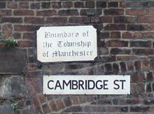
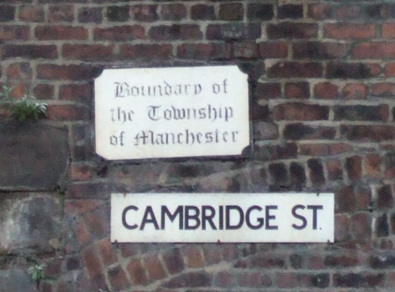
Remaining sign on Cambridge Street,
on the southern boundary of the old township.
Manchester Township was one of the many townships and chapelries which formed the ancient parish of Manchester within the Salford hundred of Lancashire, England. It included the area of what is now Manchester City Centre and the adjoining area of Ancoats.
In 1792 commissioners, usually known as police commissioners, were established for the improvement of the township. Under the Municipal Corporations Act 1835, the Municipal borough of Manchester was established in 1838 as a local authority area, and included the townships of Manchester, Beswick, Cheetham, Chorlton-on-Medlock and Hulme.[1]
References
- ^ Greater Manchester Gazetteer, Greater Manchester County Record Office, Places names - M to N, http://www.gmcro.co.uk/Guides/Gazeteer/gazzm2n.htm, retrieved 17 October 2008
Wikimedia Foundation.
2010.
Look at other dictionaries:
Manchester (ancient parish) — Manchester Geography Status Ecclesiastical parish HQ … Wikipedia
Butterworth (ancient township) — infobox historic subdivision Name= Butterworth HQ= Status= Township (? 1894) Civil Parish (1866 1894) Start= End= 1894 Replace= Milnrow Urban District, Littleborough Urban District, Wardle Urban District, County Borough of Rochdale AreaFirst=… … Wikipedia
Manchester Township (England) — Manchester Township was one of the many townships and chapelries which formed the ancient parish of Manchester within the Salford hundred of Lancashire, England. It included the area of the current city centre of Manchester and the area of… … Wikipedia
Manchester — This article is about the city of Manchester in England. For the wider metropolitan county, see Greater Manchester. For the larger conurbation, see Greater Manchester Urban Area. For other uses, see Manchester (disambiguation). Coordinates … Wikipedia
Ancient borough — An early historical analysis of cities and boroughs by Robert Brady (1704) … Wikipedia
Atherton, Greater Manchester — Coordinates: 53°31′23″N 2°29′42″W / 53.523°N 2.495°W / 53.523; 2.495 … Wikipedia
Littleborough, Greater Manchester — infobox UK place country = England latitude= 53.644 longitude= 2.098 official name= Littleborough population= 13,807 (2001 Census) metropolitan borough= Rochdale metropolitan county= Greater Manchester region= North West England constituency… … Wikipedia
Belfield, Greater Manchester — infobox UK place country = England latitude= 53.61819 longitude= 2.127756 official name= Belfield population= metropolitan borough= Rochdale metropolitan county= Greater Manchester region= North West England constituency westminster= post town=… … Wikipedia
History of Manchester — The history of Manchester is one of change from a minor Lancastrian township into the pre eminent industrial metropolis of the United Kingdom and the world. Manchester began expanding at an astonishing rate around the turn of the 19th century as… … Wikipedia
Denton, Greater Manchester — Coordinates: 53°27′19″N 2°06′44″W / 53.4554°N 2.1122°W / 53.4554; 2.1122 … Wikipedia