- Malamulele
-
For other uses, see Malamulele (disambiguation).
Malamulele
Malamulele— Town — Location of Malamulele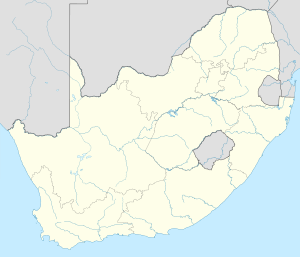

Coordinates (Malamulele): 22°58′16″S 30°40′25″E / 22.97111°S 30.67361°ECoordinates: 22°58′16″S 30°40′25″E / 22.97111°S 30.67361°E Country  South Africa
Province Limpopo Province Vhembe Thulamela Malamulele Town Established Government - Mayor T.N. Makumbane [1] Time zone SAST (UTC+2) Area code(s) 015 Malamulele can refer to the town of Malamulele or the area of Malamulele. Both the town (approximately in the center of the area) and area are in the Limpopo province of South Africa and predominantly occupied by Tsonga people. The town itself is located 35 km away from the Punda Maria gate of the Kruger National Park although the borders of it are against the fence of the Kruger. An example is Ntlhaveni Block H. Malamulele is situated between Giyani (former Gazankulu Capital) and Thohoyandou (former Venda capital). 243 km away from Polokwane, and 453 km away from Pretoria.Written by Baloyi Amukelani and Refilwe Maphatha
Malamulele is contained within the Thulamela Local Municipality along with Thohoyandou.
Contents
History
99% of the people in malamulele are the Vatsonga People and speak Xitsonga as their language.
More the Fifteen years after South Africa became a democracy, Malamulele is still dictated by the Thulamela Municipality. Malamulele is small but is big enough to have its own municipality. Progress is however being made to meet those ends. Evidence is here: http://www.facebook.com/pages/Bantsi/110498611429#!/group.php?gid=29884352779&ref=ts. A number of people, especially young people of employable age, migrate from Malamulele to Major Cities like Johannesburg and Pretoria to seek higher education and employment.
Post Apartheid
More the Fifteen years after South Africa became a democracy, Malamulele is still dictated by the Thulamela Municipality. Malamulele is small but is big enough to have its own municipality. Progress is however being made to meet those ends. Sometimes is so painful when we compare Malamulele with Thohoyandou, Malamulele is not developing but Thohoyandou is. Only Tsonga people live there but this town is being controlled by Venda people. Why can't Malamulele have its own municipality, Malamulele is surrounded by many villages, it deserve its own municipality. Those venda people only concentrate in their town, they do not care about Malamulele. Why can't government do something about this. Malamulele do not even have a mall but Thohoyandou have two malls. When is government going to see our cry? Evidence is here: http://www.facebook.com/pages/Bantsi/110498611429#!/group.php?gid=29884352779&ref=ts. A number of people, especially young people of employable age, migrate from Malamulele to Major Cities like Johannesburg and Pretoria to seek higher education and employment.
We the people of Malamulele its like we are not South Africans as we do not use our own language for government services, its painful to use other people's language in your own yard otherwise you won't get help if you do not know Venda. So lets get up and fight for our own municipality.Government officials please just come and evidence the poor condition that we are living in.
Geography
Malamulele is situated approximately 35 km away from the Punda Maria gate of the Kruger National Park, and approximately 195 km north-east of Polokwane.
Climate
The town has a very dry subtropical climate, specifically a humid subtropical climate (Köppen climate classification: Cwa), with long hot and rainy summers and short cool and dry winters.
Demographics
Malamulele has a population of 400 000 people, at the moment Malamulele has 4 sections. The area can only get a life during the festive season because most people from there prefer to spend their festive season in their Homeland.
Parks and gardens
Make mention of the parks and gardens around Malamulele.
Transport
The residents of Malamulele and the surrounding villages mostly use taxis as a mode of transport. Private bus services are also used.
Buses
City to City and other bus operators operate a long-distance bus services to Gauteng, especially Pretoria and Johannesburg. Do Light Transport, Hawk, Mosmat,Nduma ya vanwanati]] operate bus services to Giyani and Thohoyandou.
Road
The R81 is the major road that runs through Malamulele. It links Malamulele to Giyani and also joins the R524 to Punda Maria gate of the Kruger National Park.
Society and culture
Media
Main article: Media in MalamuleleSince Malamulele forms part the Thulamela Local Municipality, most radio, television and paper media is the same as what can be found in the rest of the municipality area.
Music
A number of popular Tsonga artists and musicians are originally from Malamulele. These include Thomas Chauke, Matshwa-bemuda, George Maluleke, Neol Maluleke from Nyavani and many others.
Sport
Two of the most popular sports in Malamulele are soccer and boxing. Malamulele stadium is sometimes used by Black Leopards for National First Division matches. Malamulele Boxing Gym is also a world class gym facility where boxing training is administered by Cassius Baloyi's father. Cassius Baloyi, a boxer who holds six world championship belts originate from malamulele. Other notable boxers from the area are Isaac Hlatswayo and Jeffrey Mathebula.
Stadiums
- Malamulele Stadium
- Malamulele Showground
Commerce and Industry
Malamulele shopping centre, Quick Save shopping complex and Cheapside shopping complex are the main shopping areas around the town of Malamulele. There also used to be gold mining activities in Menele.
Education
Secondary education
High schools in the Malamulele area includes the following:
- P.P Hlungwani High school (Green farm)
- Dlamani High School (Nyavani Village)
- E.P.P Mhinga High School
- Hlaluko High School
- Hlalukweni High School
- Humula High School
- Jim Yingwani High School (Bulwini Village)
- Khatisa High School
- Malamulele High School
- New Era College
- Nkatini High School
- Photani High School
- Shingwedzi High School
- Ximun'wani High School
- Gidjana High School (Magona)
- Govhu high School (Govhu)
- Nghezimani High School (Nkovani, Makhasa, Nsimbi and Nghezimani scholars attends)
- Matimba Junior Secondary School( nkavele village 'or' Ntlhabeni Block A)
- Ntlhabeni High School
Primary education
Primary schools in the Malamulele area includes the following:
- Guwela Primary School
- Hlawulekani Primary School
- Hangalakani Primary School ( nkavele village)
- Khanani Primary School.
- Magangeni Primary School
- Magoda Primary School
- Mahlahle Primary School
- Mahlepfunye Primary School
- Makahlule Primary School
- Makhasa Primary School
- Mulamula Primary School (in Bulwini)
- Phaphazela Primary School
- Ripindzi Primary School
- Tiyiselani Primary School
- Tsundzukani Primary School
- Twananani Primary School
- Xigalo Primary School.
- Xihlovo Primary School
- Tivoneleni Primary School (Nkovani)
- Tiyiselani Primary School
- Tivanani School where Foster Mchini Baloyi started his school in the early 80s
- Ntlhaveni High School(Salani Wiseman Wisani)
List of Villages
Malamulele Town is surrounded by a number of villages (matiko). Underneath is an non-exhaustive listing (in alphabetical order):
- Bevhula
- Boxa-huku
- Bulwini - Dumela
- Dinga
- Hlengani
- Gandlanani
- Gija-mhandzeni
- Green Farm
- Govhu
- Gumbani
- Hasani (Dakari)
- Jerome (Rha-Mukhuba)
- Jimmy Jones
- Josefa
- Madonsi
- Mafanele
- Magona
- Mahonisi
- Makhasa
- Makuleke
- Makumeke
- Maphophe
- Mashobye
- Matsakali
- Mavambe
- Mbhalati
- Mdavula (Tlangelani)
- Menele
- Mhinga
- Mphakati
- Mphambo
- Mtititi
- Muchipisi
- Makhasa
- Mukhomi
- Mulamula
- Muswani
- Nghezimani
- Nghomunghomu
- Nhombelani
- Nkovani
- Nsimbhi
- Ntlhaveni Block A( NKAVELE)
- Ntlhaveni Block C
- Ntlhaveni Block H
- Nyavani
- Phaphazela
- Roodhuis
- Salema
- Xibangwa
- Xigalo
- Xigamani
- Xihosani
- Xikundu
- Xitlhelani
See also
Ntlhaveni Block C AND A Phaweni Maphophe
References
en.wikipedia.org/wiki/Cassius_Baloyi boxrec.com/list_bouts.php?human_id=5534&cat=boxer www.boxingarena.co.za/?p=332
External links
- Malamulele travel guide from Wikitravel
- [2]- Thulamela Municipality
- [3]— Gazankulu facts
Province of Limpopo, South Africa Provincial Capital: Polokwane District
and Local
MunicipalitiesGreater Giyani · Greater Letaba · Greater Tzaneen · Ba-Phalaborwa · MarulengBlouberg · Aganang · Molemole · Polokwane · Lepelle-NkumpiEphraim Mogale · Elias Motsoaledi · Makhuduthamaga · Fetakgomo · Greater TubatseCategories:- Populated places in Limpopo

Wikimedia Foundation. 2010.