- Majorqaq
-
Majorqaq 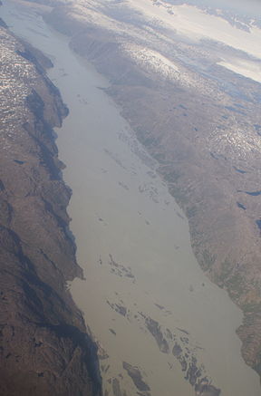
Aerial view of MajorqaqOrigin Greenland ice sheet Mouth Isortoq Fjord Basin countries Greenland Length 71 km (44 mi) Mouth elevation 0 m (0 ft) Majorqaq is a meltwater river and valley of the same name in the Qeqqata municipality in central-western Greenland. It is one of the widest rivers in western Greenland, draining the Greenland ice sheet.
Contents
Geography
Majorqaq is approximately 71 km (44 mi) long. The river source at 65°41′30″N 50°32′00″W / 65.69167°N 50.5333333°W is an outflow glacier draining the Greenland ice sheet, in the far inland region of the country.[1] Majorqaq retains approximately the same width for the entire length of the river flow, from its source to its large delta,[1] carrying large quantities of glacial silt. The river flow is variable, with large patches of quicksands across its entire length, particularly near the delta. The river empties into Isortoq Fjord at 65°35′30″N 51°54′00″W / 65.59167°N 51.9°W.[1]
Economy
Hunting
While the water from the river is not drinkable due to silt, the highland region around the river is used for game hunting. Due to considerable isolation of the region near the ice sheet, there is a large number of reindeer and muskox in the region.[2]
Hydropower
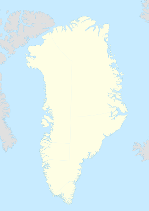
 MajorqaqLocation within Greenland
There are advanced plans for the Alcoa aluminium smelting plant in the Qeqqata municipality. Maniitsoq, the second-largest town in the municipality, is one of the proposed locations, alongside the municipal center in Sisimiut. The plant would provide employment for 600–700 people,[3] or more than 10 percent of the population. As it is a vital decision for the town, wide public consultations were carried out in 2008–2010[4][5][6] by both the town authorities and the Government of Greenland in order to address potential environmental and social concerns.[7][8]
A hydroelectric power plant at the river source would yield an estimated energy output of 1,000 gigawatts per year.[9] Combined with the second plant near Kangerlussuatsiaq Fjord with 3,170 gigawatts per year, the energy would be sufficient to power the aluminium plant near Maniitsoq.[9] The ultimate decision as to the location of the plant has not yet been taken.
References
- ^ a b c Maniitsoq, Saga Map, Tage Schjøtt, 1992
- ^ "Big Game Hunting for Reindeer". Major Hunting Greenland. http://www.mamut.net/majorhunting/subdet8.htm. Retrieved 17 July 2010.
- ^ "Aluminium smelting plant". Sisimiut town. http://www.sisimiut.gl/Business/Business-development/Aluminum-Smelter.aspx. Retrieved 17 July 2010.
- ^ "Alcoa holds town hall meeting in Sisimiut". Sermitsiaq. 15 January 2008. http://sermitsiaq.gl/erhverv/article27703.ece?lang=EN. Retrieved 17 July 2010.
- ^ "Where should Alcoa plant be located?". Sermitsiaq. 21 February 2008. http://sermitsiaq.gl/erhverv/article31788.ece?lang=EN. Retrieved 17 July 2010.
- ^ "Alcoa in Greenland". Alcoa. http://www.alcoa.com/greenland/en/home.asp. Retrieved 17 July 2010.
- ^ "Alcoa project can paralyse building sector". Sermitsiaq. 13 April 2008. http://sermitsiaq.gl/erhverv/article37125.ece?lang=EN. Retrieved 17 July 2010.
- ^ "Alcoa eller ej" (in Danish). Sermitsiaq. 25 March 2010. http://sermitsiaq.gl/indland/article113604.ece. Retrieved 17 July 2010.
- ^ a b "Aluminium Smelting Works at Maniitsoq" (PDF). Greenland Development. http://www.aluminium.gl/media(96,1033)/Maniitsoq_English_416KB.pdf. Retrieved 17 July 2010.
Categories:- Rivers of Greenland
- Valleys of Greenland


Wikimedia Foundation. 2010.