- Main Street Bridge (Jacksonville, Florida)
-
For other uses, see Main Street Bridge (disambiguation).
Main Street Bridge 
Official name John T. Alsop Jr. Bridge Carries four general purpose lanes and two sidewalks Crosses St. Johns River Locale Jacksonville, Florida Maintained by Florida Department of Transportation ID number 720022 Design steel lift bridge Total length 512.1 meters (1680 feet) Width 17.6 meters (58 feet) Longest span 111.3 meters (365 feet) Vertical clearance 4.87 meters (16.0 feet) Clearance below 11 meters (35 feet) closed
41.1 meters (135 feet) openOpened July 1941 Coordinates 30°19′22″N 81°39′31″W / 30.322852°N 81.658616°WCoordinates: 30°19′22″N 81°39′31″W / 30.322852°N 81.658616°W The Main Street Bridge, officially the John T. Alsop Jr. Bridge, is a bridge crossing the St. Johns River in Jacksonville, Florida. It was the second bridge built across the river. It carries four lanes of traffic, and is signed as U.S. Route 1/US 90 (SR 5/SR 10). A lift bridge, it opened in July 1941[1] at a cost of $1.5 million.[2] In 1957 it was named after Mayor John T. Alsop, Jr., but continues to be known, even on road signs, as the Main Street Bridge.
Contents
North (downtown) approach
When the bridge was first built, its north end was at the intersection of Main Street and Water Street. Traffic continued north on Main Street, with a one-way pair being made at some point; after that, northbound traffic turned right on Water Street and left on Ocean Street.
In 1978, several approach bridges and ramps were built. Main Street now goes over Water Street, and a ramp now carries all traffic from the bridge diagonally into Ocean Street, with a second bridge over Water Street. Ramps provide access to and from Water Street.
South approach
The bridge originally ended at Miami Road (now Prudential Drive). When Jacksonville's original expressway system was built, in 1958, ramps were built connecting this intersection to the new expressway (now I-95 (SR 9)) connecting the Fuller Warren Bridge and the Acosta Bridge to Phillips Highway (U.S. Route 1 (SR 5)) and Atlantic Boulevard (US 90 (SR 10)).
In 1968, a flyover was built between the ramps to I-95 (SR 9) and the bridge, with frontage roads continuing to serve Miami Road and several other cross streets. Thus there is now uninterrupted traffic flow from I-95 (SR 9) to the Main Street Bridge.
Gallery
-
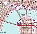
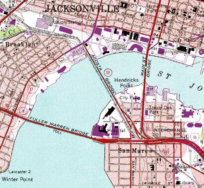
A 1992 map of the Main Street Bridge (the east one).
-
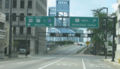
Looking south from downtown along Main Street towards the Main Street Bridge.
-
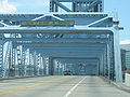
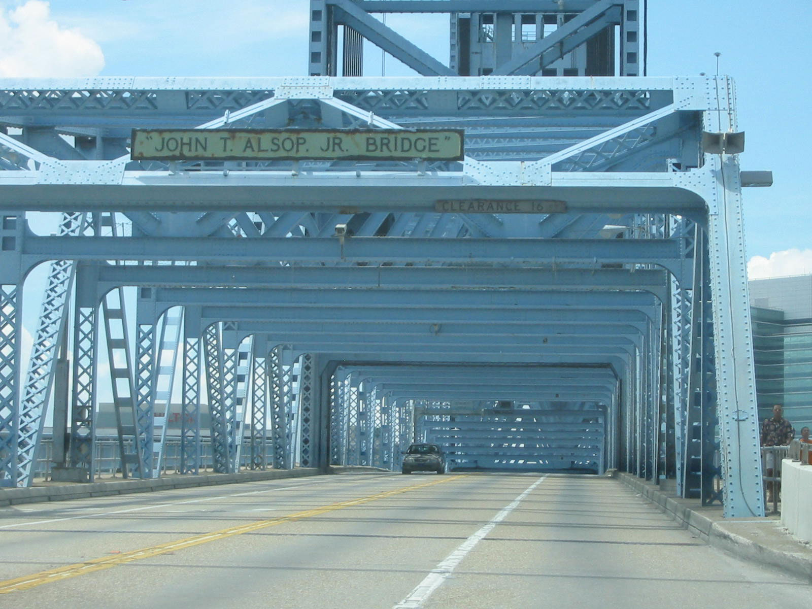
Looking south through the truss of the Main Street Bridge.
-

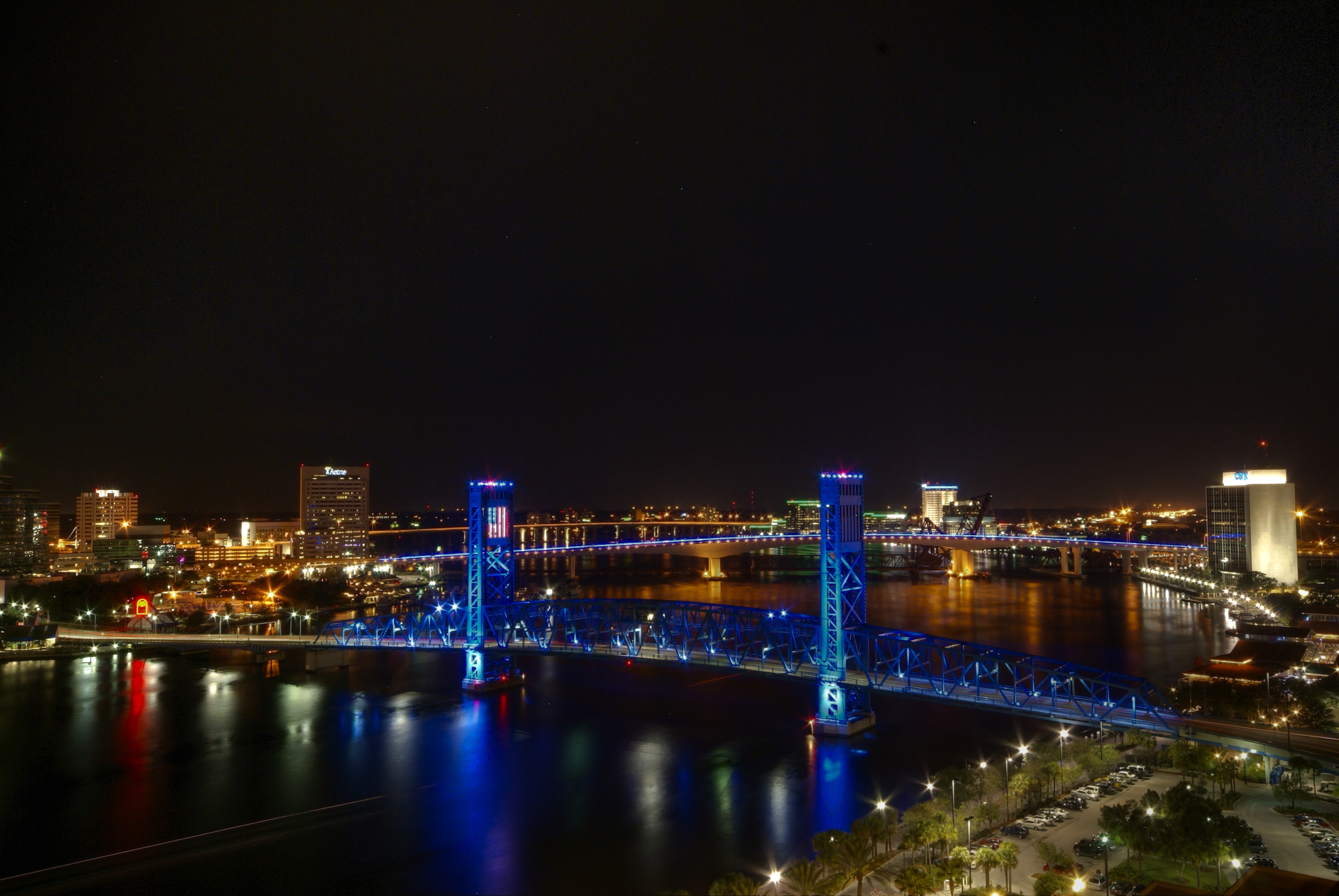
View from Hyatt Regency Hotel, with the Acosta Bridge visible in the background.
-

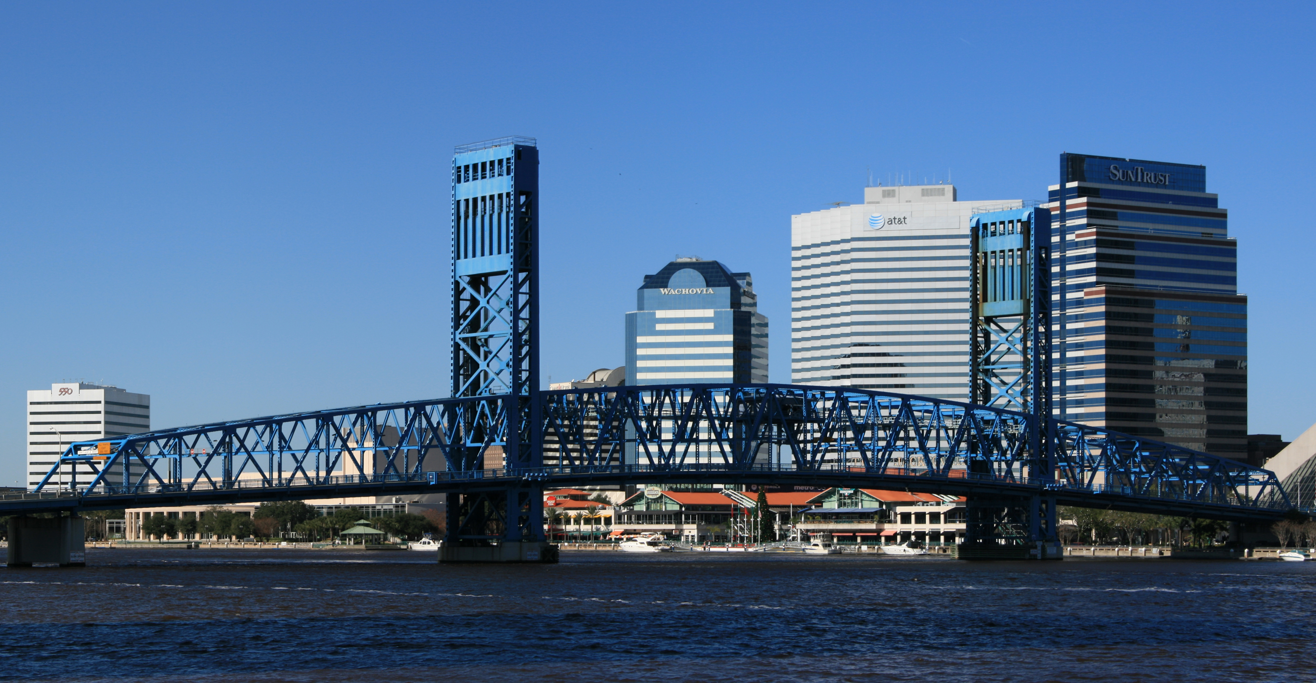
The bridge as viewed from the south bank.
The bridge opens at half past the hour.
References
- ^ "Main Street Bridge". http://jacksonville.about.com/od/walkingtours/ss/southbanktour_3.htm. Retrieved 2009-03-22.
- ^ "Main Street Bridge - Jacksonville, FL". http://www.waymarking.com/waymarks/WM2NZT. Retrieved 2009-03-22.
St. Johns River crossings in the Jacksonville, Florida area Upriver from Downtown Shands Bridge (to be replaced or supplemented) | Buckman Bridge | Timuquana Bridge (never built)
Downtown Jacksonville Fuller Warren Bridge | FEC Strauss Trunnion Bascule Bridge | Acosta Bridge | Main Street Bridge | Hart Bridge | Mathews Bridge | 20th Street Extension (never built)
Downriver from Downtown Dames Point Bridge | State Road 113A (never built) | Mayport Ferry
Crossings of the St. Johns River Upstream
Acosta Bridge

Main Street Bridge


Downstream
Hart Bridge

Categories:- Bridges completed in 1941
- Bridges in Jacksonville, Florida
- U.S. Route 1
- Vertical lift bridges
- Road bridges in Florida
-

Wikimedia Foundation. 2010.