- Dwarka Baoli
-
Coordinates: 28°35′58.86″N 77°2′38.53″E / 28.5996833°N 77.0440361°E

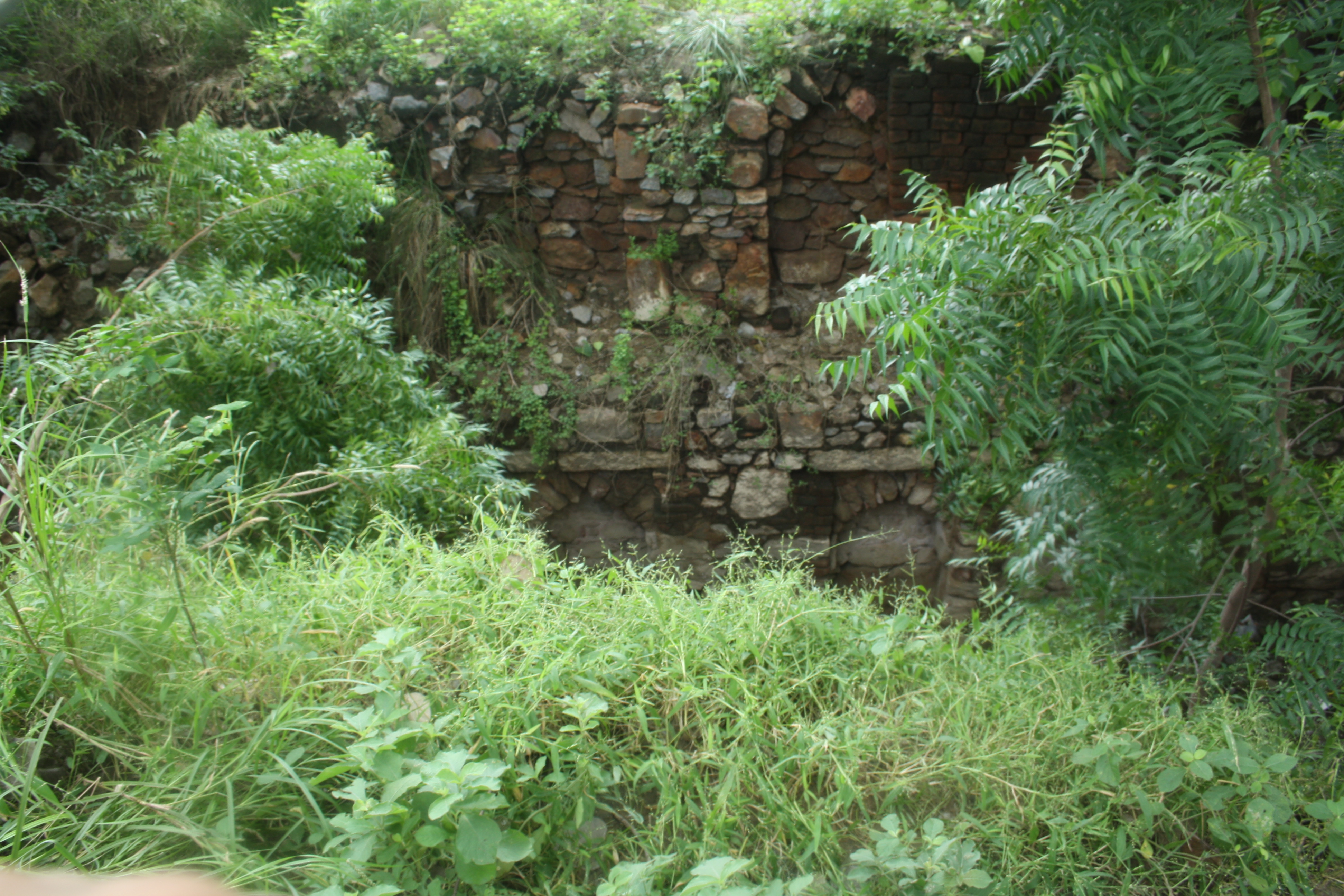
Dwarka Baoli ( also known as Loharehri Baoli ) is a historical stepwell recently discovered in Dwarka Sub City, in south west New Delhi, India. It was constructed for the residents of Loharehri village by the Sultans of the Lodi Dynasty in the early 16th century. Dwarka now stands where the Loharehri village once stood. [1] Located in a barren stretch of land between a resedential society and a private school on Azad Hind Fauj Marg, Sector 12, Dwarka, it is hidden by a large group of Peepal trees and covered by a thick undergrowth which seems to have aided in its relative obscurity. It will soon come under the protection of the State archeological department and conservation will be taken up by INTACH Delhi Chapter.[2]
Baoli or bawdi, also referred to as baori or bauri, is a Hindi word (from Sanskrit wapi [3][4] or vapi, vapika).[5] Water Temples of India and temple step wells were built in ancient India and the earliest forms of step well and reservoir were also built in India in places like Dholavira as far back as the Indus Valley Civilisation.Architecture
The structure shows typical Lodi era architecture with prominent arches along the steps and a well at the end of the baoli. The stepwell is constructed using rubble masonry, common in monuments of that period.[6] Along the steps, two levels of arches are clearly visible. Although the water level has receded leaving the well dry. The baoli seems to have disappeared from the pages of history and bears no mention in the ASI or INTACH heritage list.[7]
Although not as architecturally significant as Agrasen ki baoli and Rajon Ki Baoli, Dwarka Baoli is one-of-its-kind as there is no other structure in the area.
References
- ^ [1] The Times of India, June 28, 2011.
- ^ [2] The Times of India, July 1, 2011.
- ^ Suryakanta(1975), Sanskrit Hindi English Dictionary, page 519, Orient Longman (ISBN 086125 248 9).
- ^ Whitworth,George Clifford (1885), An Anglo-Indian Dictionary (See Baoli).
- ^ Jutta Jain- Newbauer (1981), The step wells of Gujarat in art-historical perspective (see the term).
- ^ [3] The Times of India, June 28, 2011.
- ^ [4] The Times of India, June 28, 2011.
External links
Categories:- Stepwells in India
Wikimedia Foundation. 2010.