- Dunnstable Township, Clinton County, Pennsylvania
-
Dunnstable Township,
Pennsylvania— Township — Map of Clinton County, Pennsylvania highlighting Dunnstable Township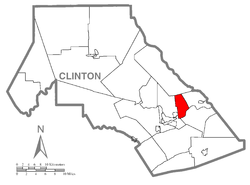 Map of Clinton County, Pennsylvania
Country United States State Pennsylvania County Clinton Settled 1785 Incorporated Before 1839 Area – Total 9.6 sq mi (24.8 km2) – Land 9.3 sq mi (24.2 km2) – Water 0.3 sq mi (0.6 km2) Population (2000) – Total 945 – Density 101.3/sq mi (39.1/km2) Dunnstable Township is a township in Clinton County, Pennsylvania, United States. The population was 945 at the 2000 census.
Geography
According to the United States Census Bureau, the township has a total area of 9.6 square miles (25 km2), of which, 9.3 square miles (24 km2) of it is land and 0.2 square miles (0.52 km2) of it (2.41%) is water.
Demographics
As of the census[1] of 2000, there were 945 people, 366 households, and 285 families residing in the township. The population density was 101.3 people per square mile (39.1/km²). There were 381 housing units at an average density of 40.8/sq mi (15.8/km²). The racial makeup of the township was 98.52% White, 0.32% African American, 0.63% Asian, 0.11% from other races, and 0.42% from two or more races. Hispanic or Latino of any race were 0.42% of the population.
There were 366 households out of which 27.3% had children under the age of 18 living with them, 68.6% were married couples living together, 6.0% had a female householder with no husband present, and 21.9% were non-families. 17.8% of all households were made up of individuals and 9.3% had someone living alone who was 65 years of age or older. The average household size was 2.57 and the average family size was 2.88.
In the township the population was spread out with 21.7% under the age of 18, 5.3% from 18 to 24, 27.4% from 25 to 44, 28.8% from 45 to 64, and 16.8% who were 65 years of age or older. The median age was 43 years. For every 100 females there were 99.4 males. For every 100 females age 18 and over, there were 98.9 males.
Historical populations Census Pop. %± 1980 982 — 1990 846 −13.8% 2000 945 11.7% source:[2][3] The median income for a household in the township was $47,981, and the median income for a family was $51,250. Males had a median income of $32,333 versus $20,469 for females. The per capita income for the township was $19,382. About 4.1% of families and 5.4% of the population were below the poverty line, including 4.5% of those under age 18 and 9.7% of those age 65 or over.
References
- ^ "American FactFinder". United States Census Bureau. http://factfinder.census.gov. Retrieved 2008-01-31.
- ^ "Clinton County Comprehensive Plan" (PDF). Clinton County, Pennsylvania. http://www.clintoncountypa.com/4203500000ccp0030.pdf. Retrieved 2007-09-19.
- ^ "Population Change 1990–2000: Pennsylvania". Pennsylvania State Data Center. http://pasdc.hbg.psu.edu/PaSDC/census_2000/cou_profiles/Pop035.html. Retrieved 2007-09-19.
Municipalities and communities of Clinton County, Pennsylvania City 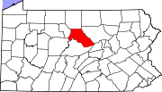
Boroughs Avis | Beech Creek | Flemington | Loganton | Mill Hall | Renovo | South Renovo
Townships CDPs Unincorporated
communitiesKeating | Westport
Footnotes ‡This populated place also has portions in an adjacent county
Coordinates: 41°10′06″N 77°22′23″W / 41.16833°N 77.37306°W
Categories:- Populated places established in 1785
- Townships in Clinton County, Pennsylvania


Wikimedia Foundation. 2010.