- Duncans, Jamaica
-
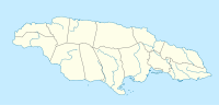
 DuncansLocation of Duncans in Jamaica
Duncans is a settlement in Jamaica.
References
 Settlements in JamaicaFor the definition of city, town, etc see Settlements in Jamaica.
Cities Towns Above Rocks · Albert Town · Alexandria · Alligator Pond · Anchovy · Annotto Bay · Balaclava · Bamboo · Bath · Bethel Town · Black River · Bluefields · Bog Walk · Brown's Town · Buff Bay · Bull Savanna · Cambridge · Cascade · Cave Valley · Chapelton · Christiana · Claremont · Clarendon Park · Clark's Town · Coleyville · Constant Spring · Croft's Hill · Dalvey · Darliston · Discovery Bay (Dry Harbour) · Duncans · Easington · Ewarton · Falmouth · Frankfield · Franklin Town · Frome · Gayle · Golden Grove · Gordon Town · Grange Hill · Green Island · Guy's Hill · Hagley Gap · Hayes · Hartland · Highgate · Hope Bay · Hopewell, Hanover · Islington · Kellits · Lacovia · Linstead · Lionel Town · Little London · Lluidas Vale · Lucea · Lucky Hill · Maggotty · Malvern · Manchioneal · Mandeville · Maroon Town · Mavis Bank · May Pen · Moneague · Moore Town · Morant Bay · Nain · Negril · Newcastle · Ocho Rios · Old Harbour Bay · Old Harbour · Oracabessa · Osbourne Store · Petersfield · Point Hill · Port Antonio · Port Esquivel · Port Maria · Port Royal · Porus · Race Course · Richmond · Rio Bueno · Riversdale · Rocky Point · Runaway Bay · Saint Ann's Bay · Sandy Bay · Santa Cruz · Savanna-la-Mar · Seaford Town · Seaforth · Sherwood Content · Siloah · Southfield · Stonehenge · Trinity Ville · Ulster Spring · Vineyard Town · Wakefield · Whitehouse · Williamsfield · Woodpark · YallahsVillages Accompong · Aeolus Valley · Airy Castle · Barking Lodge · Bog · Big Woods · Boscobel · Bull Bay · Carmel · Cattawood Springs · Cotterwood · Duckenfield · Duncans · Haddersfield · Hodges · Hopewell Hall · Hopewell, Clarendon · Hopewell, Manchester · Hopewell, Saint Andrew · Hopewell, Saint Ann · Hopewell, Saint Elizabeth · Hopewell, Westmoreland · Hopeton · Long Wood · Mavis Banks · Nanny Town · New Holland · New Roads · Nine Mile · Old Pera · Paynes Town · Port Morant · Roxborough, Manchester · San San · White Hall · Wood HallNeighbourhoods Kingston
and
St AndrewAllman Town · Barbican · Beverly Hills · Bournemouth Gardens · Camperdown · Cassava Piece · Cherry Gardens · Cockburn Gardens · Constant Spring · Cooreville Gardens · Cross Roads · Delacree Park · Denham Town · Duhaney Park · Eastwood Park · Fletcher's Land · Four Mile · Grants Pen · Greenwich Town · Half Way Tree · Hannah Town · Harbour View · Havendale · Hope Pastures · Hughenden · Jack's Hill · Jones Town · Kencot · Kingston Gardens · Kintyre · Liguanea · Manley Meadows · Mannings Hill · Maxfield · Meadowbrook · Meadowbrook Estate · Molynes Gardens · Mona · Mona Heights · Mountain View Gardens · Nannyville Gardens · New Haven · New Kingston · Newport West · Norbrook · Norman Gardens · Olympic Gardens · Papine · Patrick Gardens · Pembroke Hall · Perkins Estate · Queensborough · Queensbury · Rae Town · Red Hills · Richmond Park · Rockfort/Rennock lodge · Rollington Town · Seaview Gardens · Shooters Hill · Six Miles · St Mary · Stony Hill · Three Mile · Tivoli Gardens · Trench Town · Vineyard Town · Washington Gardens · Whitfield Town · Woodford Park · Ziadie GardensCoordinates: 18°28′4″N 77°32′12″W / 18.46778°N 77.53667°W
Categories:- Populated places in Jamaica
- Jamaica geography stubs

Wikimedia Foundation. 2010.