- Dulwich Hill railway station
-
 Dulwich Hill
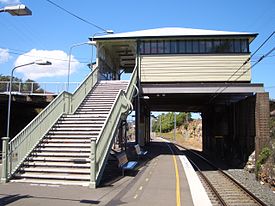
Bankstown Line Station code DHM Suburb Dulwich Hill Street(s) Wardell Road Distance from Central Station 7.87 km Altitude (above sea level) ? m Types of stopping trains Suburban all stops Number of platforms 2 Number of tracks 2 Platform arrangement 1 Island Type of station Ground Ticket barriers No Transfers available Bus Disabled access 
No Station facilities Link Dulwich Hill Railway Station is a station on the Bankstown line of Sydney's CityRail network, serving the residential area of Dulwich Hill. The station was opened in 1895 as Wardell Road and was renamed Dulwich Hill in 1920.[1] The Bankstown line passes through Marrickville before arriving at Dulwich Hill through a cut at Wardell Road (where the station is situated), then follows Ewart Street over Hercules Street to Hurlstone Park.
The double track Metropolitan Goods railway line was added to the north of the passenger lines and the Rozelle branch comes off from the main goods line just to the west of the station (Wardell Road Junction). The station has two platforms using the island platform configuration - the only station on the section running parallel to the goods line not to be converted to side platforms.
Contents
Platforms and services
The station is served by two to four trains per hour each way, with additional trains during weekday peak hours.
Platform Line Stopping Pattern Notes 
Bankstown Line all stations and limited stops services to Central and the City Circle via Sydenham 
Bankstown Line all stations and limited stops services to Lidcombe or Liverpool via Bankstown Accessibility
The station has access via stairs from Wardell Road, which crosses the railway line at the eastern end of the station. This does not allow for Easy Access for wheelchairs.
Transport links
Buses
Sydney Buses runs one route via Dulwich Hill station:
- Route 412 - between King Street Wharf and Campsie station.
NightRide runs one route via Dulwich Hill railway station:
- Route N40 - between East Hills station and the City (Town Hall).
Light Rail
Construction is soon to commence on an extension of the Metro Light Rail to Dulwich Hill which will utilise the disused section of the Metropolitan Goods railway line between Lilyfield and Dulwich Hill. The light rail will provide an interchange with the Bankstown line at Dulwich Hill. The light rail stop will be located at the western end of Bedford Crescent, a short walk from the railway station.
The new service will provide a direct service to the city though the Bankstown line will be quicker. The main utility of the interchange will be providing improved access to Lewisham (including Lewisham railway station on the Inner West line), Summer Hill, Leichhardt, Haberfield, Lilyfield, Annandale, Glebe, Pyrmont and Darling Harbour. Approximately 300 people are expected to interchange between the rail and light rail services every weekday by 2016.[2]
The light rail will also connect with another proposed route that will travel along Sussex Street, Hickson Road, Circular Quay and George Street, forming a complete city loop service. A feasibility study is currently being drafted for this route.[3][4][5]
Gallery
-
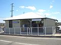
Station entrance
-
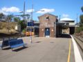
Platforms
-
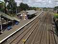
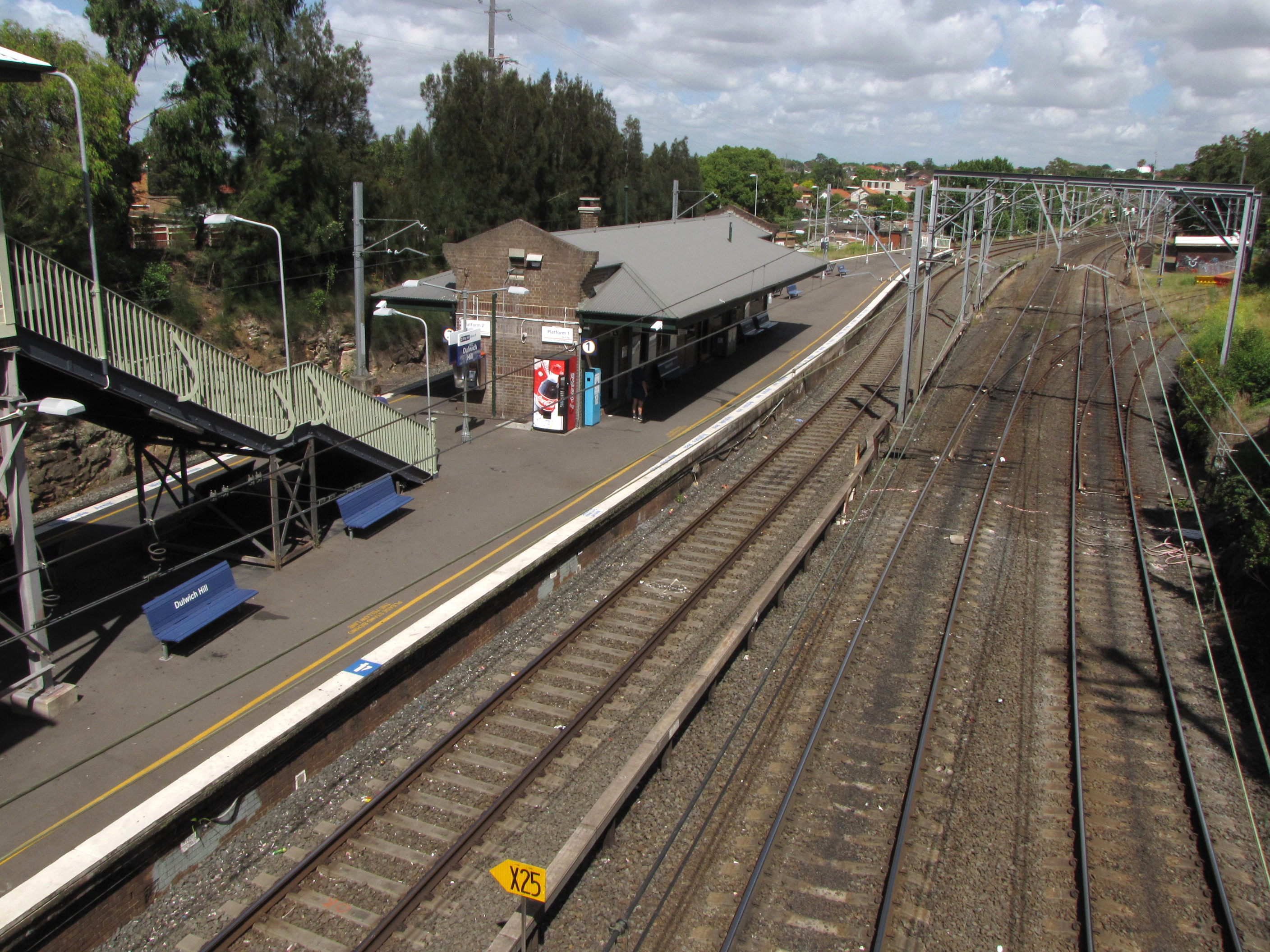
View from the Wardell Rd bridge. The Metropolitan Goods line can be seen directly to the right of the station. The light rail stop will be located adjacent to the tracks diverging to the right of the goods line.
Neighbouring stations
Preceding station CityRail Following station Hurlstone Parktowards Lidcombe or LiverpoolBankstown Line towards CentralReferences
- Oakes, John. Sydney's Forgotten Goods Railways, Australian Railway Historical Society (NSW), 2001. ISBN 0-909650-54-3
External links
Coordinates: 33°54′38″S 151°08′26″E / 33.910528°S 151.140676°ECategories:- Railway stations in Sydney
- Railway stations opened in 1895


Wikimedia Foundation. 2010.