- Otto Township, McKean County, Pennsylvania
-
Otto Township,
Pennsylvania— Township — Map of McKean County, Pennsylvania highlighting Otto Township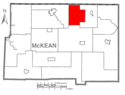 Map of McKean County, Pennsylvania
Country United States State Pennsylvania County McKean Settled 1842 Incorporated 1854 Area – Total 34.8 sq mi (90.1 km2) Population (2000) – Total 1,738 – Density 49.9/sq mi (19.3/km2) Time zone Eastern (EST) (UTC-5) – Summer (DST) EDT (UTC-4) Area code(s) 814 Otto Township is a township in McKean County, Pennsylvania, United States. The population was 1,738 at the 2000 census.
Contents
Geography
According to the United States Census Bureau, the township has a total area of 34.8 square miles (90.1 km²), all of it land.
Demographics
As of the census[1] of 2000, there were 1,738 people, 678 households, and 496 families residing in the township. The population density was 49.9 people per square mile (19.3/km²). There were 742 housing units at an average density of 21.3/sq mi (8.2/km²). The racial makeup of the township was 98.62% White, 0.29% African American, 0.40% Native American, 0.23% Asian, 0.06% from other races, and 0.40% from two or more races. Hispanic or Latino of any race were 0.23% of the population.
There were 678 households out of which 32.6% had children under the age of 18 living with them, 58.7% were married couples living together, 9.4% had a female householder with no husband present, and 26.7% were non-families. 24.0% of all households were made up of individuals and 10.0% had someone living alone who was 65 years of age or older. The average household size was 2.55 and the average family size was 3.00.
In the township the population was spread out with 26.6% under the age of 18, 6.8% from 18 to 24, 27.0% from 25 to 44, 25.5% from 45 to 64, and 14.0% who were 65 years of age or older. The median age was 38 years. For every 100 females there were 92.9 males. For every 100 females age 18 and over, there were 92.6 males.
The median income for a household in the township was $32,037, and the median income for a family was $37,857. Males had a median income of $30,117 versus $23,667 for females. The per capita income for the township was $15,697. About 10.4% of families and 14.6% of the population were below the poverty line, including 25.3% of those under age 18 and 7.9% of those age 65 or over.
Locations
There are three villages in Otto Township, which are signed as such. They are:
Duke Center - The largest population center in Otto Township. Located around the intersection of SR 346 and 546.
Rixford - The second largest village in Otto-Township, located on route 246, commonly referred to as Looker Mountain Trail.
Prenticevale - The third largest village, signed near the intersection of SR 346 and 246, extending east towards the Eldred Township Line.
References
- ^ "American FactFinder". United States Census Bureau. http://factfinder.census.gov. Retrieved 2008-01-31.
Municipalities and communities of McKean County, Pennsylvania City 
Boroughs Eldred | Kane | Lewis Run | Mount Jewett | Port Allegany | Smethport
Townships Unincorporated
communitiesBurning Well | Coryville | Cyclone | Farmers Valley | Gifford | Ludlow
Categories:- Populated places established in 1842
- Townships in McKean County, Pennsylvania


Wikimedia Foundation. 2010.