- Dryna
-
Dryna 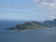
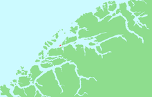
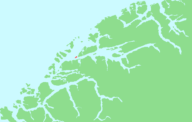
Location in Møre og RomsdalGeography Location Romsdal, Norway Coordinates 62°38′43″N 6°31′49″E / 62.6454°N 6.5304°ECoordinates: 62°38′43″N 6°31′49″E / 62.6454°N 6.5304°E Area 1.7 km2 (0.66 sq mi) Length 2.5 km (1.55 mi) Width 1 km (0.6 mi) Coastline 6 km (3.7 mi) Highest elevation 200 m (700 ft) Highest point Drynjahatten Norway County Møre og Romsdal Municipality Midsund Dryna is an island in the municipality of Midsund in Møre og Romsdal county, Norway. It is the westernmost of the main islands in the municipality. The island sits between the Harøyfjord and the Midfjord, at the entrance to the great Romsdalfjord. Until 1965, Dryna was part of Haram.[1]
Dryna has a road connection to Midøya to the east. There are ferry connections from the western end of the island to Brattvåg (in Haram) and Myklebost (in Sandøy).[2]
The name
The Norse form of the name was Dryn f. The name is probably derived from the word drynr m 'rumble, roar' (referring to the swell of the waves on the island).
References
- ^ Jukvam, Dag (1999). "Historisk oversikt over endringer i kommune- og fylkesinndelingen" (in Norwegian). Statistisk sentralbyrå. http://www.ssb.no/emner/00/90/rapp_9913/rapp_9913.pdf.
- ^ "Dryna" (in Norwegian). yr.no. http://www.yr.no/place/Norway/M%C3%B8re_og_Romsdal/Midsund/Dryna~188458/. Retrieved 2010-10-23.
Categories:- Møre og Romsdal geography stubs
- Midsund
- Islands of Møre og Romsdal

Wikimedia Foundation. 2010.